Skip to content
Mountain

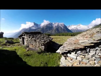
Alpe Entova (Valmalenco)
Italy

We have no zone data for this country: ask the local authority before flying.Official zones map (Italy)

The video is only loaded from YouTube (youtube-nocookie.com) when you start it.

No reviews yet

Have you flown here? Share your experience with other pilots.

+ Write the first review

Description

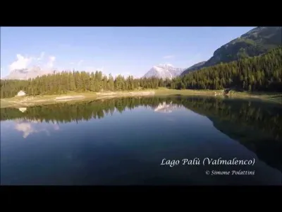
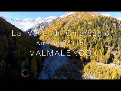
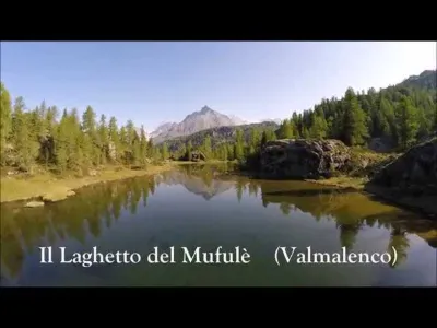
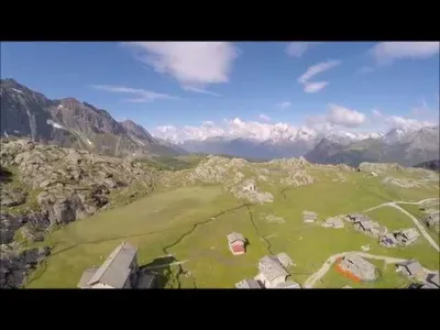
Aerial shooting at Alpe Entova, a magnificent alpine pasture situated in the valley of San Giuseppe / Chiareggio.

Aviation weather (METAR and TAF)

LSZS – Samedan Airport · 23 km N VFR

METAR

Observed 21/11 08:50 · 22 min ago

METAR LSZS 210750Z VRB02KT 9999 -SN FEW005 SCT050 BKN060 M02/M02 Q1016 RMK D TRL170

Wind
Variable, 4 km/h
Visibility
10 km or more
Weather
Snow light
Clouds
Few (1-2/8) at 500 ft (150 m) ; Scattered (3-4/8) at 5,000 ft (1520 m) ; Broken (5-7/8) at 6,000 ft (1830 m)
Temperature
-2 °C, dew point -2 °C
QNH
1016 hPa
Flight category
VFR: ceiling > 3,000 ft and visibility > 5 mi

TAF

Issued 21/11 06:25 · valid from 21/11 07:00 to 21/11 16:00

TAF LSZS 210525Z 2106/2115 VRB02KT 9999 -SN FEW050 SCT060 TX02/2114Z

Period (local time) Change Wind Visibility Weather Clouds
21/11 07:00 → 21/11 16:00 Initial conditions Variable, 4 km/h 10 km or more Snow light Few (1-2/8) at 5,000 ft (1520 m) ; Scattered (3-4/8) at 6,000 ft (1830 m)

Empty cell: no change forecast for that element.

METAR and TAF from NOAA (Aviation Weather Center), for guidance only: they do not replace flight planning with official sources (SIA, Météo-France). Nearest station that issues a METAR, not necessarily the nearest aerodrome.

Plan the light

Weather and Kp index

Loading forecast…

Sunrise and sunset

Local times at the spot (UTC+01:00). The golden hour, the warm, low light sought after for photos and videos, runs from sunrise until the sun reaches 6° above the horizon, and in the evening from 6° until sunset.

Day Dawn Sunrise Golden hour Sunset Dusk Day length
Sat 21 Nov06:57 07:30 07:30–08:18 · 15:55–16:43 16:43 17:169 h 12
Sun 22 Nov06:58 07:32 07:32–08:19 · 15:54–16:42 16:42 17:159 h 10
Mon 23 Nov07:00 07:33 07:33–08:21 · 15:53–16:41 16:41 17:149 h 08
Tue 24 Nov07:01 07:34 07:34–08:22 · 15:52–16:40 16:40 17:149 h 06
Wed 25 Nov07:02 07:36 07:36–08:24 · 15:52–16:40 16:40 17:139 h 03
Thu 26 Nov07:03 07:37 07:37–08:25 · 15:51–16:39 16:39 17:129 h 02
Fri 27 Nov07:05 07:38 07:38–08:27 · 15:50–16:38 16:38 17:129 h 00

Nearby on Wikipedia

  • Piz Tremoggia · 3.5 km away

    Le piz Tremoggia ou pizzo delle Tre Mogge en italien est un sommet des Alpes, à cheval entre la Lombardie en Italie et le canton des Grisons en Suisse. Situé à d'altitude dans la chaîne de la Bernina en Engadine, son accès est possible par le refuge Longoni ou par le bivouac Colombo Aurora Bijelich (...)

  • Piz Glüschaint · 4.5 km away

    Le piz Gluschaint est un sommet des Alpes, à , dans la chaîne de la Bernina, à cheval entre l'Italie (Lombardie) et la Suisse (canton des Grisons). Sa voie d'accès se fait par le refuge Coaz . (...)

  • Piz Dschimels · 5.0 km away

    Le piz Dschimels est un sommet des Alpes, à cheval entre la Lombardie en Italie et le canton des Grisons en Suisse. Situé à d'altitude dans la chaîne de la Bernina en Engadine, sa voie d'accès se fait par le refuge Coaz .

  • Piz Sella · 5.1 km away

    Le piz Sella est un sommet des Alpes, à cheval entre la Lombardie en Italie et le canton des Grisons en Suisse. Situé à d'altitude, dans la chaîne de la Bernina, sa voie d'accès se fait par le refuge Coaz .

  • Refuge Carate Brianza · 5.2 km away

    Le refuge Carate Brianza se situe dans la province de Sondrio, en Lombardie. Il est situé à d'altitude. Il est équipé de matelas, de couvertures mais il n'a ni gaz ni chauffage. Du refuge on peut atteindre les sommets suivants : * piz Bernina ; * piz Palü ; * piz Roseg ; * Bellavista ; * piz Zupò ; (...)

Articles found by GeoNames from the spot's position.

Nearby spots

Reviews

Log in to review this spot. Log in · Create a free account

No reviews yet. Share yours!

Connection to the site lost. Trying again…

The site is not responding. Trying again in seconds.

The site is no longer responding.

The site has been updated. Reloading the page…

This page has expired.

Resuming failed. Please reload the page.

The site is no longer responding.