

Jablines

No reviews yet
Have you flown here? Share your experience with other pilots.
+ Write the first reviewDescription
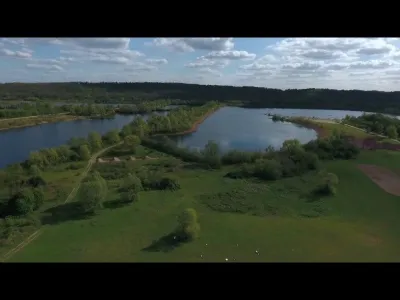
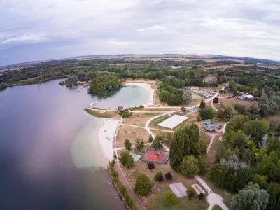
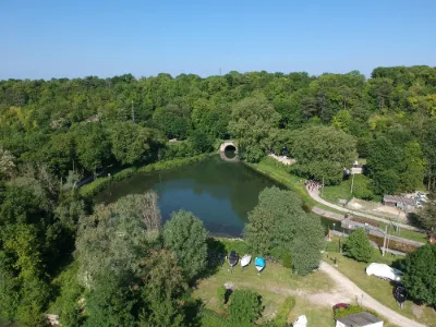
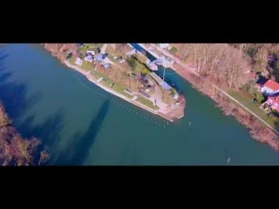
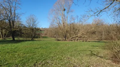
Jablines' flint quarries were long ago. Our history begins between 3500 and 4200 BC, in a period called Neolithic. At that time, our ancestors (not even Gauls!) were already digging the earth near here to find SILEX ... In more modern times, they have been SABLES and GYPSE quarries that have punctuated this landscape. Most of these quarries are now closed and flooded. Flying over old quarries
Map and restricted areas
Open in the main mapNearby aerodromes
Open aerodromes within 25 km of the spot, heliports included, with their distance and direction from the spot. Near an aerodrome, drone flying is prohibited or height-limited: check the UAS zones map.
| Aerodrome | Type | Distance | Elevation | Difference |
|---|---|---|---|---|
| Aérodrome de Meaux-Esbly | Aerodrome | 6.4 km E | 66 m | spot 13 m lower |
| Aérodrome de Chelles-le-Pin | Aerodrome | 11 km W | 63 m | spot 10 m lower |
| Lognes Emerainville | Aerodrome | 14 km SW | 109 m | spot 57 m lower |
| Centre Hospitalier Intercommunal Robert Ballanger Heliport | Heliport | 17 km W | 58 m | spot 5 m lower |
| Charles de Gaulle International Airport | Major airport | 18 km NW | 119 m | spot 67 m lower |
Aviation weather (METAR and TAF)
LFPG – Charles de Gaulle International Airport MVFR
METAR
METAR LFPG 210630Z 13005KT 6000 SCT023 BKN065 07/06 Q1018 TEMPO 4000 BR BKN006
- Wind
- 130°, 9 km/h
- Visibility
- 6 km
- Clouds
- Scattered (3-4/8) at 2,300 ft (700 m) ; Broken (5-7/8) at 6,500 ft (1980 m)
- Temperature
- 7 °C, dew point 6 °C
- QNH
- 1018 hPa
- Flight category
- MVFR: ceiling 1,000–3,000 ft or visibility 3–5 mi
TAF
TAF LFPG 210500Z 2106/2212 09005KT 6000 BKN060 TX10/2114Z TN06/2205Z TEMPO 2106/2111 4000 BR BKN008 PROB30 TEMPO 2106/2109 1500 BR BKN004 BECMG 2113/2116 BKN020 BECMG 2208/2210 BKN012
| Period (local time) | Change | Wind | Visibility | Weather | Clouds |
|---|---|---|---|---|---|
| 21/11 07:00 → 21/11 14:00 | Initial conditions | 090°, 9 km/h | 6 km | Broken (5-7/8) at 6,000 ft (1830 m) | |
| 21/11 07:00 → 21/11 12:00 | Temporarily | 4.0 km | Mist | Broken (5-7/8) at 800 ft (240 m) | |
| 21/11 07:00 → 21/11 10:00 | Temporarily, probability 30% | 1.5 km | Mist | Broken (5-7/8) at 400 ft (120 m) | |
| 21/11 14:00 → 22/11 09:00 | Becoming | 090°, 9 km/h | 6 km | Broken (5-7/8) at 2,000 ft (610 m) | |
| 22/11 09:00 → 22/11 13:00 | Becoming | 090°, 9 km/h | 6 km | Broken (5-7/8) at 1,200 ft (370 m) |
Weather and Kp index
Sunrise and sunset
| Day | Dawn | Sunrise | Golden hour | Sunset | Dusk | Day length |
|---|---|---|---|---|---|---|
| Sat 21 Nov | 07:32 | 08:07 | 08:07–08:58 · 16:11–17:02 | 17:02 | 17:38 | 8 h 55 |
| Sun 22 Nov | 07:34 | 08:09 | 08:09–09:00 · 16:10–17:01 | 17:01 | 17:37 | 8 h 52 |
| Mon 23 Nov | 07:35 | 08:10 | 08:10–09:02 · 16:09–17:01 | 17:01 | 17:36 | 8 h 50 |
| Tue 24 Nov | 07:36 | 08:12 | 08:12–09:03 · 16:08–17:00 | 17:00 | 17:35 | 8 h 47 |
| Wed 25 Nov | 07:38 | 08:13 | 08:13–09:05 · 16:07–16:59 | 16:59 | 17:34 | 8 h 45 |
| Thu 26 Nov | 07:39 | 08:15 | 08:15–09:07 · 16:06–16:58 | 16:58 | 17:34 | 8 h 43 |
| Fri 27 Nov | 07:40 | 08:16 | 08:16–09:08 · 16:05–16:57 | 16:57 | 17:33 | 8 h 41 |

Reviews
Log in to review this spot. Log in · Create a free account
No reviews yet. Share yours!