

Water
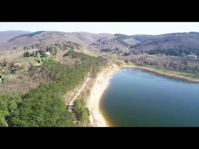
Lake Saint-Ferréol
2 pilot reviews
“@Franck: En effet le coté digue est interdite de vol. Faire attention aux voiles selon les…” — Yogui, 7 years ago
Read the reviews + Write my reviewDescription
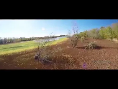
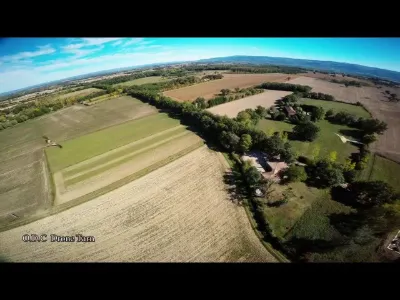
Lake of Saint-Ferréol on the side of REVEL at the confluence of the Haute Garonne, the Tarn and the Aude.
Map and restricted areas
Open in the main mapNearby aerodromes
Open aerodromes within 25 km of the spot, heliports included, with their distance and direction from the spot. Near an aerodrome, drone flying is prohibited or height-limited: check the UAS zones map.
| Aerodrome | Type | Distance | Elevation | Difference |
|---|---|---|---|---|
| Aérodrome de la Montagne Noire | Aerodrome | 4.7 km SW | 448 m | spot 101 m lower |
| Revel Montgey Airfield | Aerodrome | 6.3 km NW | 196 m | spot 151 m higher |
| Aérodrome de Castelnaudary-Villeneuve | Aerodrome | 17 km SW | 168 m | spot 179 m higher |
| Castres-Mazamet Airport | Airport | 25 km NE | 240 m | spot 107 m higher |
| Centre Hospitalier Heliport | Heliport | 25 km NE | 196 m | spot 152 m higher |
Aviation weather (METAR and TAF)
LFCK – Castres-Mazamet Airport VFR
METAR
METAR LFCK 211000Z AUTO 11009KT CAVOK 15/09 Q1020 NOSIG
- Wind
- 110°, 17 km/h
- Visibility
- 10 km or more
- Clouds
- –
- Temperature
- 15 °C, dew point 9 °C
- QNH
- 1020 hPa
- Flight category
- VFR: ceiling > 3,000 ft and visibility > 5 mi
TAF
TAF LFCK 210800Z 2109/2118 12010KT CAVOK BECMG 2112/2114 12015G25KT TEMPO 2117/2118 12020G35KT
| Period (local time) | Change | Wind | Visibility | Weather | Clouds |
|---|---|---|---|---|---|
| 21/11 10:00 → 21/11 13:00 | Initial conditions | 120°, 19 km/h | 10 km or more | No significant weather | No significant cloud |
| 21/11 13:00 → 21/11 19:00 | Becoming | 120°, 28 km/h, gusts 46 km/h | 10 km or more | No significant weather | No significant cloud |
| 21/11 18:00 → 21/11 19:00 | Temporarily | 120°, 37 km/h, gusts 65 km/h |
Weather and Kp index
Sunrise and sunset
| Day | Dawn | Sunrise | Golden hour | Sunset | Dusk | Day length |
|---|---|---|---|---|---|---|
| Sat 21 Nov | 07:22 | 07:53 | 07:53–08:37 · 16:38–17:23 | 17:23 | 17:54 | 9 h 29 |
| Sun 22 Nov | 07:23 | 07:54 | 07:54–08:38 · 16:38–17:22 | 17:22 | 17:53 | 9 h 27 |
| Mon 23 Nov | 07:24 | 07:55 | 07:55–08:40 · 16:37–17:21 | 17:21 | 17:52 | 9 h 25 |
| Tue 24 Nov | 07:25 | 07:57 | 07:57–08:41 · 16:36–17:21 | 17:21 | 17:52 | 9 h 23 |
| Wed 25 Nov | 07:26 | 07:58 | 07:58–08:42 · 16:35–17:20 | 17:20 | 17:51 | 9 h 22 |
| Thu 26 Nov | 07:27 | 07:59 | 07:59–08:44 · 16:35–17:19 | 17:19 | 17:51 | 9 h 20 |
| Fri 27 Nov | 07:29 | 08:00 | 08:00–08:45 · 16:34–17:19 | 17:19 | 17:50 | 9 h 18 |

Reviews
Log in to review this spot. Log in · Create a free account
Yogui
@Franck: En effet le coté digue est interdite de vol. Faire attention aux voiles selon les différents évènements.
Franck
Le spot est super beau, c'est certain. Toutefois il faut être très prudent et bien respecter les interdictions de vol. on ne peut pas aller partout. Il y a une forte activité de vol à voile à coté