

Ruins of Montaigle
No reviews yet
Have you flown here? Share your experience with other pilots.
+ Write the first reviewDescription
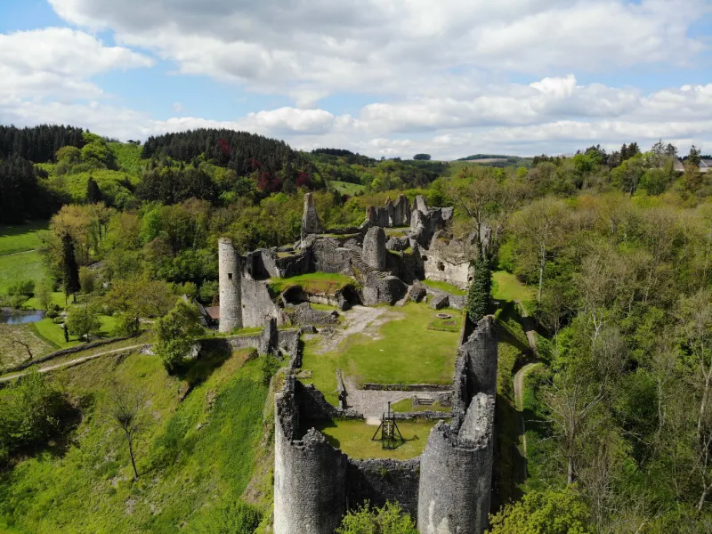
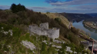
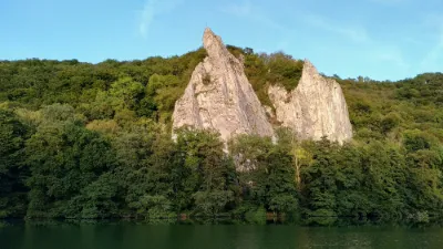
Situated at the confluence of the Molignée and Flavion rivers, the castle of Montaigle stands on a steep rocky spur which was occupied by a small military garrison at the end of the Roman period, in the Lower Empire (3rd-5th c.). Built on an older structure, the medieval fortress was built in the early 14th century by the Dampierre family, then at the head of the County of Namur, and was the property of Guy de Dampierre's youngest son, Guy de Namur, regent of Flanders and figurehead of the famous Battle of the Golden Spurs (1302). Renovated in the 15th century, Montaigle became a comfortable residence, with additional floors and cellars, large windows, fireplaces, latrines... Most of the remains that can be discovered today date from this period, but the attentive visitor will be able to see traces of the castle's former state here and there: walled archways and crenellations; walls thickened by doubling and then raised; differences in the apparatus in the facing stones; etc...
At that time, Montaigle had become the chief town of one of the nine bailiwicks of the County, a sort of administrative and judicial district. The castle often served as the residence of the last Countess of Namur, Jeanne d'Harcourt, grande dame of the courts of France and Burgundy.
Abandoned on the orders of Charles V, then at war with Henry II, King of France, Montaigle was burned by the latter's troops in 1554. Having lost its strategic interest, the castle was not rebuilt, but it seems that some of its parts were still occupied by private individuals until the early nineteenth century... Delivered to the devastating ivy and bad weather, abandoned to the crows and ghosts of his moving legends. Montaigle became of course a place of pilgrimage for artists and romantic souls, but also, alas, a quarry for the unscrupulous inhabitants of the surrounding area... The old fortress only owed its salvation to the intervention of the Count de Beauffort who bought it back in 1854 to avoid its total annihilation and to undertake the first consolidation works. The del Marmol family, owners of Montaigle since 1865, continued this work of safeguarding, obtaining, among other things, the classification of the site (1946 and 1981) and that of the ruins (1965).
It was at the end of the sixties that the Association des Amis de Montaigle was gradually formed, a group of volunteers who wanted to help the owner save and enhance this endangered monument. Their efforts have resulted in particular in the development of a new consolidation method using micro-concrete spraying.
Subsidized since 1982 by the French Community first, then by the Walloon Region, the systematic consolidation of the ruins also benefits from the assistance of personnel made available by the Region (P.R.I.M.E. project), from the help of generous patrons, as well as from the occasional collaboration of other groups of volunteers.
The Friends of Montaigle were rewarded in March 1985 with a prize from the "Fondation Roi Baudouin" (competition "Entreprendre pour sauvegarder"), and in 1993 with a prize from the "Association royale des Demeures historiques de Belgique" (Master Foods competition). But above all they are proud that Montaigle is part of the Exceptional Heritage of Wallonia (1992 classification).
Map and restricted areas
Open in the main mapAviation weather (METAR and TAF)
EBCI – Brussels South Charleroi Airport IFR
METAR
METAR EBCI 210650Z 21006KT 4000 BR NSC 01/01 Q1018 NOSIG
- Wind
- 210°, 11 km/h
- Visibility
- 4.0 km
- Weather
- Mist
- Clouds
- –
- Temperature
- 1 °C, dew point 1 °C
- QNH
- 1018 hPa
- Flight category
- IFR: ceiling 500–1,000 ft or visibility 1–3 mi
TAF
TAF EBCI 210500Z 2106/2212 20004KT 9999 FEW035 PROB30 2106/2108 2000 BR BKN003 PROB30 2203/2207 4000 BR
| Period (local time) | Change | Wind | Visibility | Weather | Clouds |
|---|---|---|---|---|---|
| 21/11 07:00 → 22/11 13:00 | Initial conditions | 200°, 7 km/h | 10 km or more | Few (1-2/8) at 3,500 ft (1070 m) | |
| 21/11 07:00 → 21/11 09:00 | probability 30% | 2.0 km | Mist | Broken (5-7/8) at 300 ft (90 m) | |
| 22/11 04:00 → 22/11 08:00 | probability 30% | 4.0 km | Mist |
Weather and Kp index
Sunrise and sunset
| Day | Dawn | Sunrise | Golden hour | Sunset | Dusk | Day length |
|---|---|---|---|---|---|---|
| Sat 21 Nov | 07:28 | 08:04 | 08:04–08:57 · 15:56–16:49 | 16:49 | 17:25 | 8 h 44 |
| Sun 22 Nov | 07:29 | 08:06 | 08:06–08:59 · 15:54–16:48 | 16:48 | 17:25 | 8 h 42 |
| Mon 23 Nov | 07:31 | 08:07 | 08:07–09:01 · 15:53–16:47 | 16:47 | 17:24 | 8 h 39 |
| Tue 24 Nov | 07:32 | 08:09 | 08:09–09:03 · 15:52–16:46 | 16:46 | 17:23 | 8 h 37 |
| Wed 25 Nov | 07:33 | 08:10 | 08:10–09:05 · 15:51–16:45 | 16:45 | 17:22 | 8 h 35 |
| Thu 26 Nov | 07:35 | 08:12 | 08:12–09:06 · 15:50–16:44 | 16:44 | 17:21 | 8 h 32 |
| Fri 27 Nov | 07:36 | 08:13 | 08:13–09:08 · 15:49–16:44 | 16:44 | 17:21 | 8 h 30 |

Reviews
Log in to review this spot. Log in · Create a free account
No reviews yet. Share yours!