

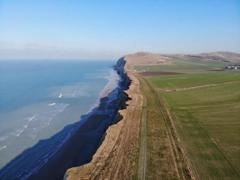
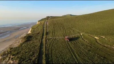
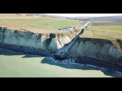
The cliffs of Cap Blanc-Nez
No reviews yet
Have you flown here? Share your experience with other pilots.
+ Write the first reviewDescription
Cap Blanc-Nez, a high land.
The varied and admirable spectacles offered to the observer by the shores of the sea are a magnificent example of the eternal changes that the surface of the earth is undergoing. - When the coast is low, and the bottom is sandy, the waves push this sand towards the edge; with each ebb it becomes a little dryer, and the wind, which almost always blows from the sea, throws it onto the beach.
This is how dunes are formed, those sandy mounds which, if man's industry fails to fix them with suitable vegetation, walk slowly but invariably inland.
When, on the contrary, the coast is high, the sea which cannot cast anything back has a destructive action; its waves gnaw at the foot of it and scrape its entire height into a cliff, because the higher parts, being without support, fall ceaselessly into the water; they are agitated in the waves until the softest and loosest parts disappear.
The harder portions, as a result of being rolled in opposite directions by the waves, form these rounded pebbles or this strike that eventually accumulates enough to serve as a rampart at the foot of the cliff. (Vatter)
Map and restricted areas
Open in the main mapNearby aerodromes
Open aerodromes within 25 km of the spot, heliports included, with their distance and direction from the spot. Near an aerodrome, drone flying is prohibited or height-limited: check the UAS zones map.
| Aerodrome | Type | Distance | Elevation | Difference |
|---|---|---|---|---|
| Saint-Inglevert Aerodrome | Aerodrome | 4.8 km SE | 117 m | spot 113 m lower |
| Coquelles Eurotunnel Heliport | Heliport | 7.0 km E | 9 m | spot 6 m lower |
| Calais-Dunkerque Airport | Airport | 19 km E | 4 m | same altitude as the spot |
| Boulogne Sur Mer Centre Hospitalier Heliport | Heliport | 22 km S | 85 m | spot 81 m lower |
Aviation weather (METAR and TAF)
LFAC – Calais-Dunkerque Airport VFR
METAR
METAR LFAC 211130Z AUTO 11004KT CAVOK 10/04 Q1019
- Wind
- 110°, 7 km/h
- Visibility
- 10 km or more
- Clouds
- –
- Temperature
- 10 °C, dew point 4 °C
- QNH
- 1019 hPa
- Flight category
- VFR: ceiling > 3,000 ft and visibility > 5 mi
TAF
Weather and Kp index
Sunrise and sunset
| Day | Dawn | Sunrise | Golden hour | Sunset | Dusk | Day length |
|---|---|---|---|---|---|---|
| Sat 21 Nov | 07:42 | 08:19 | 08:19–09:13 · 16:05–16:59 | 16:59 | 17:36 | 8 h 40 |
| Sun 22 Nov | 07:43 | 08:21 | 08:21–09:15 · 16:03–16:58 | 16:58 | 17:35 | 8 h 37 |
| Mon 23 Nov | 07:45 | 08:22 | 08:22–09:17 · 16:02–16:57 | 16:57 | 17:34 | 8 h 34 |
| Tue 24 Nov | 07:46 | 08:24 | 08:24–09:19 · 16:01–16:56 | 16:56 | 17:33 | 8 h 32 |
| Wed 25 Nov | 07:48 | 08:25 | 08:25–09:21 · 16:00–16:55 | 16:55 | 17:33 | 8 h 29 |
| Thu 26 Nov | 07:49 | 08:27 | 08:27–09:23 · 15:58–16:54 | 16:54 | 17:32 | 8 h 27 |
| Fri 27 Nov | 07:50 | 08:28 | 08:28–09:24 · 15:57–16:53 | 16:53 | 17:31 | 8 h 25 |

Reviews
Log in to review this spot. Log in · Create a free account
No reviews yet. Share yours!