

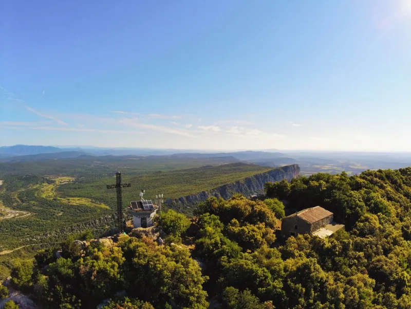
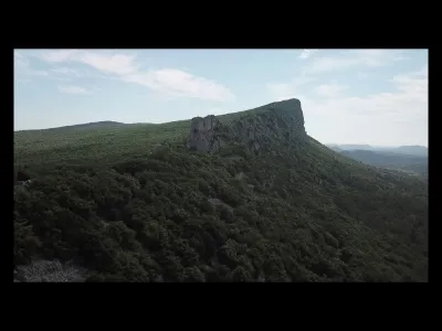
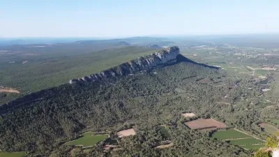
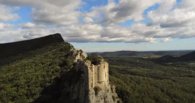
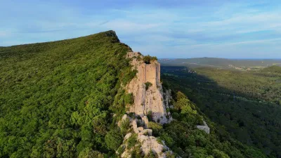
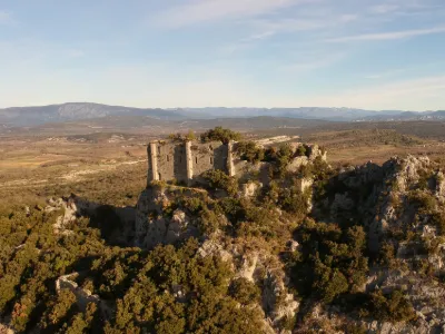
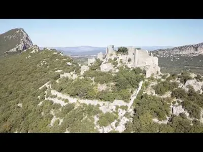
Pic Saint Loup above Montpellier
1 pilot review
“Bonjour, Pilote de planeur et de drone, je trouve ce spot limite . En effet les planeurs d…” — GGDTP, 5 years ago
Read the reviews + Write my reviewDescription
Panoramic summit above Montpellier from the small village of Cazevieille. 1h walk on a well marked but stony path with a difference in altitude of about 380m. Favour early morning or evening to avoid bothering the many hikers and trailers who come to the summit during the day. Moreover the summit is quite steep and reduced with trees all around. A good mastery of flight is necessary.
Map and restricted areas
Open in the main mapNearby aerodromes
Open aerodromes within 25 km of the spot, heliports included, with their distance and direction from the spot. Near an aerodrome, drone flying is prohibited or height-limited: check the UAS zones map.
| Aerodrome | Type | Distance | Elevation | Difference |
|---|---|---|---|---|
| Aérodrome de Saint-Martin-de-Londres | Aerodrome | 3.4 km NW | 182 m | spot 424 m higher |
| Montpellier Chr Heliport | Heliport | 17 km S | 46 m | spot 561 m higher |
| Le Corum Heliport | Heliport | 19 km S | 54 m | spot 553 m higher |
Aviation weather (METAR and TAF)
LFMT – Montpellier-Méditerranée Airport VFR
METAR
METAR LFMT 211100Z AUTO 08007KT CAVOK 15/11 Q1019 NOSIG
- Wind
- 080°, 13 km/h
- Visibility
- 10 km or more
- Clouds
- –
- Temperature
- 15 °C, dew point 11 °C
- QNH
- 1019 hPa
- Flight category
- VFR: ceiling > 3,000 ft and visibility > 5 mi
TAF
TAF LFMT 210800Z 2109/2209 07003KT CAVOK BECMG 2118/2120 01010KT TEMPO 2118/2203 BKN010 BECMG 2206/2208 28020G30KT
| Period (local time) | Change | Wind | Visibility | Weather | Clouds |
|---|---|---|---|---|---|
| 21/11 10:00 → 21/11 19:00 | Initial conditions | 070°, 6 km/h | 10 km or more | No significant weather | No significant cloud |
| 21/11 19:00 → 22/11 07:00 | Becoming | 010°, 19 km/h | 10 km or more | No significant weather | No significant cloud |
| 21/11 19:00 → 22/11 04:00 | Temporarily | Broken (5-7/8) at 1,000 ft (300 m) | |||
| 22/11 07:00 → 22/11 10:00 | Becoming | 280°, 37 km/h, gusts 56 km/h | 10 km or more | No significant weather | No significant cloud |
Weather and Kp index
| Day | Weather | Temp. min. / max. | Wind | Rain | Max Kp |
|---|---|---|---|---|---|
| Sat 21 Nov | Partly cloudy | 8° / 13° | 15 km/h NE | 1.2 mm | 2 |
| Sun 22 Nov | Partly cloudy | 9° / 12° | 39 km/h W | 1.3 mm | 2 |
| Mon 23 Nov | Fair | 4° / 12° | 34 km/h NW | – | 4 |
| Tue 24 Nov | Cloudy | 1° / 8° | 11 km/h NE | 9.9 mm | 2 |
| Wed 25 Nov | Rain | 6° / 8° | 21 km/h E | 77 mm | – |
| Thu 26 Nov | Clear sky | 2° / 10° | 4 km/h N | – | – |
| Fri 27 Nov | Clear sky | 1° / 10° | 8 km/h NW | – | – |
Hour by hour: Saturday 21 November
| Time | Weather | Temp. | Wind | Rain | Clouds | Kp |
|---|---|---|---|---|---|---|
| 12:00 | Fair | 13° | 4 km/h SE | – | 31 % | 2 |
| 13:00 | Partly cloudy | 13° | 6 km/h SE | – | 44 % | 1 |
| 14:00 | Partly cloudy | 13° | 7 km/h SE | – | 57 % | 1 |
| 15:00 | Partly cloudy | 13° | 8 km/h SE | – | 50 % | 1 |
| 16:00 | Partly cloudy | 12° | 8 km/h SE | – | 78 % | 2 |
| 17:00 | Partly cloudy | 10° | 5 km/h E | – | 80 % | 2 |
| 18:00 | Cloudy | 9° | 5 km/h E | – | 99 % | 2 |
| 19:00 | Cloudy | 9° | 6 km/h NE | – | 99 % | 2 |
| 20:00 | Cloudy | 8° | 8 km/h NE | – | 100 % | 2 |
| 21:00 | Rain | 9° | 10 km/h NE | 0.6 mm | 100 % | 2 |
| 22:00 | Light rain | 9° | 12 km/h NE | 0.3 mm | 100 % | 2 |
Hour by hour: Sunday 22 November
| Time | Weather | Temp. | Wind | Rain | Clouds | Kp |
|---|---|---|---|---|---|---|
| 06:00 | Cloudy | 9° | 12 km/h NW | – | 100 % | 2 |
| 07:00 | Cloudy | 9° | 11 km/h W | – | 100 % | 2 |
| 08:00 | Cloudy | 11° | 33 km/h W | – | 94 % | 2 |
| 09:00 | Cloudy | 11° | 34 km/h W | – | 92 % | 2 |
| 10:00 | Showers | 12° | 39 km/h W | 0.1 mm | 59 % | 2 |
| 11:00 | Showers | 12° | 30 km/h W | 0.1 mm | 37 % | 2 |
| 12:00 | Partly cloudy | 12° | 35 km/h W | – | 52 % | 2 |
| 13:00 | Partly cloudy | 12° | 34 km/h W | – | 78 % | 2 |
| 14:00 | Partly cloudy | 12° | 34 km/h W | – | 62 % | 2 |
| 15:00 | Fair | 12° | 32 km/h W | – | 21 % | 2 |
| 16:00 | Cloudy | 11° | 37 km/h NW | – | 87 % | 2 |
| 17:00 | Partly cloudy | 10° | 36 km/h NW | – | 60 % | 2 |
| 18:00 | Partly cloudy | 10° | 35 km/h NW | – | 56 % | 2 |
| 19:00 | Partly cloudy | 10° | 35 km/h NW | – | 82 % | 2 |
| 20:00 | Partly cloudy | 10° | 35 km/h NW | – | 69 % | 2 |
| 21:00 | Partly cloudy | 9° | 34 km/h NW | – | 63 % | 2 |
| 22:00 | Partly cloudy | 9° | 31 km/h NW | – | 84 % | 2 |
Sunrise and sunset
| Day | Dawn | Sunrise | Golden hour | Sunset | Dusk | Day length |
|---|---|---|---|---|---|---|
| Sat 21 Nov | 07:15 | 07:47 | 07:47–08:31 · 16:30–17:14 | 17:14 | 17:46 | 9 h 27 |
| Sun 22 Nov | 07:17 | 07:48 | 07:48–08:33 · 16:29–17:14 | 17:14 | 17:45 | 9 h 25 |
| Mon 23 Nov | 07:18 | 07:49 | 07:49–08:34 · 16:28–17:13 | 17:13 | 17:45 | 9 h 23 |
| Tue 24 Nov | 07:19 | 07:50 | 07:50–08:35 · 16:27–17:12 | 17:12 | 17:44 | 9 h 21 |
| Wed 25 Nov | 07:20 | 07:52 | 07:52–08:37 · 16:27–17:12 | 17:12 | 17:43 | 9 h 20 |
| Thu 26 Nov | 07:21 | 07:53 | 07:53–08:38 · 16:26–17:11 | 17:11 | 17:43 | 9 h 18 |
| Fri 27 Nov | 07:22 | 07:54 | 07:54–08:39 · 16:25–17:11 | 17:11 | 17:42 | 9 h 16 |
Reviews
Log in to review this spot. Log in · Create a free account
GGDTP
Bonjour, Pilote de planeur et de drone, je trouve ce spot limite . En effet les planeurs du pic St loup volent sur le relief a quelques dizaines de mètres voir quelques mètres selon les ascendances au dessus du rocher. Un risque de collision est a envisager; ce serait la perte de votre drone mais peut être aussi un crash du planeur !!!! Les planeurs peuvent même voler plus bas que le sommet du Pic en pente nord ou sud !!! A éviter je pense Gérard