

Gorges du Verdon and Sainte Croix lake
No reviews yet
Have you flown here? Share your experience with other pilots.
+ Write the first reviewDescription
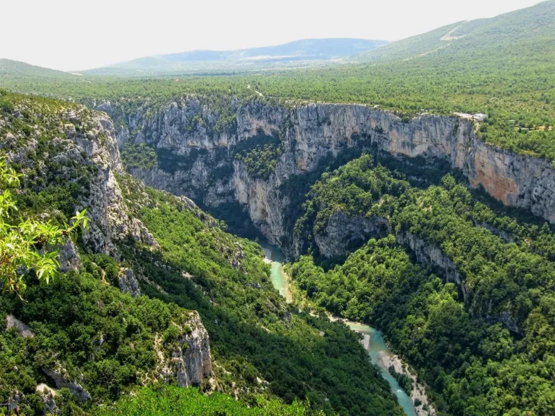
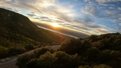
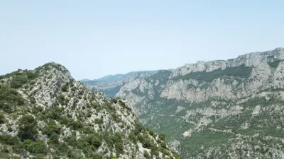
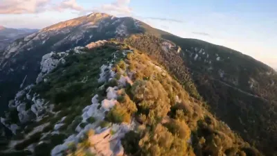
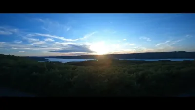
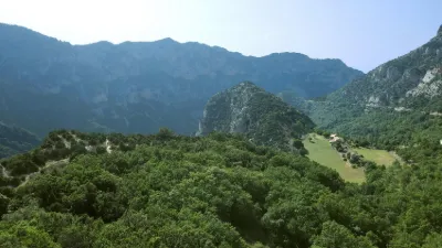
The Gorges du Verdon are located in the north of Provence. It is the largest canyon in Europe, it offers breathtaking landscapes. You can also enjoy family bathing or white water sports. The Verdon rises at 2819 metres at the Col d'Allos pass then joins the Durance at Vinon sur Verdon. Its total length is 175 km. But the most sensational is the height of the cliffs which varies from 250 to 700 meters, the width ranging from 6 to 100 meters and from 200 to 1500 meters at the top of the gorges. Search for 'Samson corridor' in google map in 3D (https://www.google.com/maps/place/Couloir Samson/@43.7804039,6.392062,1878a,35y,4.54h,17.35t/data=!3m1!1e3!4m5!3m4!1s0x12cbf7c31bf65d99:0x37a2ed514db980d5!8m2!3d43.786741!4d6.395368). Ah, I think I'll go back soon and show you this up close! Beware during the tourist season of the number of motorcyclists and camper vans that frequent this beautiful place. You can swim there but also go hiking. There is a biotope protection zone to be respected, so we don't throw anything into the canyon and leave it as we found it. Thank you in advance.
Map and restricted areas
Open in the main mapNearby aerodromes
Open aerodromes within 25 km of the spot, heliports included, with their distance and direction from the spot. Near an aerodrome, drone flying is prohibited or height-limited: check the UAS zones map.
| Aerodrome | Type | Distance | Elevation | Difference |
|---|---|---|---|---|
| Puimoisson Airfield | Aerodrome | 13 km NW | 769 m | spot 286 m higher |
| Col de Lèques | Aerodrome | 19 km NE | 1,126 m | spot 71 m lower |
Aviation weather (METAR and TAF)
LFMC – Le Luc-Le Cannet Airport VFR
METAR
METAR LFMC 211000Z AUTO 26015KT CAVOK 14/05 Q1018
- Wind
- 260°, 28 km/h
- Visibility
- 10 km or more
- Clouds
- –
- Temperature
- 14 °C, dew point 5 °C
- QNH
- 1018 hPa
- Flight category
- VFR: ceiling > 3,000 ft and visibility > 5 mi
TAF
Weather and Kp index
| Day | Weather | Temp. min. / max. | Wind | Rain | Max Kp |
|---|---|---|---|---|---|
| Sat 21 Nov | Fair | 2° / 9° | 16 km/h W | – | 2 |
| Sun 22 Nov | Showers | 2° / 7° | 32 km/h NW | 19 mm | 2 |
| Mon 23 Nov | Partly cloudy | -1° / 5° | 43 km/h NW | – | 4 |
| Tue 24 Nov | Cloudy | -2° / 7° | 16 km/h SE | 0.6 mm | 2 |
| Wed 25 Nov | Sleet | 1° / 2° | 29 km/h E | 20 mm | – |
| Thu 26 Nov | Fair | -3° / 3° | 6 km/h N | 16 mm | – |
| Fri 27 Nov | Clear sky | -4° / 5° | 4 km/h N | – | – |
Hour by hour: Saturday 21 November
| Time | Weather | Temp. | Wind | Rain | Clouds | Kp |
|---|---|---|---|---|---|---|
| 11:00 | Partly cloudy | 8° | 15 km/h NW | – | 72 % | 2 |
| 12:00 | Fair | 9° | 14 km/h NW | – | 38 % | 2 |
| 13:00 | Fair | 9° | 14 km/h NW | – | 13 % | 1 |
| 14:00 | Fair | 9° | 15 km/h W | – | 36 % | 1 |
| 15:00 | Partly cloudy | 9° | 16 km/h W | – | 66 % | 1 |
| 16:00 | Partly cloudy | 8° | 14 km/h W | – | 59 % | 2 |
| 17:00 | Partly cloudy | 4° | 9 km/h NW | – | 83 % | 2 |
| 18:00 | Partly cloudy | 4° | 9 km/h W | – | 59 % | 2 |
| 19:00 | Partly cloudy | 3° | 9 km/h N | – | 80 % | 2 |
| 20:00 | Partly cloudy | 2° | 8 km/h NE | – | 90 % | 2 |
| 21:00 | Partly cloudy | 2° | 8 km/h NE | – | 75 % | 2 |
| 22:00 | Cloudy | 2° | 6 km/h NE | – | 98 % | 2 |
Hour by hour: Sunday 22 November
| Time | Weather | Temp. | Wind | Rain | Clouds | Kp |
|---|---|---|---|---|---|---|
| 06:00 | Rain | 6° | 16 km/h SE | 0.9 mm | 100 % | 2 |
| 07:00 | Heavy rain | 7° | 18 km/h SE | 1.9 mm | 100 % | 2 |
| 08:00 | Heavy rain | 7° | 16 km/h S | 3.6 mm | 100 % | 2 |
| 09:00 | Heavy rain | 7° | 13 km/h S | 2.5 mm | 100 % | 2 |
| 10:00 | Rain | 7° | 12 km/h W | 0.9 mm | 100 % | 2 |
| 11:00 | Fog | 7° | 27 km/h W | – | 100 % | 2 |
| 12:00 | Rain | 7° | 30 km/h W | 0.6 mm | 99 % | 2 |
| 13:00 | Showers | 6° | 29 km/h NW | 0.5 mm | 54 % | 2 |
| 14:00 | Light rain | 7° | 30 km/h NW | 0.2 mm | 91 % | 2 |
| 15:00 | Showers | 7° | 31 km/h NW | 0.3 mm | 44 % | 2 |
| 16:00 | Showers | 6° | 30 km/h NW | 0.3 mm | 30 % | 2 |
| 17:00 | Showers | 4° | 29 km/h NW | 0.4 mm | 50 % | 2 |
| 18:00 | Showers | 3° | 24 km/h NW | 0.2 mm | 28 % | 2 |
| 19:00 | Partly cloudy | 3° | 26 km/h NW | – | 45 % | 2 |
| 20:00 | Sleet | 2° | 26 km/h W | 0.1 mm | 30 % | 2 |
| 21:00 | Sleet | 2° | 27 km/h W | 0.1 mm | 49 % | 2 |
| 22:00 | Partly cloudy | 2° | 28 km/h NW | – | 54 % | 2 |
Sunrise and sunset
| Day | Dawn | Sunrise | Golden hour | Sunset | Dusk | Day length |
|---|---|---|---|---|---|---|
| Sat 21 Nov | 07:06 | 07:37 | 07:37–08:21 · 16:20–17:05 | 17:05 | 17:36 | 9 h 27 |
| Sun 22 Nov | 07:07 | 07:38 | 07:38–08:23 · 16:19–17:04 | 17:04 | 17:35 | 9 h 25 |
| Mon 23 Nov | 07:08 | 07:39 | 07:39–08:24 · 16:19–17:03 | 17:03 | 17:35 | 9 h 23 |
| Tue 24 Nov | 07:09 | 07:41 | 07:41–08:26 · 16:18–17:03 | 17:03 | 17:34 | 9 h 21 |
| Wed 25 Nov | 07:10 | 07:42 | 07:42–08:27 · 16:17–17:02 | 17:02 | 17:34 | 9 h 20 |
| Thu 26 Nov | 07:11 | 07:43 | 07:43–08:28 · 16:16–17:01 | 17:01 | 17:33 | 9 h 18 |
| Fri 27 Nov | 07:12 | 07:44 | 07:44–08:30 · 16:16–17:01 | 17:01 | 17:33 | 9 h 16 |
Reviews
Log in to review this spot. Log in · Create a free account
No reviews yet. Share yours!