

Water
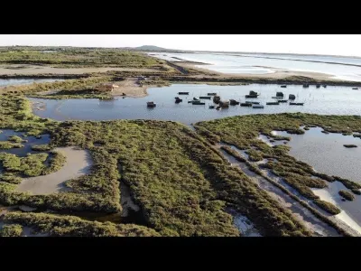
Thau Lagoon
3 pilot reviews
“Garde du littoral, merci pour votre retour. Je suis justement sur place et au vu du pannea…” — Taz34, 4 years ago
Read the reviews + Write my reviewDescription
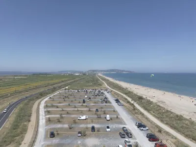
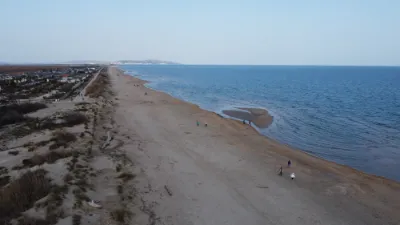
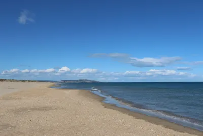
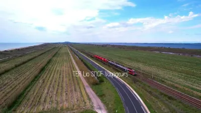
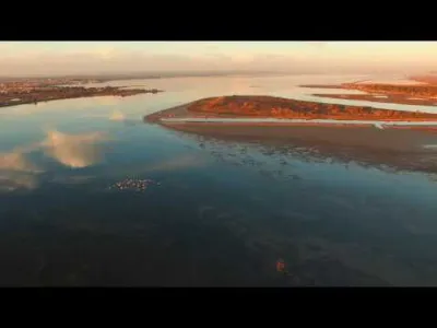
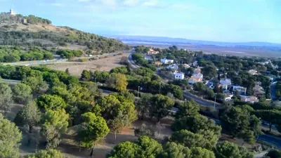
Drone is beautiful. Little picnic...
Map and restricted areas
Open in the main mapNearby aerodromes
Open aerodromes within 25 km of the spot, heliports included, with their distance and direction from the spot. Near an aerodrome, drone flying is prohibited or height-limited: check the UAS zones map.
| Aerodrome | Type | Distance | Elevation |
|---|---|---|---|
| Béziers-Vias Airport | Airport | 18 km W | 17 m |
Aviation weather (METAR and TAF)
LFMU – Béziers-Vias Airport VFR
METAR
METAR LFMU 210630Z AUTO 34002KT CAVOK 08/08 Q1020 NOSIG
- Wind
- 340°, 4 km/h
- Visibility
- 10 km or more
- Clouds
- –
- Temperature
- 8 °C, dew point 8 °C
- QNH
- 1020 hPa
- Flight category
- VFR: ceiling > 3,000 ft and visibility > 5 mi
TAF
TAF LFMU 210200Z 2103/2203 01004KT CAVOK BECMG 2110/2112 07010KT TEMPO 2120/2203 BKN014
| Period (local time) | Change | Wind | Visibility | Weather | Clouds |
|---|---|---|---|---|---|
| 21/11 04:00 → 21/11 11:00 | Initial conditions | 010°, 7 km/h | 10 km or more | No significant weather | No significant cloud |
| 21/11 11:00 → 22/11 04:00 | Becoming | 070°, 19 km/h | 10 km or more | No significant weather | No significant cloud |
| 21/11 21:00 → 22/11 04:00 | Temporarily | Broken (5-7/8) at 1,400 ft (430 m) |
Weather and Kp index
| Day | Weather | Temp. min. / max. | Wind | Rain | Max Kp |
|---|---|---|---|---|---|
| Sat 21 Nov | Fair | 9° / 16° | 26 km/h NE | – | 2 |
| Sun 22 Nov | Partly cloudy | 11° / 15° | 51 km/h W | 0.4 mm | 2 |
| Mon 23 Nov | Partly cloudy | 10° / 15° | 35 km/h W | 0.3 mm | 4 |
| Tue 24 Nov | Light rain | 5° / 10° | 16 km/h NE | 15 mm | 2 |
| Wed 25 Nov | Showers | 9° / 13° | 30 km/h SE | 22 mm | – |
| Thu 26 Nov | Clear sky | 6° / 13° | 12 km/h NW | – | – |
| Fri 27 Nov | Fair | 8° / 13° | 13 km/h NW | – | – |
Hour by hour: Saturday 21 November
| Time | Weather | Temp. | Wind | Rain | Clouds | Kp |
|---|---|---|---|---|---|---|
| 07:00 | Cloudy | 9° | 9 km/h NW | – | 100 % | 2 |
| 08:00 | Cloudy | 9° | 11 km/h NW | – | 100 % | 2 |
| 09:00 | Cloudy | 11° | 12 km/h N | – | 100 % | 2 |
| 10:00 | Cloudy | 12° | 10 km/h N | – | 100 % | 2 |
| 11:00 | Cloudy | 14° | 5 km/h NE | – | 98 % | 2 |
| 12:00 | Partly cloudy | 15° | 6 km/h E | – | 53 % | 2 |
| 13:00 | Fair | 16° | 12 km/h E | – | 32 % | 1 |
| 14:00 | Partly cloudy | 16° | 13 km/h E | – | 40 % | 1 |
| 15:00 | Partly cloudy | 15° | 17 km/h E | – | 55 % | 1 |
| 16:00 | Partly cloudy | 15° | 18 km/h E | – | 80 % | 2 |
| 17:00 | Partly cloudy | 14° | 20 km/h E | – | 80 % | 2 |
| 18:00 | Cloudy | 13° | 23 km/h E | – | 91 % | 2 |
| 19:00 | Cloudy | 13° | 25 km/h E | – | 98 % | 2 |
| 20:00 | Cloudy | 14° | 26 km/h NE | – | 100 % | 2 |
| 21:00 | Cloudy | 14° | 22 km/h NE | – | 100 % | 2 |
| 22:00 | Cloudy | 14° | 20 km/h NE | – | 100 % | 2 |
Hour by hour: Sunday 22 November
| Time | Weather | Temp. | Wind | Rain | Clouds | Kp |
|---|---|---|---|---|---|---|
| 06:00 | Showers | 12° | 13 km/h NW | 0.1 mm | 42 % | 2 |
| 07:00 | Clear sky | 11° | 10 km/h W | – | 10 % | 2 |
| 08:00 | Partly cloudy | 12° | 33 km/h W | – | 80 % | 2 |
| 09:00 | Light rain | 14° | 37 km/h W | 0.1 mm | 94 % | 2 |
| 10:00 | Partly cloudy | 14° | 40 km/h W | – | 70 % | 2 |
| 11:00 | Partly cloudy | 14° | 51 km/h W | – | 80 % | 2 |
| 12:00 | Cloudy | 15° | 48 km/h W | – | 93 % | 2 |
| 13:00 | Partly cloudy | 15° | 43 km/h W | – | 41 % | 2 |
| 14:00 | Cloudy | 15° | 45 km/h W | – | 88 % | 2 |
| 15:00 | Partly cloudy | 14° | 46 km/h W | – | 43 % | 2 |
| 16:00 | Partly cloudy | 14° | 44 km/h W | – | 78 % | 2 |
| 17:00 | Partly cloudy | 13° | 40 km/h W | – | 62 % | 2 |
| 18:00 | Partly cloudy | 12° | 39 km/h W | – | 69 % | 2 |
| 19:00 | Partly cloudy | 12° | 39 km/h W | – | 75 % | 2 |
| 20:00 | Cloudy | 12° | 38 km/h W | – | 92 % | 2 |
| 21:00 | Partly cloudy | 12° | 37 km/h W | – | 66 % | 2 |
| 22:00 | Partly cloudy | 12° | 37 km/h W | – | 55 % | 2 |
Sunrise and sunset
| Day | Dawn | Sunrise | Golden hour | Sunset | Dusk | Day length |
|---|---|---|---|---|---|---|
| Sat 21 Nov | 07:15 | 07:47 | 07:47–08:31 · 16:33–17:17 | 17:17 | 17:48 | 9 h 30 |
| Sun 22 Nov | 07:17 | 07:48 | 07:48–08:32 · 16:32–17:16 | 17:16 | 17:47 | 9 h 28 |
| Mon 23 Nov | 07:18 | 07:49 | 07:49–08:33 · 16:31–17:15 | 17:15 | 17:47 | 9 h 26 |
| Tue 24 Nov | 07:19 | 07:50 | 07:50–08:35 · 16:30–17:15 | 17:15 | 17:46 | 9 h 24 |
| Wed 25 Nov | 07:20 | 07:51 | 07:51–08:36 · 16:29–17:14 | 17:14 | 17:45 | 9 h 22 |
| Thu 26 Nov | 07:21 | 07:53 | 07:53–08:37 · 16:29–17:13 | 17:13 | 17:45 | 9 h 20 |
| Fri 27 Nov | 07:22 | 07:54 | 07:54–08:39 · 16:28–17:13 | 17:13 | 17:45 | 9 h 19 |
Reviews
Log in to review this spot. Log in · Create a free account
Taz34
Garde du littoral, merci pour votre retour. Je suis justement sur place et au vu du panneau à l’entrée du site, ai préféré garder mon drone dans le sac. Prise de vue uniquement à l’appareil photo. Même si parfois le règlement peut l’autoriser, faisons preuve de bon sens. Prenons soin de notre biodiversité.
Yves gujan
Aurorise ou non autorise ? C’est quand meme simple?
Garde du littoral - Police de l'environnement
ATTENTION - Site naturel protégé Lido de Thau Site sensible, oiseaux protégés. Risque de dérangement. Survol, décollage et atterrissage de drone déconseillés.