

MOUNTAIN WOOD TANK

No reviews yet
Have you flown here? Share your experience with other pilots.
+ Write the first reviewDescription
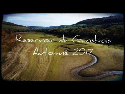
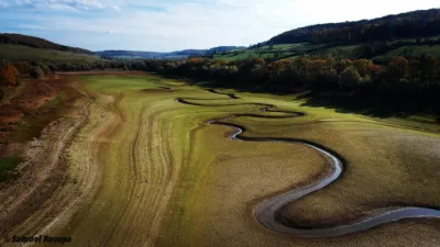
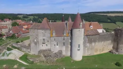
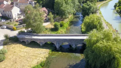
Grosbois is, with a capacity of 8.6 million cubic metres, the largest of all the reservoirs of the Burgundy Canal until 1875, when it was enlarged. This reservoir is located in the upper Brenne valley, at an altitude of nearly 400 m. A 14 km long gully brings water into the Pouilly basin, at an altitude of 378 m, giving a slope of 0.16%. This gully crosses the very marked relief that separates the slopes of the Brenne and Armançon rivers, through a 3.6 km long underground passage that leads to Soussey, where it collects water from the Brionne before doing the same with two other streams downstream. In 1900, Grosbois received a "counter-reservoir" just downstream of its dyke, intended to counterbalance the thrust exerted on it by the reservoir (please specify because it is unclear. Thank you). This second body of water contains 0.9 million cubic metres, and is used as a place for nautical leisure activities, in addition to its role as a regulator of the Brenne River.
Map and restricted areas
Open in the main mapNearby aerodromes
Open aerodromes within 25 km of the spot, heliports included, with their distance and direction from the spot. Near an aerodrome, drone flying is prohibited or height-limited: check the UAS zones map.
| Aerodrome | Type | Distance | Elevation | Difference |
|---|---|---|---|---|
| Pouilly Maconge Airport | Aerodrome | 11 km S | 430 m | spot 35 m lower |
Aviation weather (METAR and TAF)
LFSD – Dijon-Bourgogne Airport VFR
METAR
METAR LFSD 211030Z AUTO 19004KT 160V230 CAVOK 11/08 Q1020
- Wind
- 190°, 7 km/h
- Visibility
- 10 km or more
- Clouds
- –
- Temperature
- 11 °C, dew point 8 °C
- QNH
- 1020 hPa
- Flight category
- VFR: ceiling > 3,000 ft and visibility > 5 mi
TAF
Weather and Kp index
Sunrise and sunset
| Day | Dawn | Sunrise | Golden hour | Sunset | Dusk | Day length |
|---|---|---|---|---|---|---|
| Sat 21 Nov | 07:21 | 07:54 | 07:54–08:43 · 16:12–17:00 | 17:00 | 17:34 | 9 h 05 |
| Sun 22 Nov | 07:22 | 07:56 | 07:56–08:45 · 16:11–17:00 | 17:00 | 17:33 | 9 h 03 |
| Mon 23 Nov | 07:23 | 07:57 | 07:57–08:46 · 16:10–16:59 | 16:59 | 17:33 | 9 h 01 |
| Tue 24 Nov | 07:24 | 07:59 | 07:59–08:48 · 16:09–16:58 | 16:58 | 17:32 | 8 h 59 |
| Wed 25 Nov | 07:26 | 08:00 | 08:00–08:49 · 16:08–16:57 | 16:57 | 17:31 | 8 h 57 |
| Thu 26 Nov | 07:27 | 08:01 | 08:01–08:51 · 16:07–16:56 | 16:56 | 17:31 | 8 h 55 |
| Fri 27 Nov | 07:28 | 08:03 | 08:03–08:52 · 16:06–16:56 | 16:56 | 17:30 | 8 h 53 |
Reviews
Log in to review this spot. Log in · Create a free account
No reviews yet. Share yours!