

Submarine UC-61

No reviews yet
Have you flown here? Share your experience with other pilots.
+ Write the first reviewDescription
The Unterseeboot UC-61 or SM UC-61 is a German submarine (U-Boot) type UC II used by the Kaiserliche Marine during the First World War. The submarine was ordered on 12 January 1916 in Bremen (AG Weser), its keel was laid on 3 April 1916, it was launched on 11 November 1916 and put into service on 13 December 1916, under the command of Kapitänleutnant Georg Gerth. She was abandoned by her crew near Wissant after an accidental grounding in July 1917 and was damaged by explosives by the crew. This submarine will sink 12 ships and damage several others in its short career.
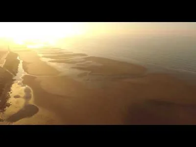
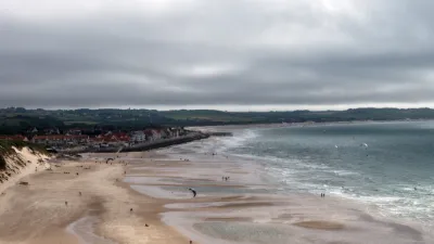
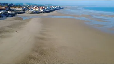
From 1932 until January 2019, the wreck was completely silted up and forgotten by the collective memory. Since this year, it is again visible at the following coordinates: 50° 54′ N, 1° 40′ E. Be careful, it's a remnant of war, even if its size is small, there may be danger.
Map and restricted areas
Open in the main mapNearby aerodromes
Open aerodromes within 25 km of the spot, heliports included, with their distance and direction from the spot. Near an aerodrome, drone flying is prohibited or height-limited: check the UAS zones map.
| Aerodrome | Type | Distance | Elevation | Difference |
|---|---|---|---|---|
| Saint-Inglevert Aerodrome | Aerodrome | 5.2 km E | 117 m | spot 115 m lower |
| Coquelles Eurotunnel Heliport | Heliport | 9.7 km E | 9 m | spot 7 m lower |
| Boulogne Sur Mer Centre Hospitalier Heliport | Heliport | 19 km S | 85 m | spot 83 m lower |
| Calais-Dunkerque Airport | Airport | 22 km E | 4 m | same altitude as the spot |
Aviation weather (METAR and TAF)
LFAC – Calais-Dunkerque Airport VFR
METAR
METAR LFAC 210630Z AUTO 23003KT CAVOK 02/02 Q1018
- Wind
- 230°, 6 km/h
- Visibility
- 10 km or more
- Clouds
- –
- Temperature
- 2 °C, dew point 2 °C
- QNH
- 1018 hPa
- Flight category
- VFR: ceiling > 3,000 ft and visibility > 5 mi
TAF
Weather and Kp index
| Day | Weather | Temp. min. / max. | Wind | Rain | Max Kp |
|---|---|---|---|---|---|
| Sat 21 Nov | Fair | 5° / 10° | 19 km/h E | – | 2 |
| Sun 22 Nov | Cloudy | 4° / 7° | 36 km/h E | – | 2 |
| Mon 23 Nov | Clear sky | 1° / 6° | 31 km/h E | – | 4 |
| Tue 24 Nov | Fair | 0° / 3° | 22 km/h E | – | 2 |
| Wed 25 Nov | Cloudy | -1° / 2° | 30 km/h E | – | – |
| Thu 26 Nov | Fair | -2° / 1° | 24 km/h E | – | – |
| Fri 27 Nov | Partly cloudy | -1° / 3° | 22 km/h SE | 1.0 mm | – |
Hour by hour: Saturday 21 November
| Time | Weather | Temp. | Wind | Rain | Clouds | Kp |
|---|---|---|---|---|---|---|
| 07:00 | Fair | 5° | 9 km/h S | – | 30 % | 2 |
| 08:00 | Fog | 5° | 10 km/h SE | – | 44 % | 2 |
| 09:00 | Fog | 5° | 11 km/h SE | – | 41 % | 2 |
| 10:00 | Clear sky | 6° | 12 km/h SE | – | 4 % | 2 |
| 11:00 | Fair | 8° | 12 km/h SE | – | 22 % | 2 |
| 12:00 | Fair | 8° | 12 km/h SE | – | 29 % | 2 |
| 13:00 | Fair | 9° | 11 km/h SE | – | 28 % | 1 |
| 14:00 | Fair | 10° | 9 km/h SE | – | 13 % | 1 |
| 15:00 | Clear sky | 10° | 13 km/h E | – | 2 % | 1 |
| 16:00 | Clear sky | 9° | 16 km/h E | – | 2 % | 2 |
| 17:00 | Clear sky | 7° | 19 km/h E | – | 2 % | 2 |
| 18:00 | Clear sky | 6° | 19 km/h SE | – | 3 % | 2 |
| 19:00 | Fair | 6° | 18 km/h SE | – | 21 % | 2 |
| 20:00 | Partly cloudy | 6° | 17 km/h SE | – | 85 % | 2 |
| 21:00 | Cloudy | 6° | 16 km/h SE | – | 91 % | 2 |
| 22:00 | Cloudy | 6° | 17 km/h E | – | 100 % | 2 |
Hour by hour: Sunday 22 November
| Time | Weather | Temp. | Wind | Rain | Clouds | Kp |
|---|---|---|---|---|---|---|
| 06:00 | Cloudy | 6° | 31 km/h E | – | 100 % | 2 |
| 07:00 | Cloudy | 5° | 32 km/h E | – | 100 % | 2 |
| 08:00 | Cloudy | 5° | 32 km/h E | – | 100 % | 2 |
| 09:00 | Cloudy | 5° | 33 km/h E | – | 100 % | 2 |
| 10:00 | Cloudy | 5° | 33 km/h E | – | 100 % | 2 |
| 11:00 | Cloudy | 5° | 35 km/h E | – | 100 % | 2 |
| 12:00 | Cloudy | 6° | 34 km/h E | – | 100 % | 2 |
| 13:00 | Cloudy | 6° | 36 km/h E | – | 100 % | 2 |
| 14:00 | Cloudy | 6° | 36 km/h E | – | 100 % | 2 |
| 15:00 | Cloudy | 7° | 35 km/h E | – | 100 % | 2 |
| 16:00 | Cloudy | 6° | 33 km/h E | – | 100 % | 2 |
| 17:00 | Cloudy | 6° | 32 km/h E | – | 100 % | 2 |
| 18:00 | Partly cloudy | 6° | 33 km/h E | – | 99 % | 2 |
| 19:00 | Partly cloudy | 5° | 33 km/h E | – | 82 % | 2 |
| 20:00 | Partly cloudy | 5° | 32 km/h E | – | 93 % | 2 |
| 21:00 | Partly cloudy | 4° | 31 km/h E | – | 98 % | 2 |
| 22:00 | Partly cloudy | 4° | 31 km/h E | – | 89 % | 2 |
Sunrise and sunset
| Day | Dawn | Sunrise | Golden hour | Sunset | Dusk | Day length |
|---|---|---|---|---|---|---|
| Sat 21 Nov | 07:42 | 08:19 | 08:19–09:13 · 16:05–16:59 | 16:59 | 17:36 | 8 h 40 |
| Sun 22 Nov | 07:43 | 08:21 | 08:21–09:15 · 16:04–16:58 | 16:58 | 17:35 | 8 h 37 |
| Mon 23 Nov | 07:45 | 08:22 | 08:22–09:17 · 16:02–16:57 | 16:57 | 17:35 | 8 h 35 |
| Tue 24 Nov | 07:46 | 08:24 | 08:24–09:19 · 16:01–16:56 | 16:56 | 17:34 | 8 h 32 |
| Wed 25 Nov | 07:48 | 08:25 | 08:25–09:21 · 16:00–16:55 | 16:55 | 17:33 | 8 h 30 |
| Thu 26 Nov | 07:49 | 08:27 | 08:27–09:23 · 15:59–16:55 | 16:55 | 17:32 | 8 h 27 |
| Fri 27 Nov | 07:50 | 08:28 | 08:28–09:24 · 15:58–16:54 | 16:54 | 17:31 | 8 h 25 |


Reviews
Log in to review this spot. Log in · Create a free account
No reviews yet. Share yours!