

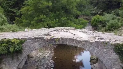
Bridge near Noceta (Upper Corsica)
No reviews yet
Have you flown here? Share your experience with other pilots.
+ Write the first reviewDescription
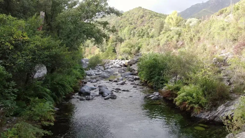
Located on the road that goes from Venaco to Aleria, this ancient bridge allows you to reach the village of Noceta. The river that flows underneath is called the Vecchiu and is a tributary of the Tavignano river into which it flows a few kilometers further.If at the moment the corner is deserted, it is not the same in the summer or these water holes are used as natural swimming pool and are welcome during the heat wave. This valley is very sheltered and it is very good to walk there, we see on the penultimate picture the hotel "e caselle" built on the edge of the water in river pebbles.
Map and restricted areas
Open in the main mapNearby aerodromes
Open aerodromes within 25 km of the spot, heliports included, with their distance and direction from the spot. Near an aerodrome, drone flying is prohibited or height-limited: check the UAS zones map.
| Aerodrome | Type | Distance | Elevation | Difference |
|---|---|---|---|---|
| Aérodrome de Corte | Aerodrome | 7.7 km N | 345 m | spot 106 m lower |
| Base ULM d'Aghione Casone | Aerodrome | 22 km SE | 51 m | spot 188 m higher |
| Aérodrome de Ghisonaccia - Alzitone | Aerodrome | 25 km SE | 54 m | spot 185 m higher |
Aviation weather (METAR and TAF)
LFKS – Solenzara (BA 126) Air Base VFR
METAR
METAR LFKS 211100Z AUTO 28006KT 210V340 CAVOK 20/03 Q1017
- Wind
- 280°, 11 km/h
- Visibility
- 10 km or more
- Clouds
- –
- Temperature
- 20 °C, dew point 3 °C
- QNH
- 1017 hPa
- Flight category
- VFR: ceiling > 3,000 ft and visibility > 5 mi
TAF
Weather and Kp index
Sunrise and sunset
| Day | Dawn | Sunrise | Golden hour | Sunset | Dusk | Day length |
|---|---|---|---|---|---|---|
| Sat 21 Nov | 06:50 | 07:21 | 07:21–08:04 · 16:14–16:57 | 16:57 | 17:28 | 9 h 36 |
| Sun 22 Nov | 06:52 | 07:22 | 07:22–08:05 · 16:14–16:57 | 16:57 | 17:27 | 9 h 34 |
| Mon 23 Nov | 06:53 | 07:23 | 07:23–08:06 · 16:13–16:56 | 16:56 | 17:27 | 9 h 32 |
| Tue 24 Nov | 06:54 | 07:24 | 07:24–08:08 · 16:12–16:55 | 16:55 | 17:26 | 9 h 30 |
| Wed 25 Nov | 06:55 | 07:26 | 07:26–08:09 · 16:11–16:55 | 16:55 | 17:25 | 9 h 29 |
| Thu 26 Nov | 06:56 | 07:27 | 07:27–08:10 · 16:11–16:54 | 16:54 | 17:25 | 9 h 27 |
| Fri 27 Nov | 06:57 | 07:28 | 07:28–08:12 · 16:10–16:54 | 16:54 | 17:25 | 9 h 25 |


Reviews
Log in to review this spot. Log in · Create a free account
No reviews yet. Share yours!