Skip to content
Water

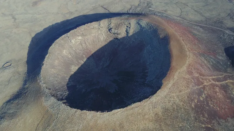
Calderón Hondo (Volcano), Fuerteventura
Spain

Calderón Hondo (Volcano), Fuerteventura – photo 1

No reviews yet

Have you flown here? Share your experience with other pilots.

+ Write the first review

Description

Calderón Hondo (Volcano), Fuerteventura

Automatic translation.

Aviation weather (METAR and TAF)

GCFV – Fuerteventura Airport · 29 km S VFR

METAR

Observed 21/11 11:00 · 20 min ago

METAR GCFV 211100Z 06007KT 9999 FEW015 23/18 Q1022

Wind
060°, 13 km/h
Visibility
10 km or more
Clouds
Few (1-2/8) at 1,500 ft (460 m)
Temperature
23 °C, dew point 18 °C
QNH
1022 hPa
Flight category
VFR: ceiling > 3,000 ft and visibility > 5 mi

TAF

Issued 21/11 08:00 · valid from 21/11 09:00 to 22/11 09:00

TAF GCFV 210800Z 2109/2209 04010KT 9999 FEW015 TX24/2113Z TN20/2121Z TEMPO 2109/2111 VRB05KT

Period (local time) Change Wind Visibility Weather Clouds
21/11 09:00 → 22/11 09:00 Initial conditions 040°, 19 km/h 10 km or more Few (1-2/8) at 1,500 ft (460 m)
21/11 09:00 → 21/11 11:00 Temporarily Variable, 9 km/h

Empty cell: no change forecast for that element.

METAR and TAF from NOAA (Aviation Weather Center), for guidance only: they do not replace flight planning with official sources (SIA, Météo-France). Nearest station that issues a METAR, not necessarily the nearest aerodrome.

Plan the light

Weather and Kp index

Loading forecast…

Sunrise and sunset

Local times at the spot (UTC). The golden hour, the warm, low light sought after for photos and videos, runs from sunrise until the sun reaches 6° above the horizon, and in the evening from 6° until sunset.

Day Dawn Sunrise Golden hour Sunset Dusk Day length
Sat 21 Nov06:58 07:23 07:23–07:58 · 17:25–18:00 18:00 18:2510 h 36
Sun 22 Nov06:59 07:24 07:24–07:58 · 17:25–18:00 18:00 18:2510 h 35
Mon 23 Nov07:00 07:25 07:25–07:59 · 17:25–17:59 17:59 18:2510 h 34
Tue 24 Nov07:00 07:26 07:26–08:00 · 17:25–17:59 17:59 18:2410 h 33
Wed 25 Nov07:01 07:26 07:26–08:01 · 17:24–17:59 17:59 18:2410 h 32
Thu 26 Nov07:02 07:27 07:27–08:02 · 17:24–17:59 17:59 18:2410 h 31
Fri 27 Nov07:03 07:28 07:28–08:03 · 17:24–17:59 17:59 18:2410 h 30

Nearby on Wikipedia

  • Corralejo · 6.2 km away

    Corralejo est la localité la plus importante de la commune de La Oliva, au nord de Fuerteventura, une des sept îles des Canaries. (...)

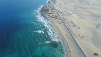
  • Parc naturel de Corralejo · 7.6 km away

    Le parc natural de Corralejo (en) est un parc naturel situé sur l'île de Fuerteventura dans l'archipel des îles Canaries (Espagne) a été créé en 1994. Il est également appelé « parc des dunes de Corralejo ». (...)

  • El Cotillo · 9.0 km away

    El Cotillo est une ville côtière de la municipalité de la Oliva, située dans la partie nord de l'île de Fuerteventura, dans la province de Las Palmas, dans la région des îles Canaries, en Espagne. Il a une population de 1.312 habitants. (...)

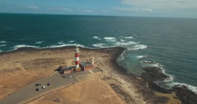
  • Phare de Tostón · 9.3 km away

    Le phare de Tostón ou phare d'El Coltillo est un phare situé à La Oliva au nord-ouest de l'île de Fuerteventura, dans les Îles Canaries (Espagne). Le phare est situé dans le village d'El Cotillo , et avec les autres feux du phare de Punta Pechiguera e du phare de Punta Martiño, marque le détroit de (...)

  • La Oliva · 10.0 km away

    La Oliva est une commune de la communauté autonome des Îles Canaries en Espagne. Elle est située au nord de l'île de Fuerteventura dans la province de Las Palmas. Le paysage de dunes de Corralejo (Parque Natural de las Dunas de Corralejo) est, depuis 1982, une zone naturelle protégée à laquelle est (...)

Articles found by GeoNames from the spot's position.

Nearby spots

Reviews

Log in to review this spot. Log in · Create a free account

No reviews yet. Share yours!

Connection to the site lost. Trying again…

The site is not responding. Trying again in seconds.

The site is no longer responding.

The site has been updated. Reloading the page…

This page has expired.

Resuming failed. Please reload the page.

The site is no longer responding.