

Castle of the horns of Urfé - Champoly
No reviews yet
Have you flown here? Share your experience with other pilots.
+ Write the first reviewDescription
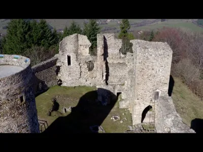
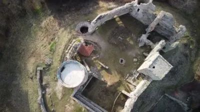
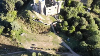
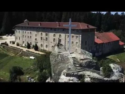
Built between the 12th and 16th centuries, the Château d'Urfé was born from the desire to observe the region from an exceptional viewpoint. The fruit of rivalries between great lords, it became the seat of the d'Urfé family, which would become one of the most powerful in Forez and whose aura would spread to the entourage of the King of France.
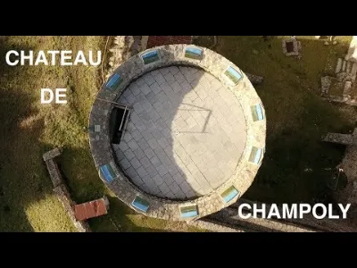
Open to all and in all seasons, a route with signs is proposed to you allowing you to discover the strong points of the castle, from the arboretum to the dungeon. The latter offers a viewpoint and an orientation table that will allow you to discover or rediscover the region. It is also a remarkable place to stop for a hike.
The objectives of the Association pour la Renaissance d'Urfé are to safeguard the remains of the castle, to maintain and develop the surroundings of the building, and to preserve and enhance the cultural value of the site. It is part of the R.E.M.P.A.R.T federation (rehabilitation and maintenance of artistic heritage monuments). Every summer a team of volunteers works on the castle from mid-July to mid-August. Every 15 August, visits of the workcamp and the castle are organised.
The castle is open to everyone, all year round, every day. Admission is free. Guided tours for groups and individuals are possible according to the availability of the animators and the seasons. LABELS
Map and restricted areas
Open in the main mapNearby aerodromes
Open aerodromes within 25 km of the spot, heliports included, with their distance and direction from the spot. Near an aerodrome, drone flying is prohibited or height-limited: check the UAS zones map.
| Aerodrome | Type | Distance | Elevation | Difference |
|---|---|---|---|---|
| Col du Béal Altiport | Aerodrome | 21 km S | 1,470 m | spot 540 m lower |
| Roanne-Renaison Airport | Airport | 24 km NE | 337 m | spot 593 m higher |
Aviation weather (METAR and TAF)
LFLV – Vichy-Charmeil Airport VFR
METAR
METAR LFLV 211130Z AUTO 16006KT 120V200 CAVOK 15/08 Q1019
- Wind
- 160°, 11 km/h
- Visibility
- 10 km or more
- Clouds
- –
- Temperature
- 15 °C, dew point 8 °C
- QNH
- 1019 hPa
- Flight category
- VFR: ceiling > 3,000 ft and visibility > 5 mi
TAF
Weather and Kp index
Sunrise and sunset
| Day | Dawn | Sunrise | Golden hour | Sunset | Dusk | Day length |
|---|---|---|---|---|---|---|
| Sat 21 Nov | 07:20 | 07:53 | 07:53–08:40 · 16:21–17:08 | 17:08 | 17:41 | 9 h 15 |
| Sun 22 Nov | 07:21 | 07:54 | 07:54–08:41 · 16:20–17:07 | 17:07 | 17:40 | 9 h 13 |
| Mon 23 Nov | 07:23 | 07:55 | 07:55–08:43 · 16:19–17:06 | 17:06 | 17:39 | 9 h 10 |
| Tue 24 Nov | 07:24 | 07:57 | 07:57–08:44 · 16:18–17:06 | 17:06 | 17:39 | 9 h 08 |
| Wed 25 Nov | 07:25 | 07:58 | 07:58–08:46 · 16:18–17:05 | 17:05 | 17:38 | 9 h 06 |
| Thu 26 Nov | 07:26 | 07:59 | 07:59–08:47 · 16:17–17:04 | 17:04 | 17:38 | 9 h 05 |
| Fri 27 Nov | 07:27 | 08:01 | 08:01–08:48 · 16:16–17:04 | 17:04 | 17:37 | 9 h 03 |
Reviews
Log in to review this spot. Log in · Create a free account
No reviews yet. Share yours!