

Pont du Châtelet (From 30 to 1min 30)
No reviews yet
Have you flown here? Share your experience with other pilots.
+ Write the first reviewDescription
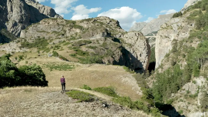
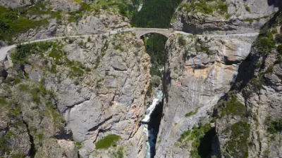
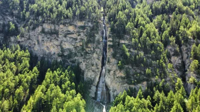
The Châtelet bridge is part of the only vehicular access in the hamlet of Fouillouse. It has a single lane width of 3m, located in the commune of Saint-Paul-sur-Ubaye. In spite of its unique stone arch, it seems as if it is standing at the top of a narrow gorge of 27 meters, very deep, as it overhangs the river Ubaye by 108 meters. The mountainous setting, the ochre-grey tones of the rock, the narrowness, as well as the immediate link with a small single-track rock tunnel, make the site really striking. The only possibility of pedestrian and mule access ended in 1888 with the opening of this road for the very first cambered road.
Map and restricted areas
Open in the main mapNearby aerodromes
Open aerodromes within 25 km of the spot, heliports included, with their distance and direction from the spot. Near an aerodrome, drone flying is prohibited or height-limited: check the UAS zones map.
| Aerodrome | Type | Distance | Elevation | Difference |
|---|---|---|---|---|
| Vars Helistrip | Heliport | 6.8 km W | 2,163 m | spot 575 m lower |
| Barcelonnette - Saint-Pons Airfield | Aerodrome | 22 km SW | 1,132 m | spot 456 m higher |
| Mont-Dauphin - St-Crépin Airfield | Aerodrome | 24 km NW | 903 m | spot 685 m higher |
Aviation weather (METAR and TAF)
No METAR station within 50 km.
Weather and Kp index
Sunrise and sunset
| Day | Dawn | Sunrise | Golden hour | Sunset | Dusk | Day length |
|---|---|---|---|---|---|---|
| Sat 21 Nov | 07:05 | 07:37 | 07:37–08:22 · 16:15–17:00 | 17:00 | 17:32 | 9 h 23 |
| Sun 22 Nov | 07:06 | 07:38 | 07:38–08:24 · 16:14–17:00 | 17:00 | 17:32 | 9 h 21 |
| Mon 23 Nov | 07:08 | 07:40 | 07:40–08:25 · 16:13–16:59 | 16:59 | 17:31 | 9 h 19 |
| Tue 24 Nov | 07:09 | 07:41 | 07:41–08:27 · 16:12–16:58 | 16:58 | 17:30 | 9 h 17 |
| Wed 25 Nov | 07:10 | 07:42 | 07:42–08:28 · 16:12–16:58 | 16:58 | 17:30 | 9 h 15 |
| Thu 26 Nov | 07:11 | 07:43 | 07:43–08:29 · 16:11–16:57 | 16:57 | 17:29 | 9 h 13 |
| Fri 27 Nov | 07:12 | 07:45 | 07:45–08:31 · 16:10–16:56 | 16:56 | 17:29 | 9 h 11 |


Reviews
Log in to review this spot. Log in · Create a free account
No reviews yet. Share yours!