

Heritage
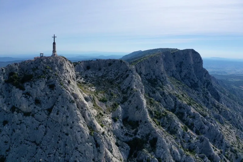
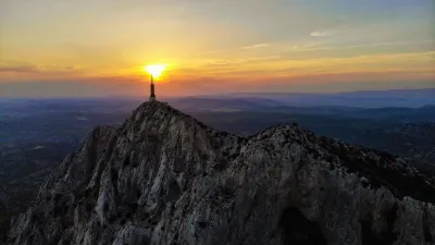
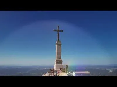
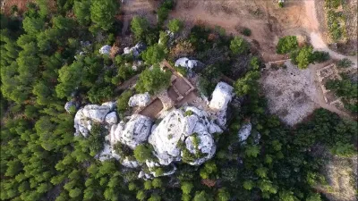
Holy Victory Cross
4 pilot reviews
“Aujourd’hui des gendarmes à cheval m’ont dit que le drone était « pas trop autorisé dans l…” — jhabasque, 4 years ago
Read the reviews + Write my reviewDescription
Nice hike to do early in the morning to avoid the heat and crowds!
Map and restricted areas
Open in the main mapNearby aerodromes
Open aerodromes within 25 km of the spot, heliports included, with their distance and direction from the spot. Near an aerodrome, drone flying is prohibited or height-limited: check the UAS zones map.
| Aerodrome | Type | Distance | Elevation | Difference |
|---|---|---|---|---|
| Pays d'Aix Medical Center Heliport | Heliport | 11 km W | 222 m | spot 718 m higher |
| Aix - Les Milles Airport | Aerodrome | 17 km W | 112 m | spot 828 m higher |
| Nord Heliport | Heliport | 24 km SW | 187 m | spot 753 m higher |
Aviation weather (METAR and TAF)
LFML – Marseille Provence Airport VFR
METAR
METAR LFML 211200Z AUTO VRB02KT CAVOK 15/07 Q1018 NOSIG
- Wind
- Variable, 4 km/h
- Visibility
- 10 km or more
- Clouds
- –
- Temperature
- 15 °C, dew point 7 °C
- QNH
- 1018 hPa
- Flight category
- VFR: ceiling > 3,000 ft and visibility > 5 mi
TAF
TAF LFML 210800Z 2109/2215 VRB03KT CAVOK TX17/2117Z TN13/2205Z BECMG 2116/2118 12010KT BECMG 2119/2121 -SHRA TEMPO 2120/2209 4000 SHRA BKN012 BKN025TCU BECMG 2208/2210 26020G35KT NSW
| Period (local time) | Change | Wind | Visibility | Weather | Clouds |
|---|---|---|---|---|---|
| 21/11 10:00 → 21/11 17:00 | Initial conditions | Variable, 6 km/h | 10 km or more | No significant cloud | |
| 21/11 17:00 → 21/11 20:00 | Becoming | 120°, 19 km/h | 10 km or more | No significant cloud | |
| 21/11 20:00 → 22/11 09:00 | Becoming | 120°, 19 km/h | 10 km or more | Showers of rain light | No significant cloud |
| 21/11 21:00 → 22/11 10:00 | Temporarily | 4.0 km | Showers of rain | Broken (5-7/8) at 1,200 ft (370 m) ; Broken (5-7/8) at 2,500 ft (760 m) (towering cumulus) | |
| 22/11 09:00 → 22/11 16:00 | Becoming | 260°, 37 km/h, gusts 65 km/h | 10 km or more | No significant weather | No significant cloud |
Weather and Kp index
| Day | Weather | Temp. min. / max. | Wind | Rain | Max Kp |
|---|---|---|---|---|---|
| Sat 21 Nov | Fair | 5° / 11° | 14 km/h W | 0.5 mm | 2 |
| Sun 22 Nov | Clear sky | 6° / 11° | 30 km/h W | 6.1 mm | 2 |
| Mon 23 Nov | Partly cloudy | 2° / 9° | 30 km/h NW | – | 4 |
| Tue 24 Nov | Cloudy | -0° / 11° | 13 km/h SE | 1.6 mm | 2 |
| Wed 25 Nov | Heavy rain | 5° / 6° | 28 km/h E | 58 mm | – |
| Thu 26 Nov | Fair | -1° / 7° | 7 km/h W | – | – |
| Fri 27 Nov | Fair | -2° / 8° | 5 km/h E | 0.7 mm | – |
Hour by hour: Saturday 21 November
| Time | Weather | Temp. | Wind | Rain | Clouds | Kp |
|---|---|---|---|---|---|---|
| 13:00 | Fair | 11° | 12 km/h W | – | 22 % | 2 |
| 14:00 | Fair | 11° | 13 km/h W | – | 31 % | 2 |
| 15:00 | Fair | 11° | 14 km/h W | – | 29 % | 2 |
| 16:00 | Partly cloudy | 10° | 13 km/h W | – | 43 % | 2 |
| 17:00 | Partly cloudy | 7° | 7 km/h SW | – | 82 % | 2 |
| 18:00 | Partly cloudy | 6° | 6 km/h SW | – | 96 % | 2 |
| 19:00 | Partly cloudy | 5° | 5 km/h S | – | 95 % | 2 |
| 20:00 | Partly cloudy | 5° | 5 km/h SE | – | 89 % | 2 |
| 21:00 | Cloudy | 5° | 6 km/h SE | – | 98 % | 2 |
| 22:00 | Light rain | 6° | 9 km/h E | 0.2 mm | 100 % | 2 |
Hour by hour: Sunday 22 November
| Time | Weather | Temp. | Wind | Rain | Clouds | Kp |
|---|---|---|---|---|---|---|
| 06:00 | Rain | 9° | 18 km/h SE | 0.5 mm | 100 % | 2 |
| 07:00 | Heavy rain | 10° | 17 km/h S | 1.2 mm | 100 % | 2 |
| 08:00 | Heavy rain | 10° | 12 km/h SW | 1.4 mm | 100 % | 2 |
| 09:00 | Rain | 10° | 16 km/h W | 0.5 mm | 100 % | 2 |
| 10:00 | Cloudy | 10° | 25 km/h W | – | 95 % | 2 |
| 11:00 | Cloudy | 9° | 24 km/h W | – | 94 % | 2 |
| 12:00 | Cloudy | 10° | 22 km/h W | – | 98 % | 2 |
| 13:00 | Clear sky | 10° | 24 km/h W | – | 12 % | 2 |
| 14:00 | Fair | 11° | 30 km/h W | – | 13 % | 2 |
| 15:00 | Clear sky | 11° | 29 km/h W | – | 10 % | 2 |
| 16:00 | Clear sky | 10° | 28 km/h W | – | 9 % | 2 |
| 17:00 | Clear sky | 9° | 25 km/h W | – | 9 % | 2 |
| 18:00 | Clear sky | 8° | 23 km/h W | – | 12 % | 2 |
| 19:00 | Clear sky | 7° | 23 km/h W | – | 11 % | 2 |
| 20:00 | Fair | 7° | 23 km/h W | – | 23 % | 2 |
| 21:00 | Fair | 7° | 23 km/h W | – | 20 % | 2 |
| 22:00 | Partly cloudy | 6° | 23 km/h W | – | 45 % | 2 |
Sunrise and sunset
| Day | Dawn | Sunrise | Golden hour | Sunset | Dusk | Day length |
|---|---|---|---|---|---|---|
| Sat 21 Nov | 07:08 | 07:39 | 07:39–08:23 · 16:24–17:08 | 17:08 | 17:39 | 9 h 29 |
| Sun 22 Nov | 07:09 | 07:40 | 07:40–08:25 · 16:23–17:07 | 17:07 | 17:39 | 9 h 27 |
| Mon 23 Nov | 07:10 | 07:41 | 07:41–08:26 · 16:22–17:07 | 17:07 | 17:38 | 9 h 25 |
| Tue 24 Nov | 07:11 | 07:43 | 07:43–08:27 · 16:21–17:06 | 17:06 | 17:37 | 9 h 23 |
| Wed 25 Nov | 07:12 | 07:44 | 07:44–08:29 · 16:21–17:05 | 17:05 | 17:37 | 9 h 21 |
| Thu 26 Nov | 07:13 | 07:45 | 07:45–08:30 · 16:20–17:05 | 17:05 | 17:36 | 9 h 19 |
| Fri 27 Nov | 07:15 | 07:46 | 07:46–08:31 · 16:19–17:04 | 17:04 | 17:36 | 9 h 18 |


Reviews
Log in to review this spot. Log in · Create a free account
jhabasque
Aujourd’hui des gendarmes à cheval m’ont dit que le drone était « pas trop autorisé dans le secteur » alors que j’étais au niveau du barrage de Bimont. Ils ont été incapables de m’expliquer en vertu de quel règlement et comment je pouvais en être informé. Ils ont évoqué des problèmes de nidification, ce que je conçoit tout à fait, mais impossible de trouver la moindre information à ce sujet. C’est assez pénible de se faire réprimander (même gentiment) et alors qu’on cherche à respecter scrupuleusement les règles 😒
Squiou
Le vol de drone est maintenant interdit par les gardiens. Ils ont une cabane juste à côté de La Croix. Officiellement rien n’interdit le vol mais les gardiens ont mis un panneau et m’ont demandés de faire atterrir mon drone
Nabonide
Bonjour, plusieurs points de départ possibles. Compter environ 2 heures de montée. 600 m de dénivelé. Bonne ballade !
GameOfDrone
Bonjour, Combien de temps de marche environ, du parking, pour atteindre le sommet ? Merci