

Saint-Guilhem-le-Désert and the Devil's Bridge
No reviews yet
Have you flown here? Share your experience with other pilots.
+ Write the first reviewDescription
Saint-Guilhem-le-Désert is a spiritual stopover on the Way to Santiago de Compostela. It is a small medieval town, part of the Most Beautiful Villages in France, which offers you a unique opportunity to take a break...
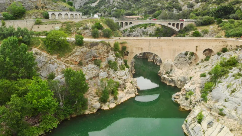
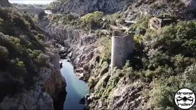
At the entrance to the Hérault gorges, at the place known as the "black abyss", the old Romanesque bridge, clinging to the steep banks, spans the river at its narrowest point.
Considered to be one of the oldest medieval bridges in France, it has been classified as a World Heritage Site by UNESCO as part of France's Way of St. James in Santiago de Compostela.
It was built between 1028 and 1031, by the two nearby abbeys of Aniane and Gellone, who jealously controlled both banks of the river. It is 50 m long and has two main round arches and two secondary openings, the gills, to facilitate the flow of water in times of flooding.
Map and restricted areas
Open in the main mapNearby aerodromes
Open aerodromes within 25 km of the spot, heliports included, with their distance and direction from the spot. Near an aerodrome, drone flying is prohibited or height-limited: check the UAS zones map.
| Aerodrome | Type | Distance | Elevation | Difference |
|---|---|---|---|---|
| Aérodrome de Saint-Martin-de-Londres | Aerodrome | 21 km NE | 182 m | spot 134 m lower |
Aviation weather (METAR and TAF)
LFMT – Montpellier-Méditerranée Airport VFR
METAR
METAR LFMT 211030Z AUTO 09006KT CAVOK 15/10 Q1020 NOSIG
- Wind
- 090°, 11 km/h
- Visibility
- 10 km or more
- Clouds
- –
- Temperature
- 15 °C, dew point 10 °C
- QNH
- 1020 hPa
- Flight category
- VFR: ceiling > 3,000 ft and visibility > 5 mi
TAF
TAF LFMT 210800Z 2109/2209 07003KT CAVOK BECMG 2118/2120 01010KT TEMPO 2118/2203 BKN010 BECMG 2206/2208 28020G30KT
| Period (local time) | Change | Wind | Visibility | Weather | Clouds |
|---|---|---|---|---|---|
| 21/11 10:00 → 21/11 19:00 | Initial conditions | 070°, 6 km/h | 10 km or more | No significant weather | No significant cloud |
| 21/11 19:00 → 22/11 07:00 | Becoming | 010°, 19 km/h | 10 km or more | No significant weather | No significant cloud |
| 21/11 19:00 → 22/11 04:00 | Temporarily | Broken (5-7/8) at 1,000 ft (300 m) | |||
| 22/11 07:00 → 22/11 10:00 | Becoming | 280°, 37 km/h, gusts 56 km/h | 10 km or more | No significant weather | No significant cloud |
Weather and Kp index
Sunrise and sunset
| Day | Dawn | Sunrise | Golden hour | Sunset | Dusk | Day length |
|---|---|---|---|---|---|---|
| Sat 21 Nov | 07:16 | 07:48 | 07:48–08:32 · 16:31–17:16 | 17:16 | 17:47 | 9 h 28 |
| Sun 22 Nov | 07:17 | 07:49 | 07:49–08:33 · 16:30–17:15 | 17:15 | 17:46 | 9 h 26 |
| Mon 23 Nov | 07:19 | 07:50 | 07:50–08:35 · 16:30–17:14 | 17:14 | 17:46 | 9 h 24 |
| Tue 24 Nov | 07:20 | 07:51 | 07:51–08:36 · 16:29–17:14 | 17:14 | 17:45 | 9 h 22 |
| Wed 25 Nov | 07:21 | 07:53 | 07:53–08:38 · 16:28–17:13 | 17:13 | 17:45 | 9 h 20 |
| Thu 26 Nov | 07:22 | 07:54 | 07:54–08:39 · 16:27–17:12 | 17:12 | 17:44 | 9 h 18 |
| Fri 27 Nov | 07:23 | 07:55 | 07:55–08:40 · 16:27–17:12 | 17:12 | 17:44 | 9 h 16 |




Reviews
Log in to review this spot. Log in · Create a free account
No reviews yet. Share yours!