

Montsec Hill Memorial
No reviews yet
Have you flown here? Share your experience with other pilots.
+ Write the first reviewDescription
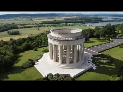
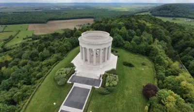
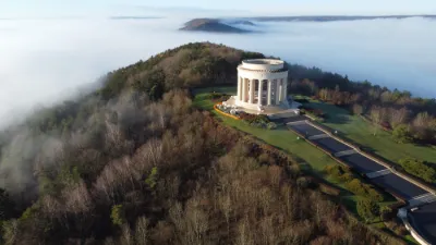
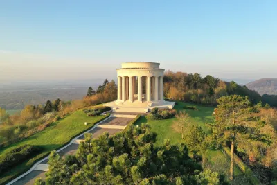
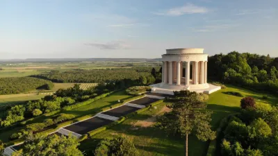
At the top of the hill, at an altitude of 377 metres, there is a monument commemorating the offensives carried out by the American army on the Saint-Mihiel salient (about fifteen kilometres west of Montsec) during the First World War, from 12 to 15 September and from 9 to 11 November 1918.
The monument, erected in 1932 in Euville stone, consists of a neoclassical-style colonnaded rotunda, the centre of which is occupied by an orientation table on which is carved a bronze map illustrating the battlefield.
Map and restricted areas
Open in the main mapNearby aerodromes
Open aerodromes within 25 km of the spot, heliports included, with their distance and direction from the spot. Near an aerodrome, drone flying is prohibited or height-limited: check the UAS zones map.
| Aerodrome | Type | Distance | Elevation | Difference |
|---|---|---|---|---|
| Chambley-Bussières Air Base | Aerodrome | 19 km NE | 264 m | spot 110 m higher |
| Chambley | Aerodrome | 19 km NE | 264 m | spot 110 m higher |
Aviation weather (METAR and TAF)
LFSO – Nancy-Ochey (BA 133) Air Base MVFR
METAR
METAR LFSO 211000Z AUTO 07002KT 5000 BR BKN018/// BKN023/// OVC030/// ///TCU 06/06 Q1020
- Wind
- 070°, 4 km/h
- Visibility
- 5 km
- Weather
- Mist
- Clouds
- Broken (5-7/8) at 1,800 ft (550 m) ; Broken (5-7/8) at 2,300 ft (700 m) ; Overcast (8/8) at 3,000 ft (910 m)
- Temperature
- 6 °C, dew point 6 °C
- QNH
- 1020 hPa
- Flight category
- MVFR: ceiling 1,000–3,000 ft or visibility 3–5 mi
TAF
Weather and Kp index
Sunrise and sunset
| Day | Dawn | Sunrise | Golden hour | Sunset | Dusk | Day length |
|---|---|---|---|---|---|---|
| Sat 21 Nov | 07:20 | 07:55 | 07:55–08:46 · 16:00–16:51 | 16:51 | 17:26 | 8 h 55 |
| Sun 22 Nov | 07:22 | 07:57 | 07:57–08:48 · 15:58–16:50 | 16:50 | 17:25 | 8 h 52 |
| Mon 23 Nov | 07:23 | 07:58 | 07:58–08:50 · 15:57–16:49 | 16:49 | 17:24 | 8 h 50 |
| Tue 24 Nov | 07:24 | 08:00 | 08:00–08:51 · 15:56–16:48 | 16:48 | 17:23 | 8 h 48 |
| Wed 25 Nov | 07:26 | 08:01 | 08:01–08:53 · 15:55–16:47 | 16:47 | 17:23 | 8 h 45 |
| Thu 26 Nov | 07:27 | 08:03 | 08:03–08:55 · 15:54–16:46 | 16:46 | 17:22 | 8 h 43 |
| Fri 27 Nov | 07:28 | 08:04 | 08:04–08:56 · 15:53–16:46 | 16:46 | 17:21 | 8 h 41 |

Reviews
Log in to review this spot. Log in · Create a free account
No reviews yet. Share yours!