

Heritage
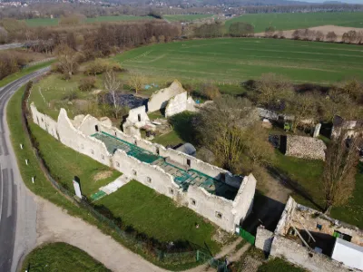
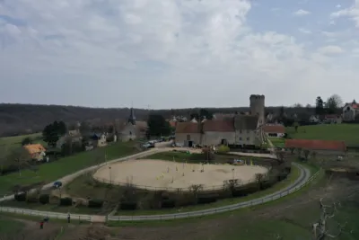
Cistercian farm of Ithe

1 pilot review
“Il y a possibilité de se garer à proximité et en dehors de la ferme, il y a de grands cham…” — RotaryB, 5 years ago
Read the reviews + Write my reviewDescription
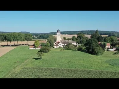
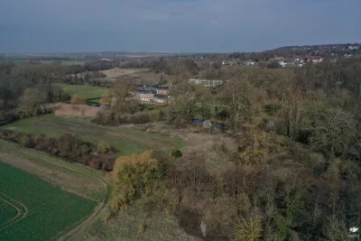
Archaeological site of the Ithe farm.
Map and restricted areas
Open in the main mapNearby aerodromes
Open aerodromes within 25 km of the spot, heliports included, with their distance and direction from the spot. Near an aerodrome, drone flying is prohibited or height-limited: check the UAS zones map.
| Aerodrome | Type | Distance | Elevation | Difference |
|---|---|---|---|---|
| Aérodrome de Beynes - Thiverval | Aerodrome | 6.1 km N | 113 m | spot 38 m lower |
| Chavenay Villepreux Airfield | Aerodrome | 9.1 km NE | 130 m | spot 55 m lower |
| Les Sangliers Heliport | Heliport | 14 km E | 158 m | spot 83 m lower |
| Aérodrome de Saint-Cyr-l'École | Aerodrome | 14 km E | 114 m | spot 39 m lower |
| Centre Hospitalier de Rambouillet | Heliport | 16 km S | 157 m | spot 82 m lower |
Aviation weather (METAR and TAF)
LFPN – Toussus-le-Noble Airport LIFR
METAR
METAR LFPN 210700Z AUTO 16003KT 9999 OVC004 08/08 Q1018 BECMG BKN006
- Wind
- 160°, 6 km/h
- Visibility
- 10 km or more
- Clouds
- Overcast (8/8) at 400 ft (120 m)
- Temperature
- 8 °C, dew point 8 °C
- QNH
- 1018 hPa
- Flight category
- LIFR: ceiling < 500 ft or visibility < 1 mi
TAF
TAF AMD LFPN 210638Z 2106/2115 13005KT 9999 BKN006 PROB40 TEMPO 2106/2111 OVC004 BECMG 2111/2113 BKN012
| Period (local time) | Change | Wind | Visibility | Weather | Clouds |
|---|---|---|---|---|---|
| 21/11 07:00 → 21/11 12:00 | Initial conditions | 130°, 9 km/h | 10 km or more | Broken (5-7/8) at 600 ft (180 m) | |
| 21/11 07:00 → 21/11 12:00 | Temporarily, probability 40% | Overcast (8/8) at 400 ft (120 m) | |||
| 21/11 12:00 → 21/11 16:00 | Becoming | 130°, 9 km/h | 10 km or more | Broken (5-7/8) at 1,200 ft (370 m) |
Weather and Kp index
| Day | Weather | Temp. min. / max. | Wind | Rain | Max Kp |
|---|---|---|---|---|---|
| Sat 21 Nov | Cloudy | 7° / 10° | 14 km/h E | – | 2 |
| Sun 22 Nov | Rain | 7° / 7° | 14 km/h E | 21 mm | 2 |
| Mon 23 Nov | Fair | 1° / 7° | 21 km/h NE | 2.6 mm | 4 |
| Tue 24 Nov | Clear sky | -3° / 3° | 17 km/h E | – | 2 |
| Wed 25 Nov | Snow | -1° / 2° | 15 km/h NE | 1.5 mm | – |
| Thu 26 Nov | Clear sky | -4° / 1° | 14 km/h NE | – | – |
| Fri 27 Nov | Cloudy | -4° / 4° | 17 km/h S | 6.3 mm | – |
Hour by hour: Saturday 21 November
| Time | Weather | Temp. | Wind | Rain | Clouds | Kp |
|---|---|---|---|---|---|---|
| 08:00 | Fog | 8° | 6 km/h SE | – | 100 % | 2 |
| 09:00 | Cloudy | 8° | 6 km/h S | – | 100 % | 2 |
| 10:00 | Cloudy | 8° | 6 km/h S | – | 100 % | 2 |
| 11:00 | Cloudy | 9° | 7 km/h S | – | 100 % | 2 |
| 12:00 | Cloudy | 9° | 6 km/h S | – | 100 % | 2 |
| 13:00 | Cloudy | 10° | 9 km/h S | – | 100 % | 1 |
| 14:00 | Cloudy | 10° | 8 km/h S | – | 100 % | 1 |
| 15:00 | Cloudy | 10° | 9 km/h SE | – | 100 % | 1 |
| 16:00 | Cloudy | 10° | 10 km/h S | – | 100 % | 2 |
| 17:00 | Cloudy | 9° | 8 km/h SE | – | 100 % | 2 |
| 18:00 | Cloudy | 9° | 8 km/h SE | – | 100 % | 2 |
| 19:00 | Cloudy | 9° | 8 km/h E | – | 100 % | 2 |
| 20:00 | Cloudy | 9° | 10 km/h E | – | 100 % | 2 |
| 21:00 | Partly cloudy | 8° | 11 km/h E | – | 98 % | 2 |
| 22:00 | Partly cloudy | 7° | 13 km/h E | – | 100 % | 2 |
Hour by hour: Sunday 22 November
| Time | Weather | Temp. | Wind | Rain | Clouds | Kp |
|---|---|---|---|---|---|---|
| 06:00 | Rain | 7° | 14 km/h E | 0.5 mm | 100 % | 2 |
| 07:00 | Rain | 7° | 13 km/h E | 0.9 mm | 100 % | 2 |
| 08:00 | Heavy rain | 7° | 13 km/h E | 1.1 mm | 100 % | 2 |
| 09:00 | Rain | 7° | 13 km/h E | 0.9 mm | 100 % | 2 |
| 10:00 | Rain | 7° | 13 km/h E | 0.8 mm | 100 % | 2 |
| 11:00 | Heavy rain | 7° | 12 km/h E | 1.1 mm | 100 % | 2 |
| 12:00 | Rain | 7° | 11 km/h E | 0.7 mm | 100 % | 2 |
| 13:00 | Rain | 7° | 10 km/h E | 0.4 mm | 100 % | 2 |
| 14:00 | Rain | 7° | 9 km/h E | 0.5 mm | 100 % | 2 |
| 15:00 | Rain | 7° | 9 km/h NE | 0.8 mm | 100 % | 2 |
| 16:00 | Rain | 7° | 9 km/h NE | 0.7 mm | 100 % | 2 |
| 17:00 | Rain | 7° | 5 km/h NE | 0.7 mm | 100 % | 2 |
| 18:00 | Heavy rain | 7° | 5 km/h NE | 1.0 mm | 100 % | 2 |
| 19:00 | Rain | 7° | 7 km/h E | 0.8 mm | 100 % | 2 |
| 20:00 | Heavy rain | 7° | 6 km/h E | 2.1 mm | 100 % | 2 |
| 21:00 | Heavy rain | 7° | 9 km/h SE | 2.4 mm | 100 % | 2 |
| 22:00 | Heavy rain | 7° | 13 km/h SE | 2.3 mm | 100 % | 2 |
Sunrise and sunset
| Day | Dawn | Sunrise | Golden hour | Sunset | Dusk | Day length |
|---|---|---|---|---|---|---|
| Sat 21 Nov | 07:35 | 08:10 | 08:10–09:01 · 16:15–17:06 | 17:06 | 17:41 | 8 h 55 |
| Sun 22 Nov | 07:37 | 08:12 | 08:12–09:03 · 16:14–17:05 | 17:05 | 17:40 | 8 h 53 |
| Mon 23 Nov | 07:38 | 08:13 | 08:13–09:05 · 16:13–17:04 | 17:04 | 17:40 | 8 h 51 |
| Tue 24 Nov | 07:39 | 08:15 | 08:15–09:06 · 16:12–17:04 | 17:04 | 17:39 | 8 h 48 |
| Wed 25 Nov | 07:41 | 08:16 | 08:16–09:08 · 16:11–17:03 | 17:03 | 17:38 | 8 h 46 |
| Thu 26 Nov | 07:42 | 08:18 | 08:18–09:10 · 16:10–17:02 | 17:02 | 17:38 | 8 h 44 |
| Fri 27 Nov | 07:43 | 08:19 | 08:19–09:11 · 16:09–17:01 | 17:01 | 17:37 | 8 h 42 |

Reviews
Log in to review this spot. Log in · Create a free account
RotaryB
Il y a possibilité de se garer à proximité et en dehors de la ferme, il y a de grands champs histoire de pouvoir voler tranquillement.