Skip to content
FPV Racing

Marbais

Belgium

The video is only loaded from YouTube (youtube-nocookie.com) when you start it.

No reviews yet

Have you flown here? Share your experience with other pilots.

+ Write the first review

Description

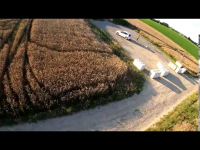
Obstacle-free sport (fields and wind turbine) perfect for beginner PVFs

Aviation weather (METAR and TAF)

EBCI – Brussels South Charleroi Airport · 10 km SW IFR

METAR

Observed 21/11 08:20 · 21 min ago

METAR EBCI 210720Z 21005KT 4500 BR NSC 01/01 Q1019 BECMG 9999 NSW

Wind
210°, 9 km/h
Visibility
4.5 km
Weather
Mist
Clouds
–
Temperature
1 °C, dew point 1 °C
QNH
1019 hPa
Flight category
IFR: ceiling 500–1,000 ft or visibility 1–3 mi

TAF

Issued 21/11 06:00 · valid from 21/11 07:00 to 22/11 13:00

TAF EBCI 210500Z 2106/2212 20004KT 9999 FEW035 PROB30 2106/2108 2000 BR BKN003 PROB30 2203/2207 4000 BR

Period (local time) Change Wind Visibility Weather Clouds
21/11 07:00 → 22/11 13:00 Initial conditions 200°, 7 km/h 10 km or more Few (1-2/8) at 3,500 ft (1070 m)
21/11 07:00 → 21/11 09:00 probability 30% 2.0 km Mist Broken (5-7/8) at 300 ft (90 m)
22/11 04:00 → 22/11 08:00 probability 30% 4.0 km Mist

Empty cell: no change forecast for that element.

METAR and TAF from NOAA (Aviation Weather Center), for guidance only: they do not replace flight planning with official sources (SIA, Météo-France). Nearest station that issues a METAR, not necessarily the nearest aerodrome.

Plan the light

Weather and Kp index

Loading forecast…

Sunrise and sunset

Local times at the spot (UTC+01:00). The golden hour, the warm, low light sought after for photos and videos, runs from sunrise until the sun reaches 6° above the horizon, and in the evening from 6° until sunset.

Day Dawn Sunrise Golden hour Sunset Dusk Day length
Sat 21 Nov07:30 08:06 08:06–09:00 · 15:56–16:49 16:49 17:268 h 43
Sun 22 Nov07:31 08:08 08:08–09:02 · 15:54–16:48 16:48 17:258 h 40
Mon 23 Nov07:32 08:09 08:09–09:04 · 15:53–16:47 16:47 17:248 h 37
Tue 24 Nov07:34 08:11 08:11–09:05 · 15:52–16:46 16:46 17:238 h 35
Wed 25 Nov07:35 08:12 08:12–09:07 · 15:51–16:45 16:45 17:238 h 33
Thu 26 Nov07:37 08:14 08:14–09:09 · 15:49–16:45 16:45 17:228 h 30
Fri 27 Nov07:38 08:15 08:15–09:11 · 15:48–16:44 16:44 17:218 h 28

Nearby on Wikipedia

  • Chapelle Notre-Dame Auxiliatrice du Triolet · 1.0 km away

    La chapelle Notre-Dame Auxiliatrice du Triolet (parfois appelée plus simplement chapelle Notre-Dame du Triolet voire chapelle du Triolet) est une chapelle de style gothique et classique située à Marbais, village de la commune belge de Villers-la-Ville en Brabant wallon. (...)

  • Marbais · 1.4 km away

    Marbais (en wallon Marbé) est une section de la commune belge de Villers-la-Ville située en Région wallonne dans la province du Brabant wallon. (...)

  • Trappiste (bière) · 1.5 km away

    Une trappiste, ou bière trappiste, est une bière brassée par ou sous contrôle des moines trappistes. Ces bières trappistes sont généralement de fermentation haute et doivent être brassées dans le respect des critères définis par l'Association Internationale Trappiste si elles veulent pouvoir arborer (...)

  • Wagnelée · 2.6 km away

    Wagnelée (en wallon Wagnlêye) est une section de la commune belge de Fleurus située en Région wallonne dans la province de Hainaut. C'était une commune à part entière avant la fusion des communes de 1977. (...)

  • Villers-Perwin · 2.6 km away

    Villers-Perwin est une section de la commune belge des Bons Villers, située en Région wallonne dans la province de Hainaut. Il se trouve à la frontière du Brabant wallon. (...)

Articles found by GeoNames from the spot's position.

Nearby spots

Reviews

Log in to review this spot. Log in · Create a free account

No reviews yet. Share yours!

Connection to the site lost. Trying again…

The site is not responding. Trying again in seconds.

The site is no longer responding.

The site has been updated. Reloading the page…

This page has expired.

Resuming failed. Please reload the page.

The site is no longer responding.