

San Gavino di Carbini - Cascade de Piscia di Gallu
No reviews yet
Have you flown here? Share your experience with other pilots.
+ Write the first reviewDescription
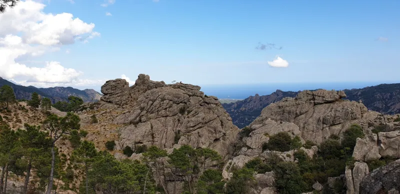
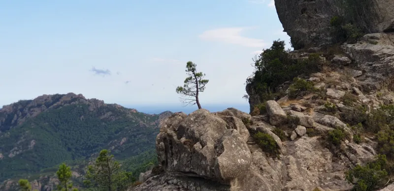
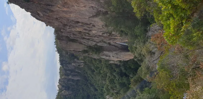
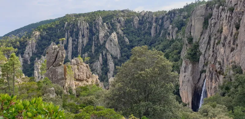
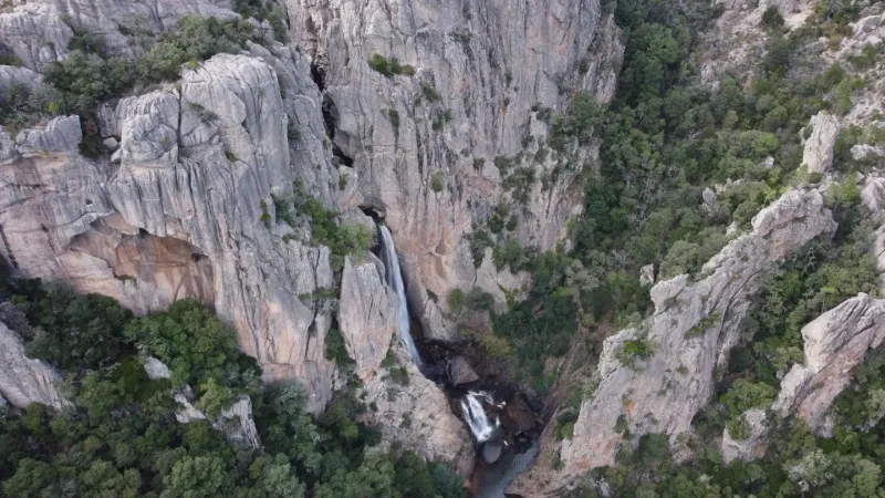
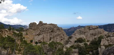
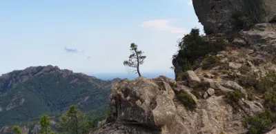
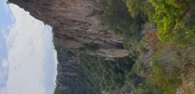
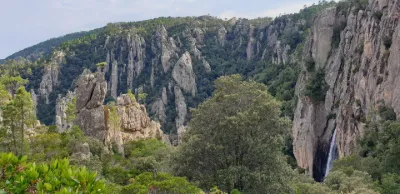
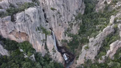
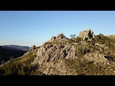
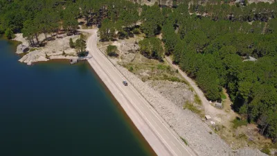
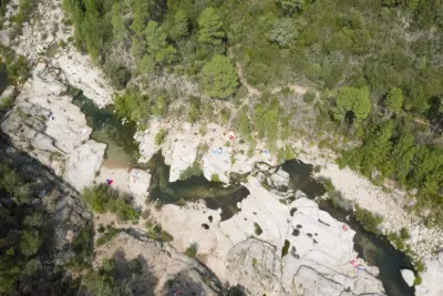
The Piscia di Gallu waterfall, or white fir waterfall, is almost 70 m high. It can be discovered at the end of a short and easy hike before a long descent to the foot of the waterfall. The hike is worth as much for its purpose, the waterfall, its cliff and the cirque it has created in the rock, as for the discovery of the wooded granite plateau of the Ospédale or the sentinel rock. The departure can be made from a paying car park offering other activities such as quad biking and refreshment stands welcome at the end of the walk, especially in the middle of summer, or from roadside tracks crossing the forest before joining the marked trail.
The Piscia di Gallu stream is the outlet of the Ospedale reservoir. Located nearby, it will offer you other landscapes to discover and a second, less windy flying site.
The take-off site is located right at the end of the granite plateau, near the large rocks carved by the wind (taffoni) and allows direct views of the path of the stream, the cliff and the waterfall. The flying area is clear over nearly 2 km in diameter, but you will of course have to avoid flying over hikers and tourists and remain particularly vigilant, as the site is windy and the approaches to the cliff and the waterfall are full of turbulence. Maximum flying altitude of 150 m. No interference noted on the day of the flight. Three Italian and German dronists met on the day of the flight, so it seems that the site is already known internationally.
Map and restricted areas
Open in the main mapNearby aerodromes
Open aerodromes within 25 km of the spot, heliports included, with their distance and direction from the spot. Near an aerodrome, drone flying is prohibited or height-limited: check the UAS zones map.
| Aerodrome | Type | Distance | Elevation | Difference |
|---|---|---|---|---|
| Helisudcorse | Heliport | 12 km SE | 4 m | spot 865 m higher |
| Figari Sud-Corse Airport | Airport | 22 km SW | 26 m | spot 843 m higher |
Aviation weather (METAR and TAF)
LFKF – Figari Sud-Corse Airport VFR
METAR
METAR LFKF 210930Z AUTO 27015KT 9999 BKN032 BKN047 BKN056 17/11 Q1020 TEMPO 27015G25KT
- Wind
- 270°, 28 km/h
- Visibility
- 10 km or more
- Clouds
- Broken (5-7/8) at 3,200 ft (980 m) ; Broken (5-7/8) at 4,700 ft (1430 m) ; Broken (5-7/8) at 5,600 ft (1710 m)
- Temperature
- 17 °C, dew point 11 °C
- QNH
- 1020 hPa
- Flight category
- VFR: ceiling > 3,000 ft and visibility > 5 mi
TAF
TAF LFKF 210800Z 2109/2209 26013KT 9999 FEW035 TEMPO 2110/2115 27015G25KT BECMG 2119/2121 VRB03KT
| Period (local time) | Change | Wind | Visibility | Weather | Clouds |
|---|---|---|---|---|---|
| 21/11 10:00 → 21/11 20:00 | Initial conditions | 260°, 24 km/h | 10 km or more | Few (1-2/8) at 3,500 ft (1070 m) | |
| 21/11 11:00 → 21/11 16:00 | Temporarily | 270°, 28 km/h, gusts 46 km/h | |||
| 21/11 20:00 → 22/11 10:00 | Becoming | Variable, 6 km/h | 10 km or more | Few (1-2/8) at 3,500 ft (1070 m) |
Weather and Kp index
Sunrise and sunset
| Day | Dawn | Sunrise | Golden hour | Sunset | Dusk | Day length |
|---|---|---|---|---|---|---|
| Sat 21 Nov | 06:49 | 07:19 | 07:19–08:02 · 16:16–16:59 | 16:59 | 17:29 | 9 h 39 |
| Sun 22 Nov | 06:50 | 07:21 | 07:21–08:03 · 16:15–16:58 | 16:58 | 17:28 | 9 h 37 |
| Mon 23 Nov | 06:51 | 07:22 | 07:22–08:04 · 16:15–16:57 | 16:57 | 17:28 | 9 h 35 |
| Tue 24 Nov | 06:52 | 07:23 | 07:23–08:06 · 16:14–16:57 | 16:57 | 17:27 | 9 h 33 |
| Wed 25 Nov | 06:54 | 07:24 | 07:24–08:07 · 16:13–16:56 | 16:56 | 17:27 | 9 h 32 |
| Thu 26 Nov | 06:55 | 07:25 | 07:25–08:08 · 16:13–16:56 | 16:56 | 17:26 | 9 h 30 |
| Fri 27 Nov | 06:56 | 07:26 | 07:26–08:09 · 16:12–16:55 | 16:55 | 17:26 | 9 h 29 |


Reviews
Log in to review this spot. Log in · Create a free account
No reviews yet. Share yours!