

Orrouer l'Eglise
No reviews yet
Have you flown here? Share your experience with other pilots.
+ Write the first reviewDescription
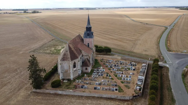
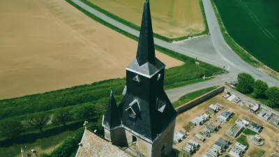
In the heart of the Beauce, in the canton of Courville-sur-Eure, lies a very strange village. Nearly 300 inhabitants should live there, but there is no one, no house, not a living soul? Only the Saint-Martin church and its cemetery, along with its place-name sign: Orrouer L'Eglise. So what is the mystery of this church standing alone in the middle of the fields? Built in the Middle Ages on the Way of St. James (Camino de Santiago), this former village suffered ransacking and looting during the Hundred Years' War. The inhabitants left to settle in the surrounding hamlets after the total destruction of the village... only the church and its cemetery survived. Despite this, the church was maintained and in the 16th century it was fully restored.
Map and restricted areas
Open in the main mapNearby aerodromes
Open aerodromes within 25 km of the spot, heliports included, with their distance and direction from the spot. Near an aerodrome, drone flying is prohibited or height-limited: check the UAS zones map.
| Aerodrome | Type | Distance | Elevation | Difference |
|---|---|---|---|---|
| Centre Hospitalier Heliport | Heliport | 16 km E | 149 m | spot 17 m higher |
| Champrond le Petit Bois Landry base ULM | Aerodrome | 17 km W | 260 m | spot 95 m lower |
| Aérodrome de Chartres-Métropole | Aerodrome | 19 km E | 155 m | spot 10 m higher |
Aviation weather (METAR and TAF)
No METAR station within 50 km.
Weather and Kp index
| Day | Weather | Temp. min. / max. | Wind | Rain | Max Kp |
|---|---|---|---|---|---|
| Sat 21 Nov | Cloudy | 8° / 9° | 16 km/h E | – | 2 |
| Sun 22 Nov | Heavy rain | 7° / 9° | 31 km/h W | 34 mm | 2 |
| Mon 23 Nov | Fair | 3° / 8° | 30 km/h SW | 4.3 mm | 4 |
| Tue 24 Nov | Clear sky | -3° / 3° | 16 km/h E | – | 2 |
| Wed 25 Nov | Sleet | -1° / 2° | 19 km/h NE | 2.1 mm | – |
| Thu 26 Nov | Clear sky | -3° / 1° | 16 km/h NE | – | – |
| Fri 27 Nov | Light rain | -4° / 5° | 18 km/h S | 4.5 mm | – |
Hour by hour: Saturday 21 November
| Time | Weather | Temp. | Wind | Rain | Clouds | Kp |
|---|---|---|---|---|---|---|
| 12:00 | Cloudy | 9° | 8 km/h S | – | 100 % | 2 |
| 13:00 | Cloudy | 9° | 8 km/h S | – | 100 % | 1 |
| 14:00 | Cloudy | 9° | 10 km/h SE | – | 100 % | 1 |
| 15:00 | Cloudy | 9° | 12 km/h SE | – | 100 % | 1 |
| 16:00 | Cloudy | 9° | 12 km/h SE | – | 100 % | 2 |
| 17:00 | Cloudy | 9° | 10 km/h SE | – | 100 % | 2 |
| 18:00 | Cloudy | 9° | 10 km/h E | – | 100 % | 2 |
| 19:00 | Cloudy | 9° | 12 km/h E | – | 100 % | 2 |
| 20:00 | Cloudy | 9° | 13 km/h E | – | 100 % | 2 |
| 21:00 | Cloudy | 9° | 14 km/h E | – | 100 % | 2 |
| 22:00 | Cloudy | 8° | 15 km/h E | – | 100 % | 2 |
Hour by hour: Sunday 22 November
| Time | Weather | Temp. | Wind | Rain | Clouds | Kp |
|---|---|---|---|---|---|---|
| 06:00 | Rain | 7° | 16 km/h E | 0.6 mm | 100 % | 2 |
| 07:00 | Rain | 7° | 15 km/h E | 0.5 mm | 100 % | 2 |
| 08:00 | Rain | 7° | 14 km/h E | 0.9 mm | 100 % | 2 |
| 09:00 | Heavy rain | 7° | 14 km/h E | 1.8 mm | 100 % | 2 |
| 10:00 | Heavy rain | 7° | 14 km/h E | 2.5 mm | 100 % | 2 |
| 11:00 | Heavy rain | 8° | 13 km/h E | 2.5 mm | 100 % | 2 |
| 12:00 | Heavy rain | 8° | 11 km/h E | 2.7 mm | 100 % | 2 |
| 13:00 | Heavy rain | 8° | 10 km/h E | 2.7 mm | 100 % | 2 |
| 14:00 | Heavy rain | 8° | 10 km/h E | 2.0 mm | 100 % | 2 |
| 15:00 | Heavy rain | 8° | 10 km/h NE | 2.4 mm | 100 % | 2 |
| 16:00 | Heavy rain | 8° | 13 km/h NE | 2.8 mm | 100 % | 2 |
| 17:00 | Heavy rain | 8° | 18 km/h N | 3.2 mm | 100 % | 2 |
| 18:00 | Heavy rain | 8° | 23 km/h NW | 3.2 mm | 100 % | 2 |
| 19:00 | Rain | 9° | 31 km/h W | 0.9 mm | 100 % | 2 |
| 20:00 | Light rain | 9° | 27 km/h W | 0.3 mm | 100 % | 2 |
| 21:00 | Light rain | 9° | 26 km/h W | 0.3 mm | 100 % | 2 |
| 22:00 | Cloudy | 8° | 26 km/h W | – | 100 % | 2 |
Sunrise and sunset
| Day | Dawn | Sunrise | Golden hour | Sunset | Dusk | Day length |
|---|---|---|---|---|---|---|
| Sat 21 Nov | 07:37 | 08:11 | 08:11–09:02 · 16:20–17:10 | 17:10 | 17:45 | 8 h 58 |
| Sun 22 Nov | 07:38 | 08:13 | 08:13–09:03 · 16:19–17:09 | 17:09 | 17:44 | 8 h 56 |
| Mon 23 Nov | 07:39 | 08:14 | 08:14–09:05 · 16:18–17:08 | 17:08 | 17:43 | 8 h 53 |
| Tue 24 Nov | 07:41 | 08:16 | 08:16–09:07 · 16:16–17:07 | 17:07 | 17:42 | 8 h 51 |
| Wed 25 Nov | 07:42 | 08:17 | 08:17–09:08 · 16:15–17:07 | 17:07 | 17:42 | 8 h 49 |
| Thu 26 Nov | 07:43 | 08:18 | 08:18–09:10 · 16:14–17:06 | 17:06 | 17:41 | 8 h 47 |
| Fri 27 Nov | 07:45 | 08:20 | 08:20–09:11 · 16:14–17:05 | 17:05 | 17:40 | 8 h 45 |





Reviews
Log in to review this spot. Log in · Create a free account
No reviews yet. Share yours!