Skip to content
Water

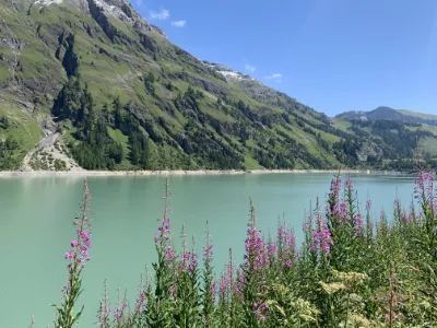
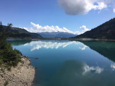
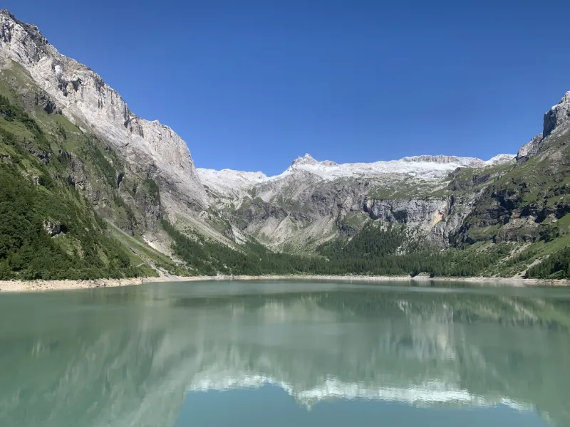
Lac de Tseuzier
Switzerland

The video is only loaded from YouTube (youtube-nocookie.com) when you start it.

No reviews yet

Have you flown here? Share your experience with other pilots.

+ Write the first review

Description

Lac de Tseuzier

Automatic translation.

Aviation weather (METAR and TAF)

LSGS – Sion Airport · 16 km SW MVFR

METAR

Observed 21/11 07:50 · 29 min ago

METAR LSGS 210650Z VRB02KT 9999 -RA SCT014 BKN025 06/06 Q1020

Wind
Variable, 4 km/h
Visibility
10 km or more
Weather
Rain light
Clouds
Scattered (3-4/8) at 1,400 ft (430 m) ; Broken (5-7/8) at 2,500 ft (760 m)
Temperature
6 °C, dew point 6 °C
QNH
1020 hPa
Flight category
MVFR: ceiling 1,000–3,000 ft or visibility 3–5 mi

TAF

Issued 21/11 06:25 · valid from 21/11 07:00 to 21/11 16:00

TAF LSGS 210525Z 2106/2115 VRB01KT 9999 BKN065 TEMPO 2106/2111 SHRA

Period (local time) Change Wind Visibility Weather Clouds
21/11 07:00 → 21/11 16:00 Initial conditions Variable, 2 km/h 10 km or more Broken (5-7/8) at 6,500 ft (1980 m)
21/11 07:00 → 21/11 12:00 Temporarily Showers of rain

Empty cell: no change forecast for that element.

METAR and TAF from NOAA (Aviation Weather Center), for guidance only: they do not replace flight planning with official sources (SIA, Météo-France). Nearest station that issues a METAR, not necessarily the nearest aerodrome.

Plan the light

Weather and Kp index

Loading forecast…

Sunrise and sunset

Local times at the spot (UTC+01:00). The golden hour, the warm, low light sought after for photos and videos, runs from sunrise until the sun reaches 6° above the horizon, and in the evening from 6° until sunset.

Day Dawn Sunrise Golden hour Sunset Dusk Day length
Sat 21 Nov07:07 07:40 07:40–08:27 · 16:05–16:52 16:52 17:259 h 12
Sun 22 Nov07:08 07:41 07:41–08:29 · 16:04–16:51 16:51 17:259 h 10
Mon 23 Nov07:09 07:43 07:43–08:30 · 16:03–16:51 16:51 17:249 h 07
Tue 24 Nov07:11 07:44 07:44–08:32 · 16:02–16:50 16:50 17:239 h 05
Wed 25 Nov07:12 07:45 07:45–08:34 · 16:01–16:49 16:49 17:239 h 03
Thu 26 Nov07:13 07:47 07:47–08:35 · 16:00–16:48 16:48 17:229 h 01
Fri 27 Nov07:14 07:48 07:48–08:36 · 15:59–16:48 16:48 17:228 h 59

Nearby on Wikipedia

  • Barrage de Tseuzier · 0.8 km away

    Le barrage de Tseuzier ou Zeuzier, parfois aussi appelé barrage du Rawyl ou Rawil, est un barrage voûte dans le canton du Valais en Suisse et proche de la station d'Anzère. Il se situe sur la rive droite du Rhône au fond du vallon de la Lienne, au pied du col du Rawyl et mesure de hauthttp://www (...)

  • Séisme de 1946 en Suisse · 2.1 km away

    Le tremblement de terre du s'est produit à 18 h 32 dans le canton du Valais avec une magnitude de sur l’échelle de Richter. Son épicentre se situe dans la région du Wildhorn, alors que les dégâts les plus importants se produisent dans la vallée du Rhône entre Sion et Loèche ; il a été ressenti dans (...)

  • Cry d'Er · 4.3 km away

    Cry d'Er est une montagne se situant dans le canton du Valais sur les hauteurs de Crans-Montana. Cry d'Er est reliée par deux télécabines : une partant de Crans (Crans-Merbé-Cry d'Er), l'autre partant de Montana (Montana-Arnouvaz-Cry d'Er) ; il y a aussi un télésiège partant des Marolires et (...)

  • Chermignon · 4.8 km away

    Chermignon est une commune suisse du canton du Valais, située dans le district de Sierre. (...)

  • Wildhorn · 5.1 km away

    Le Wildhorn est un sommet des Alpes bernoises en Suisse. Culminant à d'altitude, il se trouve à la frontière entre les cantons de Berne et Valais.

Articles found by GeoNames from the spot's position.

Nearby spots

Reviews

Log in to review this spot. Log in · Create a free account

No reviews yet. Share yours!

Connection to the site lost. Trying again…

The site is not responding. Trying again in seconds.

The site is no longer responding.

The site has been updated. Reloading the page…

This page has expired.

Resuming failed. Please reload the page.

The site is no longer responding.