

Saint Denis d'Oléron Harbor
No reviews yet
Have you flown here? Share your experience with other pilots.
+ Write the first reviewDescription
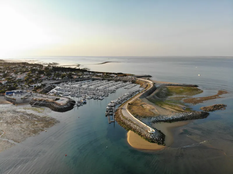
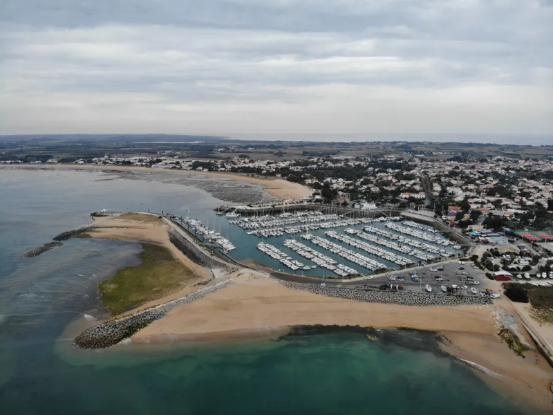
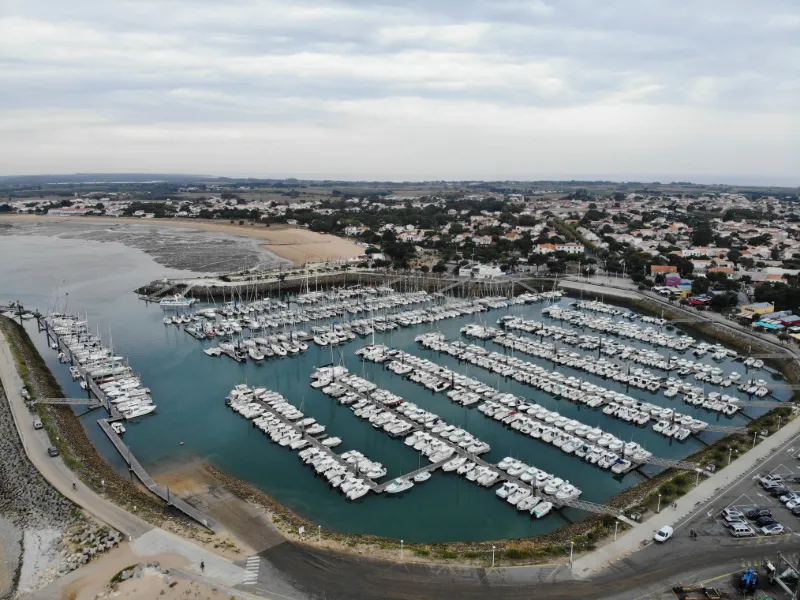
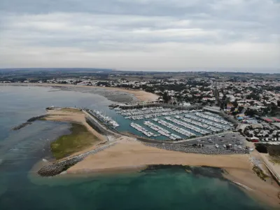
The Saint-Denis marina is the fruit of people's fight against the silting up of the coasts, a fight won after several centuries of research and unsuccessful attempts. The construction of the harbor's first pier may date back to the 12th century, allowing wine from Chassiron to be shipped to the port of La Rochelle. The first documents appear in the 17th century, mentioning a tax intended for the repair of the harbor.
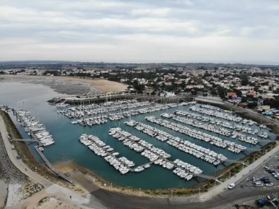
The following two centuries were a series of constructions and repairs of dikes and piers, struggling against silting that was stronger than anything. At the beginning of the 19th century, the idea of a sheltered harbor was even abandoned and the breakwater destroyed. Thus, in 1926, in Paul Thomas's historical work, L'île d'Oléron à travers les siècles, one can read: "Before rounding the far tip of the island, another abandoned harbor: Saint-Denis, also a victim of the encroachment of the sandbanks" It was the rise of tourism that revived the project. This time, the studies were better conducted, funding was easier to obtain, and the materials were better chosen and more solid. In 1989, the commune's new harbor was inaugurated.
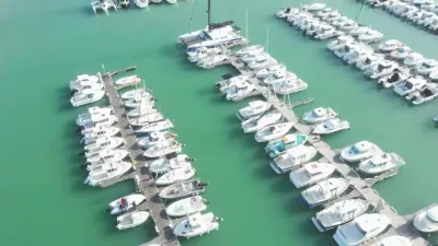
Since the summer of 2006, a commercial area has completed the infrastructure of the Saint-Denis harbor: cafés, restaurants, ice cream shops, boat chandlery, souvenirs, local products, bike rental, bookshop, jewelry, etc. In an exceptional setting, the harbor, which holds the European Blue Flag label, offers nearby all the services and shops that boaters might expect.
Walking along the quay is not disturbed by cars, as this area is reserved for pedestrians.
Map and restricted areas
Open in the main mapNearby aerodromes
Open aerodromes within 25 km of the spot, heliports included, with their distance and direction from the spot. Near an aerodrome, drone flying is prohibited or height-limited: check the UAS zones map.
| Aerodrome | Type | Distance | Elevation | Difference |
|---|---|---|---|---|
| St Pierre d'Oléron Airfield | Aerodrome | 9.4 km SE | 6 m | spot 5 m lower |
| La Rochelle-Île de Ré Airport | Airport | 21 km NE | 23 m | spot 22 m lower |
| Centre Hospitalier Heliport | Heliport | 22 km NE | 15 m | spot 14 m lower |
Aviation weather (METAR and TAF)
LFBH – La Rochelle-Île de Ré Airport LIFR
METAR
METAR LFBH 210630Z AUTO 13006KT 0900 0800 R27/1100U FG VV/// 11/10 Q1017 TEMPO 0300 FG
- Wind
- 130°, 11 km/h
- Visibility
- 900 m
- Weather
- Fog
- Clouds
- –
- Temperature
- 11 °C, dew point 10 °C
- QNH
- 1017 hPa
- Flight category
- LIFR: ceiling < 500 ft or visibility < 1 mi
TAF
TAF LFBH 210500Z 2106/2206 13005KT 3000 BR OVC002 TEMPO 2106/2110 0300 FG VV/// BECMG 2110/2113 CAVOK TEMPO 2116/2119 4000 -RA BECMG 2119/2121 4000 -RA BKN012 TEMPO 2121/2201 2500 DZRA BKN004 OVC012 TEMPO 2201/2203 16020G35KT 2500 RA BKN004 SCT030CB FM220300 25015G25KT 9999 SCT015 TEMPO 2203/2206 25020G40KT 3000 SHRA BKN020CB
| Period (local time) | Change | Wind | Visibility | Weather | Clouds |
|---|---|---|---|---|---|
| 21/11 07:00 → 21/11 11:00 | Initial conditions | 130°, 9 km/h | 3.0 km | Mist | Overcast (8/8) at 200 ft (60 m) |
| 21/11 07:00 → 21/11 11:00 | Temporarily | 300 m | Fog | ||
| 21/11 11:00 → 21/11 20:00 | Becoming | 130°, 9 km/h | 10 km or more | No significant weather | No significant cloud |
| 21/11 17:00 → 21/11 20:00 | Temporarily | 4.0 km | Rain light | ||
| 21/11 20:00 → 22/11 04:00 | Becoming | 130°, 9 km/h | 4.0 km | Rain light | Broken (5-7/8) at 1,200 ft (370 m) |
| 21/11 22:00 → 22/11 02:00 | Temporarily | 2.5 km | Drizzle ; rain | Broken (5-7/8) at 400 ft (120 m) ; Overcast (8/8) at 1,200 ft (370 m) | |
| 22/11 02:00 → 22/11 04:00 | Temporarily | 160°, 37 km/h, gusts 65 km/h | 2.5 km | Rain | Broken (5-7/8) at 400 ft (120 m) ; Scattered (3-4/8) at 3,000 ft (910 m) (cumulonimbus) |
| 22/11 04:00 → 22/11 07:00 | From | 250°, 28 km/h, gusts 46 km/h | 10 km or more | Scattered (3-4/8) at 1,500 ft (460 m) | |
| 22/11 04:00 → 22/11 07:00 | Temporarily | 250°, 37 km/h, gusts 74 km/h | 3.0 km | Showers of rain | Broken (5-7/8) at 2,000 ft (610 m) (cumulonimbus) |
Weather and Kp index
Sunrise and sunset
| Day | Dawn | Sunrise | Golden hour | Sunset | Dusk | Day length |
|---|---|---|---|---|---|---|
| Sat 21 Nov | 07:41 | 08:14 | 08:14–09:01 · 16:41–17:28 | 17:28 | 18:01 | 9 h 14 |
| Sun 22 Nov | 07:43 | 08:16 | 08:16–09:03 · 16:40–17:28 | 17:28 | 18:01 | 9 h 11 |
| Mon 23 Nov | 07:44 | 08:17 | 08:17–09:04 · 16:39–17:27 | 17:27 | 18:00 | 9 h 09 |
| Tue 24 Nov | 07:45 | 08:18 | 08:18–09:06 · 16:39–17:26 | 17:26 | 17:59 | 9 h 07 |
| Wed 25 Nov | 07:46 | 08:20 | 08:20–09:07 · 16:38–17:25 | 17:25 | 17:59 | 9 h 05 |
| Thu 26 Nov | 07:47 | 08:21 | 08:21–09:09 · 16:37–17:25 | 17:25 | 17:58 | 9 h 03 |
| Fri 27 Nov | 07:49 | 08:22 | 08:22–09:10 · 16:36–17:24 | 17:24 | 17:57 | 9 h 02 |



Reviews
Log in to review this spot. Log in · Create a free account
No reviews yet. Share yours!