

The Turghiu tower / Capo Rosso

No reviews yet
Have you flown here? Share your experience with other pilots.
+ Write the first reviewDescription
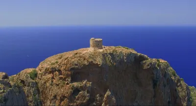
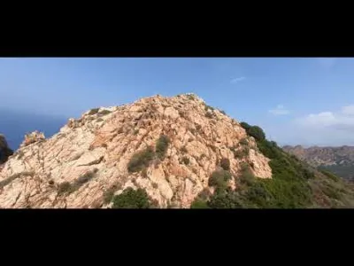
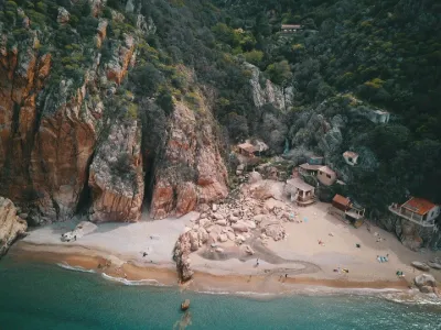
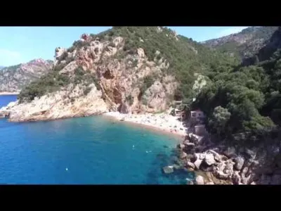
Built in 1608 and located in Corse-du-Sud not far from Piana, the Turghiu tower stands on the summit of Capo Rosso, a pink granite cape accessible only on foot and a UNESCO World Heritage site. I recommend starting early and bringing plenty of water, as there is no shade along the entire route and the hike can be grueling in the heat. The most laborious part is probably a fairly steep little gully to climb between the rocks just before reaching the tower. But reaching the top is a real reward, especially at the top of the tower, as the spectacular 360° panorama is breathtaking... Difficulty: Moderate Start: 6 km from Piana on the road to Arone (at 319 m altitude) Finish: Turghiu Tower (331 m) Elevation gain: 530 m Walking time: 3h round trip In the video = 05:14 The Turghiu tower
Map and restricted areas
Open in the main mapNearby aerodromes
Open aerodromes within 25 km of the spot, heliports included, with their distance and direction from the spot. Near an aerodrome, drone flying is prohibited or height-limited: check the UAS zones map.
No known open aerodrome within 25 km.
Aviation weather (METAR and TAF)
LFKC – Calvi-Sainte-Catherine Airport VFR
METAR
METAR LFKC 211000Z AUTO 21021KT 9999 FEW042 19/10 Q1019 BECMG 21017G27KT
- Wind
- 210°, 39 km/h
- Visibility
- 10 km or more
- Clouds
- Few (1-2/8) at 4,200 ft (1280 m)
- Temperature
- 19 °C, dew point 10 °C
- QNH
- 1019 hPa
- Flight category
- VFR: ceiling > 3,000 ft and visibility > 5 mi
TAF
TAF LFKC 210800Z 2109/2209 21017G27KT 9999 FEW045 TX20/2112Z TN11/2205Z BECMG 2115/2117 22010KT BECMG 2120/2122 VRB03KT PROB30 TEMPO 2122/2203 SHRA SCT040TCU BECMG 2207/2209 21020G30KT
| Period (local time) | Change | Wind | Visibility | Weather | Clouds |
|---|---|---|---|---|---|
| 21/11 10:00 → 21/11 16:00 | Initial conditions | 210°, 31 km/h, gusts 50 km/h | 10 km or more | Few (1-2/8) at 4,500 ft (1370 m) | |
| 21/11 16:00 → 21/11 21:00 | Becoming | 220°, 19 km/h | 10 km or more | Few (1-2/8) at 4,500 ft (1370 m) | |
| 21/11 21:00 → 22/11 08:00 | Becoming | Variable, 6 km/h | 10 km or more | Few (1-2/8) at 4,500 ft (1370 m) | |
| 21/11 23:00 → 22/11 04:00 | Temporarily, probability 30% | Showers of rain | Scattered (3-4/8) at 4,000 ft (1220 m) (towering cumulus) | ||
| 22/11 08:00 → 22/11 10:00 | Becoming | 210°, 37 km/h, gusts 56 km/h | 10 km or more | Few (1-2/8) at 4,500 ft (1370 m) |
Weather and Kp index
| Day | Weather | Temp. min. / max. | Wind | Rain | Max Kp |
|---|---|---|---|---|---|
| Sat 21 Nov | Partly cloudy | 16° / 17° | 31 km/h W | – | 2 |
| Sun 22 Nov | Partly cloudy | 16° / 18° | 67 km/h W | 10 mm | 2 |
| Mon 23 Nov | Showers | 15° / 16° | 74 km/h W | 1.0 mm | 4 |
| Tue 24 Nov | Partly cloudy | 14° / 16° | 24 km/h S | – | 2 |
| Wed 25 Nov | Light rain | 15° / 17° | 24 km/h SW | 11 mm | – |
| Thu 26 Nov | Cloudy | 14° / 16° | 20 km/h SW | 3.6 mm | – |
| Fri 27 Nov | Fair | 13° / 14° | 38 km/h N | 2.0 mm | – |
Hour by hour: Saturday 21 November
| Time | Weather | Temp. | Wind | Rain | Clouds | Kp |
|---|---|---|---|---|---|---|
| 11:00 | Partly cloudy | 17° | 31 km/h W | – | 78 % | 2 |
| 12:00 | Partly cloudy | 17° | 30 km/h W | – | 55 % | 2 |
| 13:00 | Partly cloudy | 17° | 30 km/h W | – | 39 % | 1 |
| 14:00 | Partly cloudy | 17° | 28 km/h SW | – | 41 % | 1 |
| 15:00 | Fair | 17° | 28 km/h SW | – | 21 % | 1 |
| 16:00 | Fair | 17° | 27 km/h SW | – | 16 % | 2 |
| 17:00 | Fair | 17° | 24 km/h SW | – | 28 % | 2 |
| 18:00 | Fair | 17° | 22 km/h SW | – | 36 % | 2 |
| 19:00 | Fair | 17° | 21 km/h S | – | 19 % | 2 |
| 20:00 | Partly cloudy | 17° | 21 km/h S | – | 50 % | 2 |
| 21:00 | Fair | 16° | 23 km/h SE | – | 30 % | 2 |
| 22:00 | Partly cloudy | 16° | 24 km/h SE | – | 77 % | 2 |
Hour by hour: Sunday 22 November
| Time | Weather | Temp. | Wind | Rain | Clouds | Kp |
|---|---|---|---|---|---|---|
| 06:00 | Cloudy | 17° | 36 km/h SE | – | 94 % | 2 |
| 07:00 | Cloudy | 17° | 41 km/h SE | – | 97 % | 2 |
| 08:00 | Showers | 17° | 43 km/h SE | 0.1 mm | 85 % | 2 |
| 09:00 | Light rain | 17° | 44 km/h SE | 0.3 mm | 94 % | 2 |
| 10:00 | Heavy rain | 17° | 42 km/h SE | 1.9 mm | 100 % | 2 |
| 11:00 | Heavy rain | 17° | 38 km/h S | 4.9 mm | 96 % | 2 |
| 12:00 | Showers | 17° | 43 km/h SW | 2.8 mm | 77 % | 2 |
| 13:00 | Partly cloudy | 18° | 46 km/h W | – | 41 % | 2 |
| 14:00 | Partly cloudy | 18° | 49 km/h W | – | 48 % | 2 |
| 15:00 | Fair | 18° | 51 km/h W | – | 21 % | 2 |
| 16:00 | Clear sky | 17° | 49 km/h W | – | 5 % | 2 |
| 17:00 | Clear sky | 17° | 51 km/h W | – | 2 % | 2 |
| 18:00 | Clear sky | 17° | 57 km/h W | – | 2 % | 2 |
| 19:00 | Clear sky | 17° | 60 km/h W | – | 2 % | 2 |
| 20:00 | Clear sky | 17° | 60 km/h W | – | 0 % | 2 |
| 21:00 | Clear sky | 17° | 63 km/h W | – | 1 % | 2 |
| 22:00 | Clear sky | 17° | 67 km/h W | – | 1 % | 2 |
Sunrise and sunset
| Day | Dawn | Sunrise | Golden hour | Sunset | Dusk | Day length |
|---|---|---|---|---|---|---|
| Sat 21 Nov | 06:53 | 07:24 | 07:24–08:06 · 16:17–17:00 | 17:00 | 17:30 | 9 h 36 |
| Sun 22 Nov | 06:54 | 07:25 | 07:25–08:08 · 16:16–16:59 | 16:59 | 17:30 | 9 h 34 |
| Mon 23 Nov | 06:55 | 07:26 | 07:26–08:09 · 16:15–16:58 | 16:58 | 17:29 | 9 h 32 |
| Tue 24 Nov | 06:56 | 07:27 | 07:27–08:10 · 16:15–16:58 | 16:58 | 17:29 | 9 h 30 |
| Wed 25 Nov | 06:57 | 07:28 | 07:28–08:12 · 16:14–16:57 | 16:57 | 17:28 | 9 h 29 |
| Thu 26 Nov | 06:59 | 07:29 | 07:29–08:13 · 16:13–16:57 | 16:57 | 17:28 | 9 h 27 |
| Fri 27 Nov | 07:00 | 07:30 | 07:30–08:14 · 16:13–16:56 | 16:56 | 17:27 | 9 h 25 |


Reviews
Log in to review this spot. Log in · Create a free account
No reviews yet. Share yours!