

Barfleur

No reviews yet
Have you flown here? Share your experience with other pilots.
+ Write the first reviewDescription
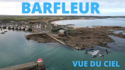
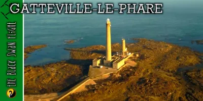
Barfleur (pronounced [baʁflœʁ], locally [baʁflœː]/[baʁfjø:]) is a French commune located in the northeast of the Manche department in the Normandy region, with a population of 570. The first port of the Anglo-Norman Kingdom in the Middle Ages, Barfleur remains a port with significant leisure boating and fishing activity. Its grey granite houses jut out toward the English Channel, watched over by the semaphore and the Gatteville lighthouse. Barfleur now holds the "Most Beautiful Villages of France" label, awarded by an independent association aiming to promote the tourist assets of small French communes rich in high-quality heritage. Location: The commune is located on the coast, a few kilometers south of the Barfleur point, which marks the northeastern tip of the Cotentin (but lies within the commune of Gatteville-le-Phare). Barfleur is surrounded to the south by the commune of Montfarville, to the northwest by the commune of Gatteville-le-Phare and to the east by the English Channel. Climate: The nearest weather station is Gonneville, located 15.99 km as the crow flies from Barfleur.
Map and restricted areas
Open in the main mapNearby aerodromes
Open aerodromes within 25 km of the spot, heliports included, with their distance and direction from the spot. Near an aerodrome, drone flying is prohibited or height-limited: check the UAS zones map.
| Aerodrome | Type | Distance | Elevation | Difference |
|---|---|---|---|---|
| Cherbourg-Maupertus Airport | Airport | 15 km W | 140 m | spot 139 m lower |
Aviation weather (METAR and TAF)
LFRC – Cherbourg-Maupertus Airport LIFR
METAR
METAR LFRC 211130Z AUTO 15009KT 0350 0300 R28/0400N FG VV/// 09/09 Q1016 BECMG 6000 NSW BKN003
- Wind
- 150°, 17 km/h
- Visibility
- 350 m
- Weather
- Fog
- Clouds
- –
- Temperature
- 9 °C, dew point 9 °C
- QNH
- 1016 hPa
- Flight category
- LIFR: ceiling < 500 ft or visibility < 1 mi
TAF
TAF LFRC 211100Z 2112/2121 17010KT 0300 FG VV/// BECMG 2112/2114 6000 NSW BKN003 BECMG 2114/2116 BKN008 TEMPO 2116/2120 BKN011 BECMG 2119/2121 13015G25KT
| Period (local time) | Change | Wind | Visibility | Weather | Clouds |
|---|---|---|---|---|---|
| 21/11 13:00 → 21/11 22:00 | Initial conditions | 170°, 19 km/h | 300 m | Fog | |
| 21/11 13:00 → 21/11 15:00 | Becoming | 170°, 19 km/h | 6 km | No significant weather | Broken (5-7/8) at 300 ft (90 m) |
| 21/11 15:00 → 21/11 20:00 | Becoming | 170°, 19 km/h | 6 km | No significant weather | Broken (5-7/8) at 800 ft (240 m) |
| 21/11 17:00 → 21/11 21:00 | Temporarily | Broken (5-7/8) at 1,100 ft (340 m) | |||
| 21/11 20:00 → 21/11 22:00 | Becoming | 130°, 28 km/h, gusts 46 km/h | 6 km | No significant weather | Broken (5-7/8) at 800 ft (240 m) |
Weather and Kp index
Sunrise and sunset
| Day | Dawn | Sunrise | Golden hour | Sunset | Dusk | Day length |
|---|---|---|---|---|---|---|
| Sat 21 Nov | 07:50 | 08:26 | 08:26–09:18 · 16:23–17:16 | 17:16 | 17:51 | 8 h 49 |
| Sun 22 Nov | 07:52 | 08:28 | 08:28–09:20 · 16:22–17:15 | 17:15 | 17:51 | 8 h 47 |
| Mon 23 Nov | 07:53 | 08:29 | 08:29–09:22 · 16:21–17:14 | 17:14 | 17:50 | 8 h 44 |
| Tue 24 Nov | 07:54 | 08:31 | 08:31–09:24 · 16:20–17:13 | 17:13 | 17:49 | 8 h 42 |
| Wed 25 Nov | 07:56 | 08:32 | 08:32–09:25 · 16:19–17:12 | 17:12 | 17:48 | 8 h 39 |
| Thu 26 Nov | 07:57 | 08:34 | 08:34–09:27 · 16:18–17:11 | 17:11 | 17:48 | 8 h 37 |
| Fri 27 Nov | 07:58 | 08:35 | 08:35–09:29 · 16:17–17:10 | 17:10 | 17:47 | 8 h 35 |




Reviews
Log in to review this spot. Log in · Create a free account
No reviews yet. Share yours!