

Atlantic Wall - Néville Battery
No reviews yet
Have you flown here? Share your experience with other pilots.
+ Write the first reviewDescription
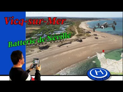
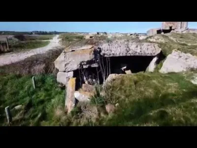
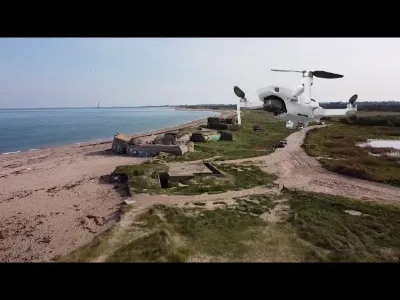
The Néville battery, code name Blankenese, is a monument in the Manche department located in the delegated commune of Néville-sur-Mer in Vicq-sur-Mer. It is part of the Atlantic Wall. It was built in 1942 at the Pointe de Néville by the German navy (Kriegsmarine). It was equipped with 4 British Vickers 94 mm anti-aircraft guns. The whole battery includes about thirty bunkers laid out along the beach, linked together by galleries. It was engaged on 6 June 1944 against the Allied landing. It attacked several naval convoys, notably on 7 June, 11 June, 13 June, 15 June and the morning of 18 June, forcing them to turn back. It suffered an air bombardment on 13 June, which did not put it out of action. Its German occupants finally scuttled it on 18 June under the "Henrich plan", which ordered the German defense to be concentrated on the "fortress of Cherbourg" (festung Cherbourg). The Americans took possession of it on 20 June. The American army used the casemates for demolition tests.
Map and restricted areas
Open in the main mapNearby aerodromes
Open aerodromes within 25 km of the spot, heliports included, with their distance and direction from the spot. Near an aerodrome, drone flying is prohibited or height-limited: check the UAS zones map.
| Aerodrome | Type | Distance | Elevation | Difference |
|---|---|---|---|---|
| Cherbourg-Maupertus Airport | Airport | 12 km SW | 140 m | spot 140 m lower |
| Centre Hospitalier Heliport | Heliport | 21 km W | 19 m | spot 19 m lower |
| Arsenal-Premar Heliport | Heliport | 23 km W | 8 m | spot 8 m lower |
Aviation weather (METAR and TAF)
LFRC – Cherbourg-Maupertus Airport LIFR
METAR
METAR LFRC 211130Z AUTO 15009KT 0350 0300 R28/0400N FG VV/// 09/09 Q1016 BECMG 6000 NSW BKN003
- Wind
- 150°, 17 km/h
- Visibility
- 350 m
- Weather
- Fog
- Clouds
- –
- Temperature
- 9 °C, dew point 9 °C
- QNH
- 1016 hPa
- Flight category
- LIFR: ceiling < 500 ft or visibility < 1 mi
TAF
TAF LFRC 211100Z 2112/2121 17010KT 0300 FG VV/// BECMG 2112/2114 6000 NSW BKN003 BECMG 2114/2116 BKN008 TEMPO 2116/2120 BKN011 BECMG 2119/2121 13015G25KT
| Period (local time) | Change | Wind | Visibility | Weather | Clouds |
|---|---|---|---|---|---|
| 21/11 13:00 → 21/11 22:00 | Initial conditions | 170°, 19 km/h | 300 m | Fog | |
| 21/11 13:00 → 21/11 15:00 | Becoming | 170°, 19 km/h | 6 km | No significant weather | Broken (5-7/8) at 300 ft (90 m) |
| 21/11 15:00 → 21/11 20:00 | Becoming | 170°, 19 km/h | 6 km | No significant weather | Broken (5-7/8) at 800 ft (240 m) |
| 21/11 17:00 → 21/11 21:00 | Temporarily | Broken (5-7/8) at 1,100 ft (340 m) | |||
| 21/11 20:00 → 21/11 22:00 | Becoming | 130°, 28 km/h, gusts 46 km/h | 6 km | No significant weather | Broken (5-7/8) at 800 ft (240 m) |
Weather and Kp index
Sunrise and sunset
| Day | Dawn | Sunrise | Golden hour | Sunset | Dusk | Day length |
|---|---|---|---|---|---|---|
| Sat 21 Nov | 07:51 | 08:27 | 08:27–09:19 · 16:24–17:16 | 17:16 | 17:52 | 8 h 49 |
| Sun 22 Nov | 07:52 | 08:28 | 08:28–09:21 · 16:22–17:15 | 17:15 | 17:51 | 8 h 46 |
| Mon 23 Nov | 07:53 | 08:30 | 08:30–09:22 · 16:21–17:14 | 17:14 | 17:50 | 8 h 44 |
| Tue 24 Nov | 07:55 | 08:31 | 08:31–09:24 · 16:20–17:13 | 17:13 | 17:49 | 8 h 41 |
| Wed 25 Nov | 07:56 | 08:32 | 08:32–09:26 · 16:19–17:12 | 17:12 | 17:48 | 8 h 39 |
| Thu 26 Nov | 07:57 | 08:34 | 08:34–09:28 · 16:18–17:11 | 17:11 | 17:48 | 8 h 37 |
| Fri 27 Nov | 07:59 | 08:35 | 08:35–09:29 · 16:17–17:11 | 17:11 | 17:47 | 8 h 35 |


Reviews
Log in to review this spot. Log in · Create a free account
No reviews yet. Share yours!