

Le Bettex
No reviews yet
Have you flown here? Share your experience with other pilots.
+ Write the first reviewDescription
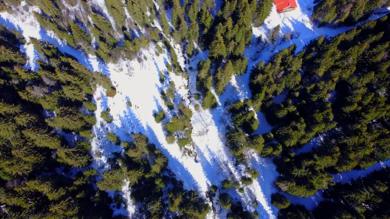
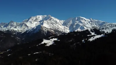
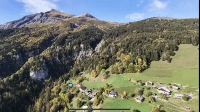
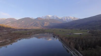
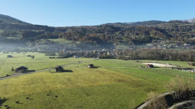
In the Pays du Mont Blanc, a place fully committed to the roof of Europe, Mont Blanc, which peaks at 4810m, there are many activities on offer from the Bettex resort in every season. Skiing, Nordic walking or summer hiking, and mountain biking too. Escape to the balcony with a view of the Mont Blanc Range, but not only that... Indeed, from this unique hiking area in Haute Savoie, you will also enjoy the panoramic view over the whole upper Arve valley. Just to the left is the Fiz range, and by turning a little further, the Aravis range is there for you to admire. On the path to Saint Nicolas de Véroce and at the start of the ascent of Mont Joly, the walk here is pleasant and full of well-being. The tall fir trees can be a hindrance for DRONE flying, but with precision and care, you can get a rather positive result.
HAUTE NATURE IMAGES, travel, inspiration and images VIDEO link
Map and restricted areas
Open in the main mapNearby aerodromes
Open aerodromes within 25 km of the spot, heliports included, with their distance and direction from the spot. Near an aerodrome, drone flying is prohibited or height-limited: check the UAS zones map.
| Aerodrome | Type | Distance | Elevation | Difference |
|---|---|---|---|---|
| Megève Altiport | Aerodrome | 5.9 km SW | 1,470 m | spot 69 m lower |
| Centre Hospitalier Heliport | Heliport | 8.0 km NW | 546 m | spot 855 m higher |
| Altisurface de Saint-Roch Mayères | Aerodrome | 12 km NW | 1,560 m | spot 159 m lower |
| Magland Heliport | Heliport | 13 km N | 2,300 m | spot 899 m lower |
| Altisurface du Glacier Du Dome Du Gouter | Aerodrome | 13 km E | 4,200 m | spot 2,799 m lower |
Aviation weather (METAR and TAF)
LFLP – Annecy-Haute-Savoie-Mont Blanc Airport VFR
METAR
METAR LFLP 211000Z AUTO 13004KT 9999 BKN054 BKN070 10/07 Q1021 NOSIG
- Wind
- 130°, 7 km/h
- Visibility
- 10 km or more
- Clouds
- Broken (5-7/8) at 5,400 ft (1650 m) ; Broken (5-7/8) at 7,000 ft (2130 m)
- Temperature
- 10 °C, dew point 7 °C
- QNH
- 1021 hPa
- Flight category
- VFR: ceiling > 3,000 ft and visibility > 5 mi
TAF
TAF LFLP 210800Z 2109/2209 VRB03KT 9999 SCT040 BECMG 2122/2124 RA BKN040 TEMPO 2200/2209 4000 RA SCT030TCU PROB40 TEMPO 2203/2209 2000 BKN012
| Period (local time) | Change | Wind | Visibility | Weather | Clouds |
|---|---|---|---|---|---|
| 21/11 10:00 → 21/11 23:00 | Initial conditions | Variable, 6 km/h | 10 km or more | Scattered (3-4/8) at 4,000 ft (1220 m) | |
| 21/11 23:00 → 22/11 10:00 | Becoming | Variable, 6 km/h | 10 km or more | Rain | Broken (5-7/8) at 4,000 ft (1220 m) |
| 22/11 01:00 → 22/11 10:00 | Temporarily | 4.0 km | Rain | Scattered (3-4/8) at 3,000 ft (910 m) (towering cumulus) | |
| 22/11 04:00 → 22/11 10:00 | Temporarily, probability 40% | 2.0 km | Broken (5-7/8) at 1,200 ft (370 m) |
Weather and Kp index
Sunrise and sunset
| Day | Dawn | Sunrise | Golden hour | Sunset | Dusk | Day length |
|---|---|---|---|---|---|---|
| Sat 21 Nov | 07:09 | 07:41 | 07:41–08:28 · 16:10–16:57 | 16:57 | 17:29 | 9 h 15 |
| Sun 22 Nov | 07:10 | 07:43 | 07:43–08:30 · 16:09–16:56 | 16:56 | 17:29 | 9 h 13 |
| Mon 23 Nov | 07:11 | 07:44 | 07:44–08:31 · 16:08–16:55 | 16:55 | 17:28 | 9 h 10 |
| Tue 24 Nov | 07:12 | 07:45 | 07:45–08:33 · 16:07–16:54 | 16:54 | 17:27 | 9 h 08 |
| Wed 25 Nov | 07:14 | 07:47 | 07:47–08:34 · 16:06–16:54 | 16:54 | 17:27 | 9 h 06 |
| Thu 26 Nov | 07:15 | 07:48 | 07:48–08:36 · 16:05–16:53 | 16:53 | 17:26 | 9 h 05 |
| Fri 27 Nov | 07:16 | 07:49 | 07:49–08:37 · 16:05–16:52 | 16:52 | 17:26 | 9 h 03 |

Reviews
Log in to review this spot. Log in · Create a free account
No reviews yet. Share yours!