Skip to content
Mountain

Emmetten

Switzerland

Emmetten – photo 1

No reviews yet

Have you flown here? Share your experience with other pilots.

+ Write the first review

Description

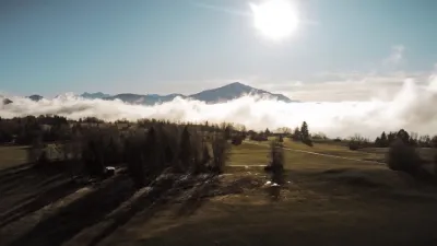
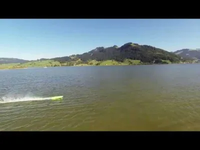
View of Lake Lucerne (the lake of the 4 cantons), watch out for power lines.

Automatic translation.

Aviation weather (METAR and TAF)

LSZC – Buochs Airport · 9.1 km W VFR

METAR

Observed 21/11 07:50 · 29 min ago

METAR LSZC 210650Z AUTO 22004KT 170V280 9999 -DZ SCT043 BKN050 07/04 Q1020

Wind
220°, 7 km/h
Visibility
10 km or more
Weather
Drizzle light
Clouds
Scattered (3-4/8) at 4,300 ft (1310 m) ; Broken (5-7/8) at 5,000 ft (1520 m)
Temperature
7 °C, dew point 4 °C
QNH
1020 hPa
Flight category
VFR: ceiling > 3,000 ft and visibility > 5 mi

TAF

This station does not issue a TAF (or none is currently valid).

METAR and TAF from NOAA (Aviation Weather Center), for guidance only: they do not replace flight planning with official sources (SIA, Météo-France). Nearest station that issues a METAR, not necessarily the nearest aerodrome.

Plan the light

Weather and Kp index

Loading forecast…

Sunrise and sunset

Local times at the spot (UTC+01:00). The golden hour, the warm, low light sought after for photos and videos, runs from sunrise until the sun reaches 6° above the horizon, and in the evening from 6° until sunset.

Day Dawn Sunrise Golden hour Sunset Dusk Day length
Sat 21 Nov07:04 07:38 07:38–08:26 · 15:58–16:46 16:46 17:209 h 08
Sun 22 Nov07:05 07:39 07:39–08:27 · 15:57–16:45 16:45 17:199 h 06
Mon 23 Nov07:07 07:40 07:40–08:29 · 15:56–16:44 16:44 17:189 h 03
Tue 24 Nov07:08 07:42 07:42–08:30 · 15:55–16:44 16:44 17:179 h 01
Wed 25 Nov07:09 07:43 07:43–08:32 · 15:54–16:43 16:43 17:178 h 59
Thu 26 Nov07:10 07:44 07:44–08:34 · 15:53–16:42 16:42 17:168 h 57
Fri 27 Nov07:12 07:46 07:46–08:35 · 15:52–16:41 16:41 17:168 h 55

Nearby on Wikipedia

  • Emmetten · 1.5 km away

    Emmetten est une commune suisse du canton de Nidwald. (...)

  • Beckenried · 4.2 km away

    Beckenried est une commune suisse du canton de Nidwald. (...)

  • Tunnel du Seelisberg · 4.3 km away

    Le tunnel du Seelisberg (Seelisbergtunnel en allemand) est un tunnel autoroutier à deux galeries situé dans les cantons de Nidwald et d'Uri en Suisse. Il se trouve sur l'autoroute A2 sur l'axe menant au portail nord du tunnel du Saint-Gothard. Il fut mis en service le 12 décembre 1980, structurae (...)

  • Auto-Fähre Vierwaldstättersee · 4.7 km away

    Le Auto-Fähre Vierwaldstättersee (en français : Bac du lac des Quatre-Cantons) est un bac (ou ferry) sur le lac des Quatre-Cantons entre Beckenried (canton de Nidwald) et Gersau (canton de Schwytz). Le trajet de est parcouru en 20 minutes, remplaçant un détour de par la route (...)

  • Lucerne (homonymie) · 4.7 km away

    == Toponymes == === === * Lucerne, village de l'Outaouais fusionné à Aylmer en 1975. Fait maintenant partie de la grande ville de Gatineau. === === *Lucerne, dans l'Ohio ; *Buick Lucerne, une automobile === === *La Lucerne-d'Outremer, commune française de la Manche (...)

Articles found by GeoNames from the spot's position.

Nearby spots

Reviews

Log in to review this spot. Log in · Create a free account

No reviews yet. Share yours!

Connection to the site lost. Trying again…

The site is not responding. Trying again in seconds.

The site is no longer responding.

The site has been updated. Reloading the page…

This page has expired.

Resuming failed. Please reload the page.

The site is no longer responding.