

The Port of Le Becquet
No reviews yet
Have you flown here? Share your experience with other pilots.
+ Write the first reviewDescription
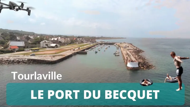
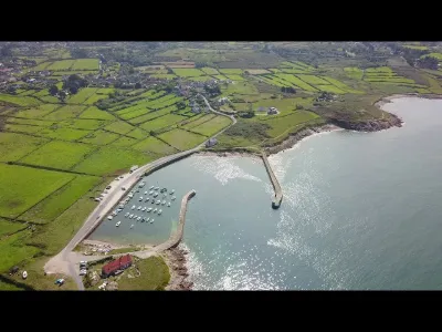
The Becquet port is a port in the Manche department located in the village of Le Becquet, in Digosville and Tourlaville. It takes its name from the two rocky points that frame it, Les Becquets. Its distinctive feature is its jetty of dry stones and vertical flat stones. Its area is 1.25 hectares. The breakwater shelters it from south, west and east winds. Construction: It was built starting in 1783 by François-Justin Asselin du Vey (1757-1840) to allow the loading of the stones needed for the riprap of the breakwaters closing the Cherbourg roadstead: "From the very beginning of this vast undertaking, the schistose mountain of Le Becquet, by its nature, its location and its great extent, was considered a very important point of extraction, and it was to facilitate the loading of the materials extracted from the quarries that were to be opened there that the navy, in 1783 and 1784, had the harbor closest to the center of the works enlarged and closed off by two dry-stone breakwaters." The first shelter, 54 meters long by 40 meters wide, parallel to the shore, had its jetty extended by more than 200 meters and its width increased to 50 meters. In 1786, the quays were built, then a second 90-meter jetty was built on the rock to the east. But the outer facings could not withstand the shock of the waves. Two years later, everything had to be redone. "They were replaced by a timber pier that was attacked by shipworms and also lasted only a short time. When the work resumed in Year XI, the stones pushed by the sea had filled the port; it was cleared and the west breakwater was rebuilt, partly with small stones and partly with large blocks." In 1839, "it is enclosed by quay walls built of dry stones set on edge, and protected on the seaward side by a rubble-mound breakwater or jetty, faced with blocks. It is about 200 m long, 40 m wide and 12.5 m in area; its quay walls extend for 550 m." On 18 October 1910, a petition from the inhabitants of Digosville and Tourlaville called for the construction of a sheltering jetty and the deepening of the port entrance. The municipality brought the matter to the public authorities. On 5 May 1927, the government granted a credit of 25,000 F to repair the damage the port suffered during the latest storms, followed by a further credit of 50,000 F on 23 August 1928. But storms caused new damage in 1936, 1975, 1977, 1978, 1980 and 1986.
Video
Map and restricted areas
Open in the main mapNearby aerodromes
Open aerodromes within 25 km of the spot, heliports included, with their distance and direction from the spot. Near an aerodrome, drone flying is prohibited or height-limited: check the UAS zones map.
| Aerodrome | Type | Distance | Elevation | Difference |
|---|---|---|---|---|
| Centre Hospitalier Heliport | Heliport | 4.9 km W | 19 m | spot 15 m lower |
| Cherbourg-Maupertus Airport | Airport | 5.6 km E | 140 m | spot 136 m lower |
| Arsenal-Premar Heliport | Heliport | 6.6 km W | 8 m | same altitude as the spot |
| Aérodrome de Vauville | Aerodrome | 21 km W | 139 m | spot 135 m lower |
Aviation weather (METAR and TAF)
LFRC – Cherbourg-Maupertus Airport LIFR
METAR
METAR LFRC 211130Z AUTO 15009KT 0350 0300 R28/0400N FG VV/// 09/09 Q1016 BECMG 6000 NSW BKN003
- Wind
- 150°, 17 km/h
- Visibility
- 350 m
- Weather
- Fog
- Clouds
- –
- Temperature
- 9 °C, dew point 9 °C
- QNH
- 1016 hPa
- Flight category
- LIFR: ceiling < 500 ft or visibility < 1 mi
TAF
TAF LFRC 211100Z 2112/2121 17010KT 0300 FG VV/// BECMG 2112/2114 6000 NSW BKN003 BECMG 2114/2116 BKN008 TEMPO 2116/2120 BKN011 BECMG 2119/2121 13015G25KT
| Period (local time) | Change | Wind | Visibility | Weather | Clouds |
|---|---|---|---|---|---|
| 21/11 13:00 → 21/11 22:00 | Initial conditions | 170°, 19 km/h | 300 m | Fog | |
| 21/11 13:00 → 21/11 15:00 | Becoming | 170°, 19 km/h | 6 km | No significant weather | Broken (5-7/8) at 300 ft (90 m) |
| 21/11 15:00 → 21/11 20:00 | Becoming | 170°, 19 km/h | 6 km | No significant weather | Broken (5-7/8) at 800 ft (240 m) |
| 21/11 17:00 → 21/11 21:00 | Temporarily | Broken (5-7/8) at 1,100 ft (340 m) | |||
| 21/11 20:00 → 21/11 22:00 | Becoming | 130°, 28 km/h, gusts 46 km/h | 6 km | No significant weather | Broken (5-7/8) at 800 ft (240 m) |
Weather and Kp index
Sunrise and sunset
| Day | Dawn | Sunrise | Golden hour | Sunset | Dusk | Day length |
|---|---|---|---|---|---|---|
| Sat 21 Nov | 07:51 | 08:27 | 08:27–09:19 · 16:25–17:17 | 17:17 | 17:53 | 8 h 49 |
| Sun 22 Nov | 07:53 | 08:29 | 08:29–09:21 · 16:23–17:16 | 17:16 | 17:52 | 8 h 47 |
| Mon 23 Nov | 07:54 | 08:30 | 08:30–09:23 · 16:22–17:15 | 17:15 | 17:51 | 8 h 44 |
| Tue 24 Nov | 07:56 | 08:32 | 08:32–09:25 · 16:21–17:14 | 17:14 | 17:50 | 8 h 42 |
| Wed 25 Nov | 07:57 | 08:33 | 08:33–09:26 · 16:20–17:13 | 17:13 | 17:49 | 8 h 40 |
| Thu 26 Nov | 07:58 | 08:35 | 08:35–09:28 · 16:19–17:12 | 17:12 | 17:49 | 8 h 37 |
| Fri 27 Nov | 08:00 | 08:36 | 08:36–09:30 · 16:18–17:12 | 17:12 | 17:48 | 8 h 35 |




Reviews
Log in to review this spot. Log in · Create a free account
No reviews yet. Share yours!