

Notre-Dame Church of Morcourt

No reviews yet
Have you flown here? Share your experience with other pilots.
+ Write the first reviewDescription
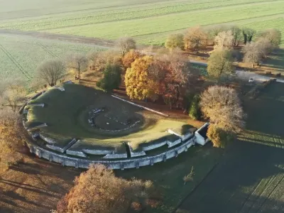
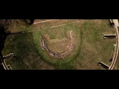
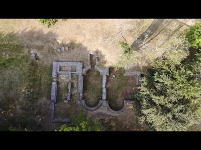
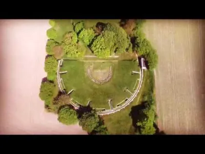
Morcourt - Notre-Dame Church.
The tall silhouette of its bell tower, now reduced to the south side only, stands out against the Valois plain: the old church of Morcourt. Like many other religious buildings in the region, its complex remains bear the mark of a rich and contrasting history made up of alternating periods of prosperity and destructive conflicts. . A two-bay choir with a flat apse had been built in the early 11th century. It was completely rebuilt a century later and given chapels to the north and south, the latest being the southeast chapel, from the late 13th century. . After the Hundred Years' War, the church was given a new choir with the classic pentagonal plan, and the bell tower, partly keeping its 13th-century base, received two stories pierced with round-arched bays and a gabled roof that makes it similar to that of Fresnoy-la-Rivière, probably slightly earlier. Fairly ruined by the conflicts of the 14th and 15th centuries, it was restored to become, in 1516, the church of Morcourt.
Disagreements between the inhabitants of Morcourt and the monks of the abbey of Lieu-Restauré led to the gradual decay of the building over the following centuries. From 1802 the church was abandoned. In 1811, a tornado ravaged the neighboring church of Feigneux. The demolition of the church of Morcourt made its restoration possible. In 1825, the church, though ruined, remained a place of devotion because the cemetery was still in use. . In 1909, the site was sold at the price of the stone. The buyer had some restoration work done, which slowed the decay a little. Currently, restoration work is being carried out by volunteers to preserve this heritage. The site was listed as a historic monument in 1927.
Map and restricted areas
Open in the main mapNearby aerodromes
Open aerodromes within 25 km of the spot, heliports included, with their distance and direction from the spot. Near an aerodrome, drone flying is prohibited or height-limited: check the UAS zones map.
| Aerodrome | Type | Distance | Elevation | Difference |
|---|---|---|---|---|
| Base ULM de Taillefontaine | Aerodrome | 13 km E | 145 m | spot 30 m lower |
| Centre Hospitalier Heliport | Heliport | 15 km NW | 33 m | spot 82 m higher |
| Compiègne Margny Airfield | Aerodrome | 20 km N | 96 m | spot 19 m higher |
| Base ULM de Mosloy | Aerodrome | 21 km SE | 138 m | spot 23 m lower |
| Le Plessis-Belleville Airfield | Aerodrome | 21 km SW | 118 m | same altitude as the spot |
Aviation weather (METAR and TAF)
LFPG – Charles de Gaulle International Airport MVFR
METAR
METAR LFPG 210630Z 13005KT 6000 SCT023 BKN065 07/06 Q1018 TEMPO 4000 BR BKN006
- Wind
- 130°, 9 km/h
- Visibility
- 6 km
- Clouds
- Scattered (3-4/8) at 2,300 ft (700 m) ; Broken (5-7/8) at 6,500 ft (1980 m)
- Temperature
- 7 °C, dew point 6 °C
- QNH
- 1018 hPa
- Flight category
- MVFR: ceiling 1,000–3,000 ft or visibility 3–5 mi
TAF
TAF AMD LFPG 210638Z 2106/2212 09005KT 6000 BKN060 TX10/2114Z TN06/2205Z PROB40 TEMPO 2106/2109 4000 BR BKN008 PROB30 TEMPO 2106/2109 1500 BR BKN004 BECMG 2208/2210 BKN012
| Period (local time) | Change | Wind | Visibility | Weather | Clouds |
|---|---|---|---|---|---|
| 21/11 07:00 → 22/11 09:00 | Initial conditions | 090°, 9 km/h | 6 km | Broken (5-7/8) at 6,000 ft (1830 m) | |
| 21/11 07:00 → 21/11 10:00 | Temporarily, probability 40% | 4.0 km | Mist | Broken (5-7/8) at 800 ft (240 m) | |
| 21/11 07:00 → 21/11 10:00 | Temporarily, probability 30% | 1.5 km | Mist | Broken (5-7/8) at 400 ft (120 m) | |
| 22/11 09:00 → 22/11 13:00 | Becoming | 090°, 9 km/h | 6 km | Broken (5-7/8) at 1,200 ft (370 m) |
Weather and Kp index
Sunrise and sunset
| Day | Dawn | Sunrise | Golden hour | Sunset | Dusk | Day length |
|---|---|---|---|---|---|---|
| Sat 21 Nov | 07:33 | 08:08 | 08:08–09:00 · 16:09–17:01 | 17:01 | 17:36 | 8 h 52 |
| Sun 22 Nov | 07:34 | 08:09 | 08:09–09:01 · 16:08–17:00 | 17:00 | 17:35 | 8 h 50 |
| Mon 23 Nov | 07:35 | 08:11 | 08:11–09:03 · 16:07–16:59 | 16:59 | 17:34 | 8 h 47 |
| Tue 24 Nov | 07:37 | 08:12 | 08:12–09:05 · 16:05–16:58 | 16:58 | 17:34 | 8 h 45 |
| Wed 25 Nov | 07:38 | 08:14 | 08:14–09:06 · 16:04–16:57 | 16:57 | 17:33 | 8 h 43 |
| Thu 26 Nov | 07:39 | 08:15 | 08:15–09:08 · 16:03–16:56 | 16:56 | 17:32 | 8 h 40 |
| Fri 27 Nov | 07:41 | 08:17 | 08:17–09:10 · 16:02–16:55 | 16:55 | 17:31 | 8 h 38 |


Reviews
Log in to review this spot. Log in · Create a free account
No reviews yet. Share yours!