

Occi abandoned village

No reviews yet
Have you flown here? Share your experience with other pilots.
+ Write the first reviewDescription
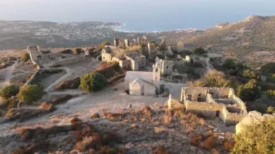
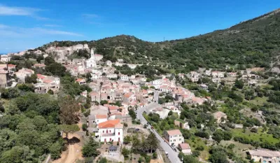
Occi, an abandoned village full of treasures Occi is one of those abandoned villages that fascinate. Its history reportedly goes back to the Middle Ages, when Saracen raids devastated Corsica, spreading terror and destruction. On the coast, the inhabitants of the place called Spano took refuge in the heights and gradually settled there. In 1589, 150 people lived in Occi, but 300 years later, in 1852, only about sixty remained. The hamlet was eventually abandoned in favor of Lumio, and its last inhabitant, Félix Giudicelli, died there in 1918.
Today, you can wander through the ruins of what was once a refuge for the islanders: granite houses weakened by time, and even a wheat threshing floor. Among them, the chapel of the Annunziata was renovated in 2002 thanks to private donations, and some masses are still celebrated there.
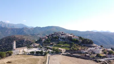
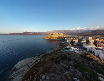
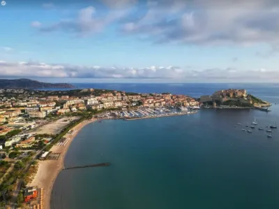
Although life has left the place, Occi remains a site protected by the Occi preservation association (Occi, paese rinascitu), supported by the very famous Laëtitia Casta, who comes from Lumio. As a result, the site can only be reached by hiking trails, to keep tourism from ravaging it. It has to be said that these remains invite quiet reflection, and Occi offers an impressive panorama over the marina of Sant Ambroggio and the sea as far as the eye can see.
How to get to Occi? To get to Occi, going on foot is the only option, but don't worry, the hike is relatively easy and will take you between 20 and 30 minutes. There are several trails to reach Occi. The best known starts from the "Hotel A Casa Di Mà", at the north entrance of Lumio, and is well maintained.
A wilder trail starts above the entrance of the "Panoramic" campsite, on departmental road 71. The climb is gentle, but wear comfortable clothes. Finally, for the bravest, take the path that starts at the chapel "Notre Dame de La Stella" between Capu d'Occi and Capu Braccaghju.
Map and restricted areas
Open in the main mapNearby aerodromes
Open aerodromes within 25 km of the spot, heliports included, with their distance and direction from the spot. Near an aerodrome, drone flying is prohibited or height-limited: check the UAS zones map.
| Aerodrome | Type | Distance | Elevation | Difference |
|---|---|---|---|---|
| Calvi-Sainte-Catherine Airport | Airport | 7.7 km SW | 64 m | spot 305 m higher |
Aviation weather (METAR and TAF)
LFKC – Calvi-Sainte-Catherine Airport VFR
METAR
METAR LFKC 210900Z AUTO 20022KT 9999 FEW043 18/09 Q1019 BECMG 21015G25KT
- Wind
- 200°, 41 km/h
- Visibility
- 10 km or more
- Clouds
- Few (1-2/8) at 4,300 ft (1310 m)
- Temperature
- 18 °C, dew point 9 °C
- QNH
- 1019 hPa
- Flight category
- VFR: ceiling > 3,000 ft and visibility > 5 mi
TAF
TAF LFKC 210800Z 2109/2209 21017G27KT 9999 FEW045 TX20/2112Z TN11/2205Z BECMG 2115/2117 22010KT BECMG 2120/2122 VRB03KT PROB30 TEMPO 2122/2203 SHRA SCT040TCU BECMG 2207/2209 21020G30KT
| Period (local time) | Change | Wind | Visibility | Weather | Clouds |
|---|---|---|---|---|---|
| 21/11 10:00 → 21/11 16:00 | Initial conditions | 210°, 31 km/h, gusts 50 km/h | 10 km or more | Few (1-2/8) at 4,500 ft (1370 m) | |
| 21/11 16:00 → 21/11 21:00 | Becoming | 220°, 19 km/h | 10 km or more | Few (1-2/8) at 4,500 ft (1370 m) | |
| 21/11 21:00 → 22/11 08:00 | Becoming | Variable, 6 km/h | 10 km or more | Few (1-2/8) at 4,500 ft (1370 m) | |
| 21/11 23:00 → 22/11 04:00 | Temporarily, probability 30% | Showers of rain | Scattered (3-4/8) at 4,000 ft (1220 m) (towering cumulus) | ||
| 22/11 08:00 → 22/11 10:00 | Becoming | 210°, 37 km/h, gusts 56 km/h | 10 km or more | Few (1-2/8) at 4,500 ft (1370 m) |
Weather and Kp index
Sunrise and sunset
| Day | Dawn | Sunrise | Golden hour | Sunset | Dusk | Day length |
|---|---|---|---|---|---|---|
| Sat 21 Nov | 06:53 | 07:23 | 07:23–08:07 · 16:14–16:58 | 16:58 | 17:28 | 9 h 34 |
| Sun 22 Nov | 06:54 | 07:25 | 07:25–08:08 · 16:14–16:57 | 16:57 | 17:28 | 9 h 32 |
| Mon 23 Nov | 06:55 | 07:26 | 07:26–08:09 · 16:13–16:56 | 16:56 | 17:27 | 9 h 30 |
| Tue 24 Nov | 06:56 | 07:27 | 07:27–08:11 · 16:12–16:56 | 16:56 | 17:27 | 9 h 28 |
| Wed 25 Nov | 06:57 | 07:28 | 07:28–08:12 · 16:11–16:55 | 16:55 | 17:26 | 9 h 27 |
| Thu 26 Nov | 06:58 | 07:29 | 07:29–08:13 · 16:11–16:55 | 16:55 | 17:26 | 9 h 25 |
| Fri 27 Nov | 06:59 | 07:30 | 07:30–08:14 · 16:10–16:54 | 16:54 | 17:25 | 9 h 23 |
Reviews
Log in to review this spot. Log in · Create a free account
No reviews yet. Share yours!