

Amay

No reviews yet
Have you flown here? Share your experience with other pilots.
+ Write the first reviewDescription
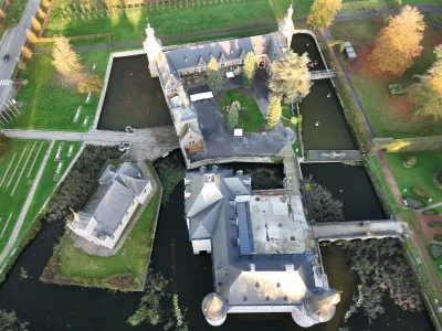
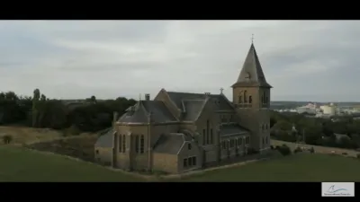
The former Paix-Dieu Abbey, whose founding was part of the mystical movement that marked the Diocese of Liège in the late 12th and early 13th centuries.
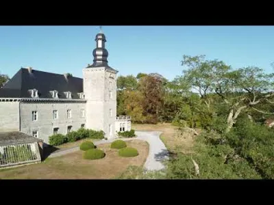
A remarkable group of 17th- and 18th-century buildings, built of red-washed brick and limestone in a green valley.
It now houses the Heritage Trades Training Centre, which ensures the preservation, transmission and improvement of skills in the heritage trades. Its aim is, on the one hand, to prevent valuable skills from becoming scarce and, on the other hand, to meet the needs of companies specializing in heritage restoration, which face a lack of interest in these specific trades as well as a shortage of qualified labor in this sector of the construction industry.
Map and restricted areas
Open in the main mapAviation weather (METAR and TAF)
EBLG – Liège Airport VFR
METAR
METAR EBLG 210720Z 16007KT 9999 FEW043 01/00 Q1019 NOSIG
- Wind
- 160°, 13 km/h
- Visibility
- 10 km or more
- Clouds
- Few (1-2/8) at 4,300 ft (1310 m)
- Temperature
- 1 °C, dew point 0 °C
- QNH
- 1019 hPa
- Flight category
- VFR: ceiling > 3,000 ft and visibility > 5 mi
TAF
TAF EBLG 210500Z 2106/2212 20005KT 9999 FEW040 PROB30 2106/2108 2000 BR BKN003 PROB30 2204/2207 4000 BR
| Period (local time) | Change | Wind | Visibility | Weather | Clouds |
|---|---|---|---|---|---|
| 21/11 07:00 → 22/11 13:00 | Initial conditions | 200°, 9 km/h | 10 km or more | Few (1-2/8) at 4,000 ft (1220 m) | |
| 21/11 07:00 → 21/11 09:00 | probability 30% | 2.0 km | Mist | Broken (5-7/8) at 300 ft (90 m) | |
| 22/11 05:00 → 22/11 08:00 | probability 30% | 4.0 km | Mist |
Weather and Kp index
Sunrise and sunset
| Day | Dawn | Sunrise | Golden hour | Sunset | Dusk | Day length |
|---|---|---|---|---|---|---|
| Sat 21 Nov | 07:27 | 08:03 | 08:03–08:57 · 15:52–16:46 | 16:46 | 17:23 | 8 h 42 |
| Sun 22 Nov | 07:28 | 08:05 | 08:05–08:59 · 15:51–16:45 | 16:45 | 17:22 | 8 h 40 |
| Mon 23 Nov | 07:29 | 08:06 | 08:06–09:01 · 15:50–16:44 | 16:44 | 17:21 | 8 h 37 |
| Tue 24 Nov | 07:31 | 08:08 | 08:08–09:03 · 15:48–16:43 | 16:43 | 17:20 | 8 h 35 |
| Wed 25 Nov | 07:32 | 08:09 | 08:09–09:04 · 15:47–16:42 | 16:42 | 17:19 | 8 h 32 |
| Thu 26 Nov | 07:34 | 08:11 | 08:11–09:06 · 15:46–16:41 | 16:41 | 17:19 | 8 h 30 |
| Fri 27 Nov | 07:35 | 08:12 | 08:12–09:08 · 15:45–16:41 | 16:41 | 17:18 | 8 h 28 |


Reviews
Log in to review this spot. Log in · Create a free account
No reviews yet. Share yours!