

Water
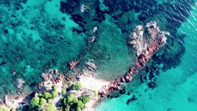
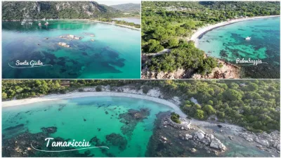
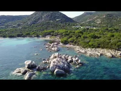
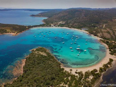
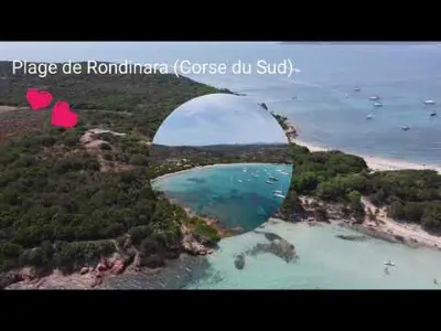
Golfe de Santa Giulia
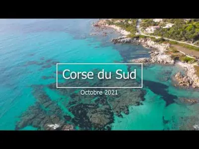



1 pilot review
“Belle vidéo. Des spots merveilleux cela ne manque pas sur l'île. J'y ai véccu 8 ans, mais…” — JEFF40, 7 months ago
Read the reviews + Write my reviewDescription
South of Porto-Vecchio 41° 31′ 35″ N, 9° 16′ 40″ E https://fr.wikipedia.org/wiki/Golfe_de_Santa_Giulia
Map and restricted areas
Open in the main mapNearby aerodromes
Open aerodromes within 25 km of the spot, heliports included, with their distance and direction from the spot. Near an aerodrome, drone flying is prohibited or height-limited: check the UAS zones map.
| Aerodrome | Type | Distance | Elevation | Difference |
|---|---|---|---|---|
| Helisudcorse | Heliport | 5.6 km N | 4 m | same altitude as the spot |
| Figari Sud-Corse Airport | Airport | 15 km W | 26 m | spot 26 m lower |
| Cavallo Helistrip | Heliport | 18 km S | 4 m | same altitude as the spot |
Aviation weather (METAR and TAF)
LFKF – Figari Sud-Corse Airport VFR
METAR
METAR LFKF 211000Z AUTO 27019KT 9999 FEW030 OVC180 17/11 Q1020 NOSIG
- Wind
- 270°, 35 km/h
- Visibility
- 10 km or more
- Clouds
- Few (1-2/8) at 3,000 ft (910 m) ; Overcast (8/8) at 18,000 ft (5490 m)
- Temperature
- 17 °C, dew point 11 °C
- QNH
- 1020 hPa
- Flight category
- VFR: ceiling > 3,000 ft and visibility > 5 mi
TAF
TAF LFKF 210800Z 2109/2209 26013KT 9999 FEW035 TEMPO 2110/2115 27015G25KT BECMG 2119/2121 VRB03KT
| Period (local time) | Change | Wind | Visibility | Weather | Clouds |
|---|---|---|---|---|---|
| 21/11 10:00 → 21/11 20:00 | Initial conditions | 260°, 24 km/h | 10 km or more | Few (1-2/8) at 3,500 ft (1070 m) | |
| 21/11 11:00 → 21/11 16:00 | Temporarily | 270°, 28 km/h, gusts 46 km/h | |||
| 21/11 20:00 → 22/11 10:00 | Becoming | Variable, 6 km/h | 10 km or more | Few (1-2/8) at 3,500 ft (1070 m) |
Weather and Kp index
Sunrise and sunset
| Day | Dawn | Sunrise | Golden hour | Sunset | Dusk | Day length |
|---|---|---|---|---|---|---|
| Sat 21 Nov | 06:49 | 07:19 | 07:19–08:01 · 16:17–16:59 | 16:59 | 17:29 | 9 h 40 |
| Sun 22 Nov | 06:50 | 07:20 | 07:20–08:02 · 16:16–16:58 | 16:58 | 17:28 | 9 h 38 |
| Mon 23 Nov | 06:51 | 07:21 | 07:21–08:04 · 16:15–16:58 | 16:58 | 17:28 | 9 h 36 |
| Tue 24 Nov | 06:52 | 07:22 | 07:22–08:05 · 16:14–16:57 | 16:57 | 17:27 | 9 h 34 |
| Wed 25 Nov | 06:53 | 07:23 | 07:23–08:06 · 16:14–16:56 | 16:56 | 17:27 | 9 h 33 |
| Thu 26 Nov | 06:54 | 07:24 | 07:24–08:07 · 16:13–16:56 | 16:56 | 17:26 | 9 h 31 |
| Fri 27 Nov | 06:55 | 07:26 | 07:26–08:09 · 16:12–16:55 | 16:55 | 17:26 | 9 h 29 |

Reviews
Log in to review this spot. Log in · Create a free account
JEFF40
Belle vidéo. Des spots merveilleux cela ne manque pas sur l'île. J'y ai véccu 8 ans, mais pas de drone à l'époque. Dommage qu'il ait beaucoup d'autres problèmes qui gâchent tout. C'était aussi mes endroits préférés sur l'Île.