

Brey-de-Vent, 01500 Ambérieu-en-Bugey
2 pilot reviews
“Bonjour, Désireux de respecter les lois et les règlements, j'avais bien regardé sur la car…” — Tellerom, 4 years ago
Read the reviews + Write my reviewDescription
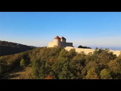
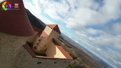
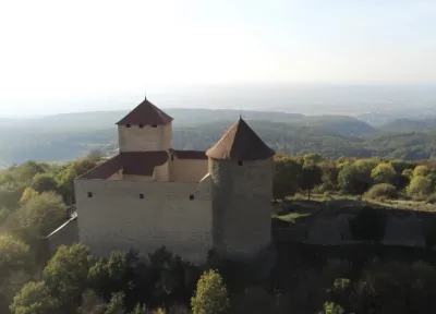
At an altitude of 650 meters, in the lower Bugey, stands the Château des Allymes, "castrum Alemorum", a former fortified house that became a medieval castle. It is listed as a historic monument and is the only example of a medieval fortress in the Bugey. As the Château des Allymes is a historic monument and municipal property open to the public (ERP), flying over and filming above the castle's inner courtyard is prohibited, unless a request has been made to the town hall, followed by a written reply from it, and presented at the castle's reception. Flying over the outside areas and the lower courtyard remains allowed, but it is advisable to make a request to the town hall and to introduce yourself at the reception.
Map and restricted areas
Open in the main mapNearby aerodromes
Open aerodromes within 25 km of the spot, heliports included, with their distance and direction from the spot. Near an aerodrome, drone flying is prohibited or height-limited: check the UAS zones map.
| Aerodrome | Type | Distance | Elevation | Difference |
|---|---|---|---|---|
| Ambérieu Air Base (BA 278) | Airport | 6.5 km W | 251 m | spot 403 m higher |
| Corlier Altiport | Aerodrome | 9.9 km NE | 842 m | spot 188 m lower |
| La Tranclière Private Airstrip | Aerodrome | 17 km NW | 250 m | spot 404 m higher |
| Aérodrome de Pérouges - Meximieux | Aerodrome | 21 km SW | 214 m | spot 440 m higher |
Aviation weather (METAR and TAF)
LFLL – Lyon Saint-Exupéry Airport VFR
METAR
METAR LFLL 211100Z 11005KT 080V140 9999 FEW014 12/09 Q1020 NOSIG
- Wind
- 110°, 9 km/h
- Visibility
- 10 km or more
- Clouds
- Few (1-2/8) at 1,400 ft (430 m)
- Temperature
- 12 °C, dew point 9 °C
- QNH
- 1020 hPa
- Flight category
- VFR: ceiling > 3,000 ft and visibility > 5 mi
TAF
TAF LFLL 210500Z 2106/2212 15006KT CAVOK PROB40 TEMPO 2106/2108 5000 -RA BKN040 TEMPO 2200/2205 4000 RA OVC035 PROB40 TEMPO 2203/2206 15015KT BKN012 BECMG 2206/2208 23010KT PROB40 TEMPO 2207/2212 24015G30KT SHRA SCT045TCU BKN050
| Period (local time) | Change | Wind | Visibility | Weather | Clouds |
|---|---|---|---|---|---|
| 21/11 07:00 → 22/11 07:00 | Initial conditions | 150°, 11 km/h | 10 km or more | No significant weather | No significant cloud |
| 21/11 07:00 → 21/11 09:00 | Temporarily, probability 40% | 5 km | Rain light | Broken (5-7/8) at 4,000 ft (1220 m) | |
| 22/11 01:00 → 22/11 06:00 | Temporarily | 4.0 km | Rain | Overcast (8/8) at 3,500 ft (1070 m) | |
| 22/11 04:00 → 22/11 07:00 | Temporarily, probability 40% | 150°, 28 km/h | Broken (5-7/8) at 1,200 ft (370 m) | ||
| 22/11 07:00 → 22/11 13:00 | Becoming | 230°, 19 km/h | 10 km or more | No significant weather | No significant cloud |
| 22/11 08:00 → 22/11 13:00 | Temporarily, probability 40% | 240°, 28 km/h, gusts 56 km/h | Showers of rain | Scattered (3-4/8) at 4,500 ft (1370 m) (towering cumulus) ; Broken (5-7/8) at 5,000 ft (1520 m) |
Weather and Kp index
| Day | Weather | Temp. min. / max. | Wind | Rain | Max Kp |
|---|---|---|---|---|---|
| Sat 21 Nov | Partly cloudy | 4° / 11° | 12 km/h SE | – | 2 |
| Sun 22 Nov | Heavy rain | 5° / 8° | 21 km/h SW | 34 mm | 2 |
| Mon 23 Nov | Light rain | 2° / 6° | 21 km/h W | 9.6 mm | 4 |
| Tue 24 Nov | Cloudy | -2° / 4° | 9 km/h N | – | 2 |
| Wed 25 Nov | Heavy rain | 1° / 3° | 8 km/h E | 14 mm | – |
| Thu 26 Nov | Cloudy | 2° / 6° | 10 km/h S | 3.5 mm | – |
| Fri 27 Nov | Fair | 0° / 6° | 3 km/h W | – | – |
Hour by hour: Saturday 21 November
| Time | Weather | Temp. | Wind | Rain | Clouds | Kp |
|---|---|---|---|---|---|---|
| 12:00 | Fair | 10° | 8 km/h S | – | 34 % | 2 |
| 13:00 | Partly cloudy | 11° | 5 km/h SW | – | 65 % | 1 |
| 14:00 | Partly cloudy | 11° | 4 km/h SW | – | 59 % | 1 |
| 15:00 | Partly cloudy | 11° | 3 km/h W | – | 70 % | 1 |
| 16:00 | Partly cloudy | 10° | 3 km/h W | – | 68 % | 2 |
| 17:00 | Partly cloudy | 7° | 3 km/h NE | – | 93 % | 2 |
| 18:00 | Partly cloudy | 6° | 5 km/h E | – | 99 % | 2 |
| 19:00 | Partly cloudy | 4° | 5 km/h E | – | 92 % | 2 |
| 20:00 | Partly cloudy | 4° | 5 km/h E | – | 97 % | 2 |
| 21:00 | Partly cloudy | 4° | 6 km/h E | – | 96 % | 2 |
| 22:00 | Cloudy | 5° | 8 km/h E | – | 98 % | 2 |
Hour by hour: Sunday 22 November
| Time | Weather | Temp. | Wind | Rain | Clouds | Kp |
|---|---|---|---|---|---|---|
| 06:00 | Heavy rain | 6° | 12 km/h E | 3.1 mm | 100 % | 2 |
| 07:00 | Heavy rain | 6° | 11 km/h SE | 2.9 mm | 100 % | 2 |
| 08:00 | Heavy rain | 6° | 14 km/h SE | 2.4 mm | 100 % | 2 |
| 09:00 | Heavy rain | 6° | 20 km/h SE | 2.0 mm | 100 % | 2 |
| 10:00 | Heavy rain | 7° | 19 km/h S | 2.3 mm | 100 % | 2 |
| 11:00 | Rain | 7° | 16 km/h S | 0.4 mm | 100 % | 2 |
| 12:00 | Light rain | 7° | 15 km/h S | 0.4 mm | 97 % | 2 |
| 13:00 | Heavy rain | 8° | 18 km/h S | 1.5 mm | 98 % | 2 |
| 14:00 | Heavy rain | 8° | 19 km/h S | 1.9 mm | 88 % | 2 |
| 15:00 | Rain | 7° | 21 km/h SW | 0.6 mm | 98 % | 2 |
| 16:00 | Heavy rain | 7° | 19 km/h SW | 1.5 mm | 95 % | 2 |
| 17:00 | Showers | 6° | 19 km/h SW | 1.2 mm | 71 % | 2 |
| 18:00 | Showers | 6° | 18 km/h SW | 3.5 mm | 72 % | 2 |
| 19:00 | Heavy rain | 5° | 16 km/h SW | 1.7 mm | 88 % | 2 |
| 20:00 | Rain | 5° | 18 km/h SW | 0.8 mm | 99 % | 2 |
| 21:00 | Heavy rain | 5° | 18 km/h SW | 1.1 mm | 100 % | 2 |
| 22:00 | Heavy rain | 5° | 18 km/h SW | 1.0 mm | 100 % | 2 |
Sunrise and sunset
| Day | Dawn | Sunrise | Golden hour | Sunset | Dusk | Day length |
|---|---|---|---|---|---|---|
| Sat 21 Nov | 07:14 | 07:47 | 07:47–08:34 · 16:15–17:01 | 17:01 | 17:34 | 9 h 14 |
| Sun 22 Nov | 07:15 | 07:48 | 07:48–08:35 · 16:14–17:01 | 17:01 | 17:34 | 9 h 12 |
| Mon 23 Nov | 07:17 | 07:50 | 07:50–08:37 · 16:13–17:00 | 17:00 | 17:33 | 9 h 10 |
| Tue 24 Nov | 07:18 | 07:51 | 07:51–08:38 · 16:12–16:59 | 16:59 | 17:32 | 9 h 08 |
| Wed 25 Nov | 07:19 | 07:52 | 07:52–08:40 · 16:11–16:58 | 16:58 | 17:32 | 9 h 06 |
| Thu 26 Nov | 07:20 | 07:53 | 07:53–08:41 · 16:10–16:58 | 16:58 | 17:31 | 9 h 04 |
| Fri 27 Nov | 07:21 | 07:55 | 07:55–08:43 · 16:09–16:57 | 16:57 | 17:31 | 9 h 02 |

Reviews
Log in to review this spot. Log in · Create a free account
Tellerom
Bonjour, Désireux de respecter les lois et les règlements, j'avais bien regardé sur la carte Drone-Spot avant d'effectuer un vol de drone. Je ne connaissais pas les contraintes liées aux monuments historiques. Je vais rajouter votre commentaire dans la fiche de vol.
ThoutmesIV
Le Château des Allymes étant Monument Historique et propriété communale accueillant du public (ERP), merci de préciser sur la fiche dédiée que le survol et la prise de vue au-dessus de la cour intérieure du château sont interdits, exceptés si une demande en mairie suivie d'une réponse écrite de celle-ci a été formulée et présentée à l'accueil du château. Le survol des extérieurs et de la basse cour reste autorisé mais il est conseillé de faire une demande en mairie et de venir se présenter à l'accueil.