

Water
Saint-Ay
2 pilot reviews
“Salut, Désolé je viens de voir seulement ton message, dommage qu'il n'y a pas eu de notifi…” — Maître bob, 4 years ago
Read the reviews + Write my reviewDescription
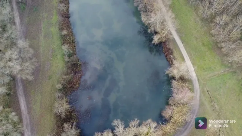
Étang de la Ballastière, where you can possibly fish, fishing permit required
Map and restricted areas
Open in the main mapNearby aerodromes
Open aerodromes within 25 km of the spot, heliports included, with their distance and direction from the spot. Near an aerodrome, drone flying is prohibited or height-limited: check the UAS zones map.
| Aerodrome | Type | Distance | Elevation | Difference |
|---|---|---|---|---|
| La Source Heliport | Heliport | 13 km E | 108 m | spot 20 m lower |
| Orléans-Bricy (BA 123) Air Base | Airport | 15 km N | 126 m | spot 38 m lower |
Aviation weather (METAR and TAF)
LFOJ – Orléans-Bricy (BA 123) Air Base MVFR
METAR
METAR LFOJ 211130Z AUTO 18001KT 9999 FEW012 OVC019 11/09 Q1018 NOSIG
- Wind
- 180°, 2 km/h
- Visibility
- 10 km or more
- Clouds
- Few (1-2/8) at 1,200 ft (370 m) ; Overcast (8/8) at 1,900 ft (580 m)
- Temperature
- 11 °C, dew point 9 °C
- QNH
- 1018 hPa
- Flight category
- MVFR: ceiling 1,000–3,000 ft or visibility 3–5 mi
TAF
TAF LFOJ 210800Z 2109/2209 23005KT 9999 OVC014 TX12/2113Z TN06/2205Z BECMG 2111/2113 BKN016 BECMG 2119/2121 10010KT TEMPO 2202/2209 4000 -RA PROB40 TEMPO 2204/2209 BKN003
| Period (local time) | Change | Wind | Visibility | Weather | Clouds |
|---|---|---|---|---|---|
| 21/11 10:00 → 21/11 12:00 | Initial conditions | 230°, 9 km/h | 10 km or more | Overcast (8/8) at 1,400 ft (430 m) | |
| 21/11 12:00 → 21/11 20:00 | Becoming | 230°, 9 km/h | 10 km or more | Broken (5-7/8) at 1,600 ft (490 m) | |
| 21/11 20:00 → 22/11 10:00 | Becoming | 100°, 19 km/h | 10 km or more | Broken (5-7/8) at 1,600 ft (490 m) | |
| 22/11 03:00 → 22/11 10:00 | Temporarily | 4.0 km | Rain light | ||
| 22/11 05:00 → 22/11 10:00 | Temporarily, probability 40% | Broken (5-7/8) at 300 ft (90 m) |
Weather and Kp index
Sunrise and sunset
| Day | Dawn | Sunrise | Golden hour | Sunset | Dusk | Day length |
|---|---|---|---|---|---|---|
| Sat 21 Nov | 07:33 | 08:08 | 08:08–08:57 · 16:21–17:10 | 17:10 | 17:44 | 9 h 02 |
| Sun 22 Nov | 07:35 | 08:09 | 08:09–08:59 · 16:20–17:09 | 17:09 | 17:44 | 9 h 00 |
| Mon 23 Nov | 07:36 | 08:11 | 08:11–09:00 · 16:18–17:08 | 17:08 | 17:43 | 8 h 57 |
| Tue 24 Nov | 07:37 | 08:12 | 08:12–09:02 · 16:17–17:08 | 17:08 | 17:42 | 8 h 55 |
| Wed 25 Nov | 07:39 | 08:13 | 08:13–09:04 · 16:16–17:07 | 17:07 | 17:41 | 8 h 53 |
| Thu 26 Nov | 07:40 | 08:15 | 08:15–09:05 · 16:16–17:06 | 17:06 | 17:41 | 8 h 51 |
| Fri 27 Nov | 07:41 | 08:16 | 08:16–09:07 · 16:15–17:05 | 17:05 | 17:40 | 8 h 49 |



Reviews
Log in to review this spot. Log in · Create a free account
Maître bob
Salut, Désolé je viens de voir seulement ton message, dommage qu'il n'y a pas eu de notification, Je ne sais pas si tu fais toujours du droner mais moi j'en fait quasiment tout les jours. Si tu lis ce message c'est quand tu veux pour un vol ensemble.je surveillerai plus régulièrement si tu réponds
Yageo
Salut maître, Sympa ce spot je ne le connaissais pas. Je serais demain matin sur le mail à 8h30 pour une prise du levé du soleil. Si tu es libre pour voler se sera avec plaisirs.