

Cap Taillat - Saint-Tropez Peninsula
No reviews yet
Have you flown here? Share your experience with other pilots.
+ Write the first reviewDescription
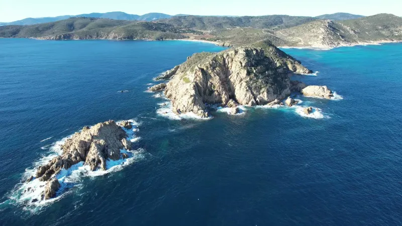
Cap Taillat - Saint-Tropez Peninsula - Côte d'Azur - Drone 4K/UHD - January 2022
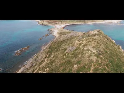
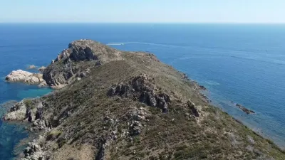
Cap Taillat is one of the natural gems of the Saint-Tropez peninsula. Nestled between Cap Lardier and Cap Camarat, it stands out in particular for its remarkable sandy isthmus.
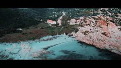
A true green lung, it offers visitors more than 2.5 km of maintained coastal path lined with magnificent, lush vegetation. Trails also lead into the interior of the massif, where you can discover a private vineyard and a megalithic burial site (Dolmen de Briande). On the coast, the Maison des Douanes shows off its 8 cells, fully restored in 2011 thanks in particular to the support of the PACA Region and the Fondation Banque Populaire. An information center for the public, it also hosts temporary exhibitions.
Protected under the 1930 Law on landscapes, Cap Taillat offers, from its summit, grand views of the two other capes, as well as of the Hyères islands.
Cap Camarat is the easternmost of the three capes of the Saint-Tropez peninsula, protected under the 1930 Law on landscapes since 1995.
The last "green lung" lying between the Escalet and Camarat housing developments to the west and the Bonnes Terrasses development to the east, it is the wildest of the 3 capes. Serving only one beach (Bonnes Terrasses), its coastal path is less traveled than those of the other two capes and its forest massif, mostly made up of cork oaks with an understory of shrub species, is denser.
It is also distinguished by the Camarat Lighthouse and its semaphore. The second highest lighthouse in France after the one in Vallauris, by the height of its light source (130 m above sea level), it offers a spectacular panoramic view over the whole Saint-Tropez peninsula as well as the vastness of the Mediterranean Sea.
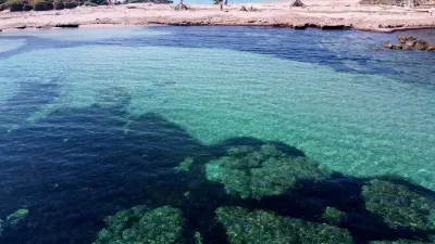
The Conservatoire du littoral has been granted 64 ha of maritime public domain off Cap Taillat in order to ensure consistent management between land and sea. Boat patrols are organized in summer in particular to raise awareness among boaters and other users of the need to protect the seagrass beds…
Map and restricted areas
Open in the main mapNearby aerodromes
Open aerodromes within 25 km of the spot, heliports included, with their distance and direction from the spot. Near an aerodrome, drone flying is prohibited or height-limited: check the UAS zones map.
| Aerodrome | Type | Distance | Elevation | Difference |
|---|---|---|---|---|
| Villa Salmanazar Helipad | Heliport | 3.7 km N | 101 m | spot 38 m lower |
| Base Hydro-ULM de St Tropez | Seaplane base | 12 km N | 0 m | spot 63 m higher |
| Sarl R.C.E Heliport | Heliport | 13 km NW | 6 m | spot 56 m higher |
| La Môle Airport | Aerodrome | 14 km W | 18 m | spot 45 m higher |
| Ile du Levant Helicopter Base | Heliport | 22 km SW | 65 m | same altitude as the spot |
Aviation weather (METAR and TAF)
LFMC – Le Luc-Le Cannet Airport VFR
METAR
METAR LFMC 210630Z AUTO 32012KT CAVOK 11/06 Q1018
- Wind
- 320°, 22 km/h
- Visibility
- 10 km or more
- Clouds
- –
- Temperature
- 11 °C, dew point 6 °C
- QNH
- 1018 hPa
- Flight category
- VFR: ceiling > 3,000 ft and visibility > 5 mi
TAF
Weather and Kp index
Sunrise and sunset
| Day | Dawn | Sunrise | Golden hour | Sunset | Dusk | Day length |
|---|---|---|---|---|---|---|
| Sat 21 Nov | 07:03 | 07:34 | 07:34–08:18 · 16:21–17:05 | 17:05 | 17:36 | 9 h 31 |
| Sun 22 Nov | 07:04 | 07:35 | 07:35–08:19 · 16:20–17:04 | 17:04 | 17:35 | 9 h 29 |
| Mon 23 Nov | 07:05 | 07:36 | 07:36–08:20 · 16:19–17:03 | 17:03 | 17:35 | 9 h 27 |
| Tue 24 Nov | 07:06 | 07:37 | 07:37–08:22 · 16:19–17:03 | 17:03 | 17:34 | 9 h 25 |
| Wed 25 Nov | 07:07 | 07:39 | 07:39–08:23 · 16:18–17:02 | 17:02 | 17:34 | 9 h 23 |
| Thu 26 Nov | 07:08 | 07:40 | 07:40–08:24 · 16:17–17:02 | 17:02 | 17:33 | 9 h 21 |
| Fri 27 Nov | 07:09 | 07:41 | 07:41–08:26 · 16:17–17:01 | 17:01 | 17:33 | 9 h 20 |
Reviews
Log in to review this spot. Log in · Create a free account
No reviews yet. Share yours!