

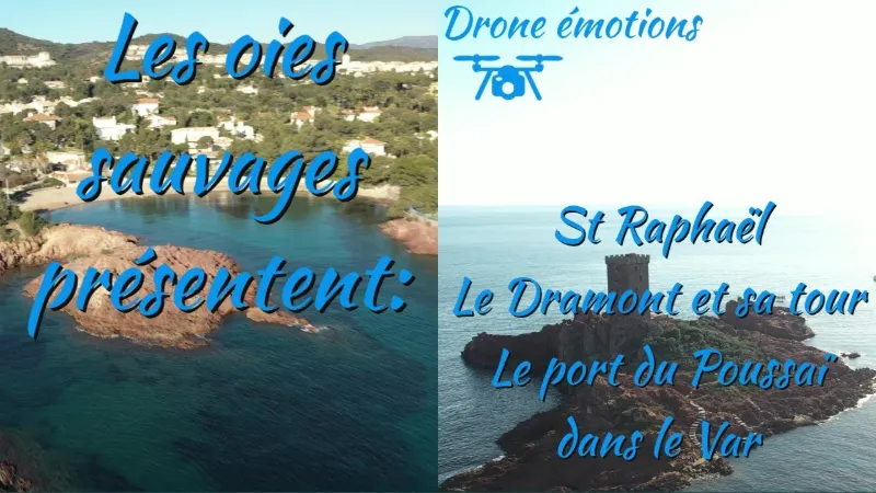
Saint Raphaël, the Dramont and the Poussaï port
2 pilot reviews
“Bonjour, merci pour ton commentaire, je t'invite à t'abonner à ma chaine you tube si tu ai…” — Lolo13, 4 years ago
Read the reviews + Write my reviewDescription
The Saint-Raphaël marina - Port du Dramont Poussaï is located in the Var. It can accommodate 90 boats on pontoons. The port is reserved for boats under 6 m.
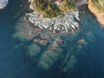
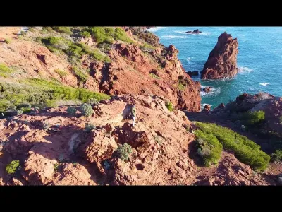
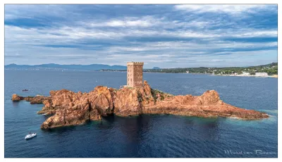
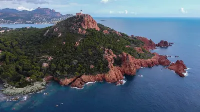
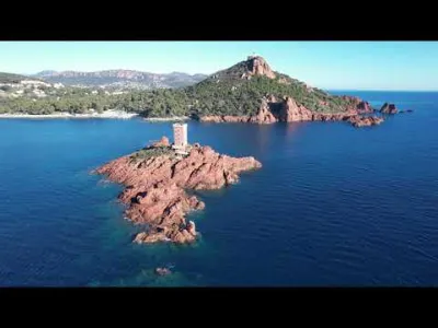
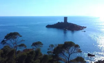
The port of Dramont, known as the Poussaï shelter port, is a small fishing and pleasure harbor that is very typical of the region. It is located to the east of the town of Saint-Raphaël, facing the Île d'Or, a rocky islet made of red porphyry and topped by an 18 m high Saracen tower. The port consists of a basin of about 3000 m² protected on the west by a rubble-mound breakwater about 80 m long, lined on its inner face with a concrete quay. It has three wooden landing stages about thirty meters long. LA PLAGE DU DRAMONT Nestled in 6 hectares of pine forest, between the red rocks of the Estérel and the blue of the Mediterranean, La Plage du Dramont is a paradise on earth for lovers of swimming, scuba diving and nature.
Located 1 hour from Nice Airport and the town of St-Tropez, La Plage du Dramont is the ideal place to take in the Île d'Or, the most beautiful sunsets and the stars, with your feet in the azure water of the Mediterranean Sea. View of the Île d'Or and direct access to the landing beach. Pitches and equipped mobile homes for rent. Swimming pool. Restaurant. Bar. Entertainment. Kids' club. Playground. Trampoline. Beauty area. International diving center. Football & basketball court. Table tennis. Pétanque court.
Map and restricted areas
Open in the main mapNearby aerodromes
Open aerodromes within 25 km of the spot, heliports included, with their distance and direction from the spot. Near an aerodrome, drone flying is prohibited or height-limited: check the UAS zones map.
| Aerodrome | Type | Distance | Elevation | Difference |
|---|---|---|---|---|
| Hôpital Bonnet Heliport | Heliport | 8.6 km W | 21 m | spot 11 m higher |
| Cannes-Mandelieu Airport | Airport | 17 km NE | 4 m | spot 28 m higher |
| Quai Du Large Heliport | Heliport | 20 km NE | 3 m | spot 29 m higher |
| Croisette Heliport | Heliport | 20 km NE | 0 m | spot 32 m higher |
| Hôpital Clavary Heliport | Heliport | 24 km N | 168 m | spot 136 m lower |
Aviation weather (METAR and TAF)
LFMD – Cannes-Mandelieu Airport VFR
METAR
METAR LFMD 210630Z AUTO VRB02KT CAVOK 09/05 Q1015 NOSIG
- Wind
- Variable, 4 km/h
- Visibility
- 10 km or more
- Clouds
- –
- Temperature
- 9 °C, dew point 5 °C
- QNH
- 1015 hPa
- Flight category
- VFR: ceiling > 3,000 ft and visibility > 5 mi
TAF
TAF AMD LFMD 210526Z 2105/2203 25010KT CAVOK TEMPO 2105/2109 VRB05KT TEMPO 2110/2116 26015G25KT BECMG 2117/2119 VRB04KT TEMPO 2200/2203 RA BKN020
| Period (local time) | Change | Wind | Visibility | Weather | Clouds |
|---|---|---|---|---|---|
| 21/11 06:00 → 21/11 18:00 | Initial conditions | 250°, 19 km/h | 10 km or more | No significant weather | No significant cloud |
| 21/11 06:00 → 21/11 10:00 | Temporarily | Variable, 9 km/h | |||
| 21/11 11:00 → 21/11 17:00 | Temporarily | 260°, 28 km/h, gusts 46 km/h | |||
| 21/11 18:00 → 22/11 04:00 | Becoming | Variable, 7 km/h | 10 km or more | No significant weather | No significant cloud |
| 22/11 01:00 → 22/11 04:00 | Temporarily | Rain | Broken (5-7/8) at 2,000 ft (610 m) |
Weather and Kp index
| Day | Weather | Temp. min. / max. | Wind | Rain | Max Kp |
|---|---|---|---|---|---|
| Sat 21 Nov | Partly cloudy | 8° / 17° | 33 km/h SW | – | 2 |
| Sun 22 Nov | Partly cloudy | 9° / 17° | 45 km/h W | 8.6 mm | 2 |
| Mon 23 Nov | Clear sky | 11° / 16° | 49 km/h W | – | 4 |
| Tue 24 Nov | Cloudy | 6° / 14° | 20 km/h E | 1.1 mm | 2 |
| Wed 25 Nov | Rain | 10° / 10° | 28 km/h E | 17 mm | – |
| Thu 26 Nov | Cloudy | 8° / 12° | 12 km/h NE | 12 mm | – |
| Fri 27 Nov | Clear sky | 2° / 12° | 6 km/h NW | – | – |
Hour by hour: Saturday 21 November
| Time | Weather | Temp. | Wind | Rain | Clouds | Kp |
|---|---|---|---|---|---|---|
| 08:00 | Partly cloudy | 10° | 28 km/h SW | – | 100 % | 2 |
| 09:00 | Partly cloudy | 11° | 26 km/h SW | – | 97 % | 2 |
| 10:00 | Partly cloudy | 13° | 27 km/h SW | – | 98 % | 2 |
| 11:00 | Cloudy | 15° | 28 km/h SW | – | 93 % | 2 |
| 12:00 | Cloudy | 16° | 29 km/h SW | – | 87 % | 2 |
| 13:00 | Partly cloudy | 17° | 33 km/h SW | – | 48 % | 1 |
| 14:00 | Partly cloudy | 17° | 33 km/h SW | – | 48 % | 1 |
| 15:00 | Partly cloudy | 17° | 31 km/h SW | – | 44 % | 1 |
| 16:00 | Partly cloudy | 16° | 31 km/h W | – | 56 % | 2 |
| 17:00 | Partly cloudy | 15° | 28 km/h W | – | 44 % | 2 |
| 18:00 | Fair | 13° | 24 km/h W | – | 38 % | 2 |
| 19:00 | Partly cloudy | 11° | 19 km/h W | – | 62 % | 2 |
| 20:00 | Partly cloudy | 10° | 16 km/h W | – | 77 % | 2 |
| 21:00 | Cloudy | 9° | 13 km/h W | – | 98 % | 2 |
| 22:00 | Cloudy | 8° | 11 km/h W | – | 100 % | 2 |
Hour by hour: Sunday 22 November
| Time | Weather | Temp. | Wind | Rain | Clouds | Kp |
|---|---|---|---|---|---|---|
| 06:00 | Rain | 11° | 19 km/h NE | 0.7 mm | 99 % | 2 |
| 07:00 | Heavy rain | 12° | 19 km/h NE | 1.3 mm | 99 % | 2 |
| 08:00 | Heavy rain | 12° | 19 km/h E | 1.2 mm | 100 % | 2 |
| 09:00 | Heavy rain | 12° | 8 km/h NE | 1.1 mm | 100 % | 2 |
| 10:00 | Rain | 12° | 8 km/h NE | 0.5 mm | 100 % | 2 |
| 11:00 | Showers | 13° | 17 km/h NW | 0.2 mm | 58 % | 2 |
| 12:00 | Partly cloudy | 16° | 38 km/h W | – | 63 % | 2 |
| 13:00 | Partly cloudy | 17° | 38 km/h W | – | 82 % | 2 |
| 14:00 | Fair | 16° | 45 km/h W | – | 17 % | 2 |
| 15:00 | Fair | 16° | 41 km/h W | – | 15 % | 2 |
| 16:00 | Fair | 16° | 40 km/h W | – | 16 % | 2 |
| 17:00 | Clear sky | 14° | 37 km/h W | – | 9 % | 2 |
| 18:00 | Fair | 13° | 36 km/h W | – | 18 % | 2 |
| 19:00 | Clear sky | 13° | 35 km/h W | – | 12 % | 2 |
| 20:00 | Clear sky | 13° | 40 km/h W | – | 10 % | 2 |
| 21:00 | Fair | 12° | 42 km/h W | – | 14 % | 2 |
| 22:00 | Fair | 11° | 44 km/h W | – | 19 % | 2 |
Sunrise and sunset
| Day | Dawn | Sunrise | Golden hour | Sunset | Dusk | Day length |
|---|---|---|---|---|---|---|
| Sat 21 Nov | 07:02 | 07:34 | 07:34–08:18 · 16:19–17:03 | 17:03 | 17:34 | 9 h 29 |
| Sun 22 Nov | 07:04 | 07:35 | 07:35–08:19 · 16:18–17:03 | 17:03 | 17:34 | 9 h 27 |
| Mon 23 Nov | 07:05 | 07:36 | 07:36–08:20 · 16:18–17:02 | 17:02 | 17:33 | 9 h 25 |
| Tue 24 Nov | 07:06 | 07:37 | 07:37–08:22 · 16:17–17:01 | 17:01 | 17:33 | 9 h 24 |
| Wed 25 Nov | 07:07 | 07:38 | 07:38–08:23 · 16:16–17:01 | 17:01 | 17:32 | 9 h 22 |
| Thu 26 Nov | 07:08 | 07:40 | 07:40–08:24 · 16:15–17:00 | 17:00 | 17:32 | 9 h 20 |
| Fri 27 Nov | 07:09 | 07:41 | 07:41–08:26 · 16:15–17:00 | 17:00 | 17:31 | 9 h 18 |
Reviews
Log in to review this spot. Log in · Create a free account
Lolo13
Bonjour, merci pour ton commentaire, je t'invite à t'abonner à ma chaine you tube si tu aimes mes vidéos. J' essaye de faire un vol par semaine, avec la vidéo du vol mise en ligne sur you tube.
jypai83
Bonjour, j'aime, tes prises de vues , le montage, la musique, et bien sûr le sud, moi je suis autodidacte pour le drone cele me plaît.