

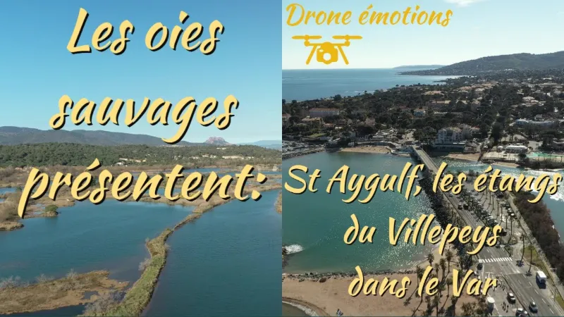
Saint Aygulf, the Villepeys ponds
No reviews yet
Have you flown here? Share your experience with other pilots.
+ Write the first reviewDescription
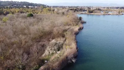
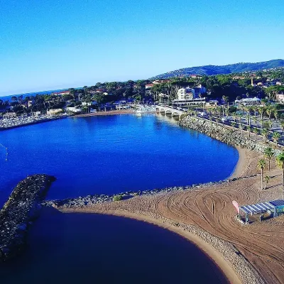
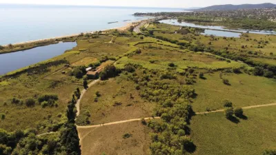
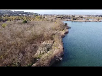
The Villepey ponds are a lake and lagoon area located in the commune of Fréjus, near the mouth of the Argens and the Saint-Aygulf district. This area of nearly 260 hectares is home to varied fauna and flora. Geography Located in the Argens floodplain between the Maures massif and the Esterel massif, the Villepey ponds lie entirely within the commune of Fréjus. They occupy an area between the Argens river and the foothills of the Maures, on the right bank of the river.
The ponds consist of three ecologically distinct zones:
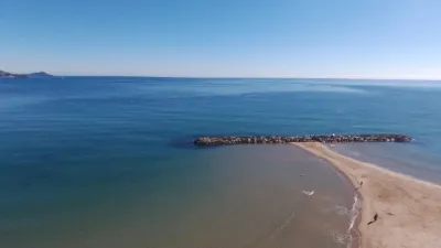
A dune zone: located to the south, between the ponds and the nearby Mediterranean Sea A marshy zone proper A mostly wooded transition zone between the ponds and the plain. The area and the ponds are crossed by the Bras de l'étang de Villepey, a 5 km watercourse that rises in the commune of Roquebrune-sur-Argens, north of the ponds1.
The ponds connect to the sea through the grau de la Galiote, a natural opening in the lido along the seafront, which tends to silt up. Access The site can be reached via departmental road 1098 (formerly RN98) to the south, along the seafront, as well as via departmental road 7 on the western edge. The ponds themselves are mainly accessible on foot or on horseback. Protection and activities Management of the site This 259-hectare area belongs to the Conservatoire du Littoral, which manages it under an agreement with the commune of Fréjus, whose services provide the guarding and development2. The land was acquired in two phases, in 1982 and then in 1997.
History Like the entire coastline of the commune of Fréjus, notably around Port Fréjus, the Villepey ponds area has evolved over time. In Roman times, the marshy zone did not exist, and the shoreline has moved by 1,200 m3. The remains of the Roman port of Fréjus are now located further inland. These changes are also linked to changes in the course of the nearby Argens.
Protection The Villepey ponds are listed as a Natural Area of Ecological, Faunal and Floral Interest (Z.N.I.E.F.F) and are part of the European Natura 2000 network. They have also been designated a Ramsar site since 15 September 20084.
Activities Human activities were long tied to agriculture, with market gardening, orchards and livestock farming. This is still the case today in the Argens plain, north of the ponds.
Activity is now geared toward tourism, with many large campsites right on the banks of some of the ponds. The Conservatoire du Littoral, together with the Fréjus town hall, has set up guided discovery outings.
Fauna An important wetland between the Camargue and the Italian border, the Villepey ponds are home to nearly 220 bird species, some of them migratory. Flamingos, birds of prey and passerines are all found here.
Land animals are also diverse, including European pond turtles, coypus, and many insects.
The geographical location of the ponds makes them an aquatic environment with variable salinity, depending on whether they are influenced by the Argens and other secondary watercourses, or by the Mediterranean. Fish populations vary accordingly, as do birds, some species being poorly adapted to relatively high salinity. Flora
Sea lily The flora is also diverse. The dune zone shelters plants such as prickly sea parsley, sea holly, and sea lily. In the wooded zone, there are certain species of orchids, such as serapias or cephalanthera. Between these two zones, plants such as glasswort, sea lavender, golden samphire, sea aster and sea purslane have been recorded.
Map and restricted areas
Open in the main mapNearby aerodromes
Open aerodromes within 25 km of the spot, heliports included, with their distance and direction from the spot. Near an aerodrome, drone flying is prohibited or height-limited: check the UAS zones map.
| Aerodrome | Type | Distance | Elevation | Difference |
|---|---|---|---|---|
| Hôpital Bonnet Heliport | Heliport | 4.6 km NE | 21 m | spot 19 m lower |
| Base Hydro-ULM de St Tropez | Seaplane base | 17 km SW | 0 m | same altitude as the spot |
| Sarl R.C.E Heliport | Heliport | 21 km SW | 6 m | spot 5 m lower |
| Villa Salmanazar Helipad | Heliport | 23 km S | 101 m | spot 99 m lower |
| Fayence Glider Field | Aerodrome | 23 km N | 226 m | spot 224 m lower |
Aviation weather (METAR and TAF)
LFMD – Cannes-Mandelieu Airport VFR
METAR
METAR LFMD 210630Z AUTO VRB02KT CAVOK 09/05 Q1015 NOSIG
- Wind
- Variable, 4 km/h
- Visibility
- 10 km or more
- Clouds
- –
- Temperature
- 9 °C, dew point 5 °C
- QNH
- 1015 hPa
- Flight category
- VFR: ceiling > 3,000 ft and visibility > 5 mi
TAF
TAF AMD LFMD 210526Z 2105/2203 25010KT CAVOK TEMPO 2105/2109 VRB05KT TEMPO 2110/2116 26015G25KT BECMG 2117/2119 VRB04KT TEMPO 2200/2203 RA BKN020
| Period (local time) | Change | Wind | Visibility | Weather | Clouds |
|---|---|---|---|---|---|
| 21/11 06:00 → 21/11 18:00 | Initial conditions | 250°, 19 km/h | 10 km or more | No significant weather | No significant cloud |
| 21/11 06:00 → 21/11 10:00 | Temporarily | Variable, 9 km/h | |||
| 21/11 11:00 → 21/11 17:00 | Temporarily | 260°, 28 km/h, gusts 46 km/h | |||
| 21/11 18:00 → 22/11 04:00 | Becoming | Variable, 7 km/h | 10 km or more | No significant weather | No significant cloud |
| 22/11 01:00 → 22/11 04:00 | Temporarily | Rain | Broken (5-7/8) at 2,000 ft (610 m) |
Weather and Kp index
Sunrise and sunset
| Day | Dawn | Sunrise | Golden hour | Sunset | Dusk | Day length |
|---|---|---|---|---|---|---|
| Sat 21 Nov | 07:03 | 07:34 | 07:34–08:18 · 16:20–17:04 | 17:04 | 17:35 | 9 h 29 |
| Sun 22 Nov | 07:04 | 07:35 | 07:35–08:19 · 16:19–17:03 | 17:03 | 17:34 | 9 h 27 |
| Mon 23 Nov | 07:05 | 07:36 | 07:36–08:21 · 16:18–17:02 | 17:02 | 17:34 | 9 h 25 |
| Tue 24 Nov | 07:06 | 07:38 | 07:38–08:22 · 16:17–17:02 | 17:02 | 17:33 | 9 h 24 |
| Wed 25 Nov | 07:07 | 07:39 | 07:39–08:24 · 16:17–17:01 | 17:01 | 17:33 | 9 h 22 |
| Thu 26 Nov | 07:09 | 07:40 | 07:40–08:25 · 16:16–17:01 | 17:01 | 17:32 | 9 h 20 |
| Fri 27 Nov | 07:10 | 07:41 | 07:41–08:26 · 16:15–17:00 | 17:00 | 17:32 | 9 h 18 |
Reviews
Log in to review this spot. Log in · Create a free account
No reviews yet. Share yours!