

Château de Bouligneux
No reviews yet
Have you flown here? Share your experience with other pilots.
+ Write the first reviewDescription
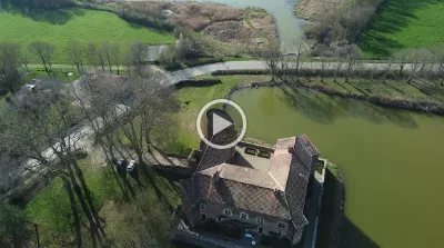
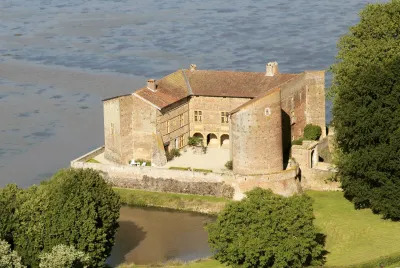
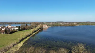
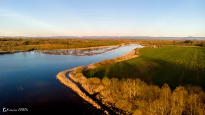
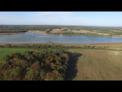
The Château de Bouligneux is a typical example of the 14th-century fortified houses built in the Dombes. The quadrangular brick enclosure, made up of right-angled residential buildings, is flanked by four round corner towers linked by curtain walls, one of which serves as the keep. The foot of this enclosure is surrounded by braies equipped for firearms. The moat-like pond surrounding the castle was crossed by a drawbridge. During later alterations, two wings were added against the curtain walls and a gallery with arcades was built
Video
Map and restricted areas
Open in the main mapNearby aerodromes
Open aerodromes within 25 km of the spot, heliports included, with their distance and direction from the spot. Near an aerodrome, drone flying is prohibited or height-limited: check the UAS zones map.
| Aerodrome | Type | Distance | Elevation | Difference |
|---|---|---|---|---|
| Hôtel Georges Blanc Heliport | Heliport | 22 km N | 199 m | spot 81 m higher |
| Aérodrome de Pérouges - Meximieux | Aerodrome | 23 km SE | 214 m | spot 66 m higher |
| Centre Hospitalier Heliport | Heliport | 23 km W | 233 m | spot 47 m higher |
| La Tranclière Private Airstrip | Aerodrome | 24 km E | 250 m | spot 30 m higher |
Aviation weather (METAR and TAF)
LFLY – Lyon-Bron Airport VFR
METAR
METAR LFLY 211130Z AUTO 07004KT 020V120 CAVOK 13/09 Q1020 NOSIG
- Wind
- 070°, 7 km/h
- Visibility
- 10 km or more
- Clouds
- –
- Temperature
- 13 °C, dew point 9 °C
- QNH
- 1020 hPa
- Flight category
- VFR: ceiling > 3,000 ft and visibility > 5 mi
TAF
TAF LFLY 210500Z 2106/2206 15006KT CAVOK PROB40 TEMPO 2106/2108 5000 -RA BKN040 TEMPO 2200/2205 4000 RA OVC035 PROB40 TEMPO 2203/2206 15015KT BKN014
| Period (local time) | Change | Wind | Visibility | Weather | Clouds |
|---|---|---|---|---|---|
| 21/11 07:00 → 22/11 07:00 | Initial conditions | 150°, 11 km/h | 10 km or more | No significant weather | No significant cloud |
| 21/11 07:00 → 21/11 09:00 | Temporarily, probability 40% | 5 km | Rain light | Broken (5-7/8) at 4,000 ft (1220 m) | |
| 22/11 01:00 → 22/11 06:00 | Temporarily | 4.0 km | Rain | Overcast (8/8) at 3,500 ft (1070 m) | |
| 22/11 04:00 → 22/11 07:00 | Temporarily, probability 40% | 150°, 28 km/h | Broken (5-7/8) at 1,400 ft (430 m) |
Weather and Kp index
| Day | Weather | Temp. min. / max. | Wind | Rain | Max Kp |
|---|---|---|---|---|---|
| Sat 21 Nov | Partly cloudy | 7° / 12° | 12 km/h SE | – | 2 |
| Sun 22 Nov | Heavy rain | 7° / 11° | 23 km/h SE | 20 mm | 2 |
| Mon 23 Nov | Light rain | 3° / 9° | 23 km/h W | 4.9 mm | 4 |
| Tue 24 Nov | Cloudy | -1° / 4° | 12 km/h N | 0.4 mm | 2 |
| Wed 25 Nov | Rain | 4° / 5° | 15 km/h S | 19 mm | – |
| Thu 26 Nov | Cloudy | 3° / 4° | 8 km/h N | 5.1 mm | – |
| Fri 27 Nov | Fair | 2° / 7° | 12 km/h SE | – | – |
Hour by hour: Saturday 21 November
| Time | Weather | Temp. | Wind | Rain | Clouds | Kp |
|---|---|---|---|---|---|---|
| 12:00 | Partly cloudy | 11° | 8 km/h SE | – | 48 % | 2 |
| 13:00 | Partly cloudy | 12° | 7 km/h SE | – | 72 % | 1 |
| 14:00 | Partly cloudy | 12° | 6 km/h SE | – | 82 % | 1 |
| 15:00 | Partly cloudy | 12° | 5 km/h S | – | 78 % | 1 |
| 16:00 | Partly cloudy | 12° | 3 km/h S | – | 81 % | 2 |
| 17:00 | Partly cloudy | 10° | 1 km/h SW | – | 98 % | 2 |
| 18:00 | Partly cloudy | 9° | 4 km/h NE | – | 97 % | 2 |
| 19:00 | Partly cloudy | 8° | 5 km/h E | – | 98 % | 2 |
| 20:00 | Partly cloudy | 7° | 3 km/h E | – | 98 % | 2 |
| 21:00 | Partly cloudy | 7° | 4 km/h SE | – | 96 % | 2 |
| 22:00 | Cloudy | 7° | 8 km/h SE | – | 99 % | 2 |
Hour by hour: Sunday 22 November
| Time | Weather | Temp. | Wind | Rain | Clouds | Kp |
|---|---|---|---|---|---|---|
| 06:00 | Heavy rain | 8° | 17 km/h SE | 2.5 mm | 100 % | 2 |
| 07:00 | Heavy rain | 7° | 23 km/h SE | 1.5 mm | 100 % | 2 |
| 08:00 | Heavy rain | 7° | 23 km/h SE | 1.4 mm | 100 % | 2 |
| 09:00 | Heavy rain | 8° | 22 km/h S | 1.5 mm | 100 % | 2 |
| 10:00 | Rain | 8° | 18 km/h S | 0.6 mm | 100 % | 2 |
| 11:00 | Cloudy | 10° | 14 km/h W | – | 100 % | 2 |
| 12:00 | Light rain | 11° | 13 km/h SW | 0.3 mm | 94 % | 2 |
| 13:00 | Heavy rain | 11° | 18 km/h SW | 2.6 mm | 97 % | 2 |
| 14:00 | Heavy rain | 10° | 18 km/h SW | 1.3 mm | 90 % | 2 |
| 15:00 | Cloudy | 11° | 21 km/h W | – | 94 % | 2 |
| 16:00 | Partly cloudy | 11° | 21 km/h W | – | 76 % | 2 |
| 17:00 | Partly cloudy | 10° | 21 km/h W | – | 63 % | 2 |
| 18:00 | Partly cloudy | 10° | 20 km/h W | – | 48 % | 2 |
| 19:00 | Showers | 10° | 19 km/h W | 1.0 mm | 72 % | 2 |
| 20:00 | Rain | 9° | 22 km/h W | 0.8 mm | 100 % | 2 |
| 21:00 | Light rain | 8° | 22 km/h W | 0.1 mm | 100 % | 2 |
| 22:00 | Cloudy | 9° | 22 km/h W | – | 100 % | 2 |
Sunrise and sunset
| Day | Dawn | Sunrise | Golden hour | Sunset | Dusk | Day length |
|---|---|---|---|---|---|---|
| Sat 21 Nov | 07:16 | 07:49 | 07:49–08:36 · 16:16–17:03 | 17:03 | 17:36 | 9 h 14 |
| Sun 22 Nov | 07:17 | 07:50 | 07:50–08:37 · 16:15–17:02 | 17:02 | 17:35 | 9 h 12 |
| Mon 23 Nov | 07:18 | 07:51 | 07:51–08:39 · 16:14–17:01 | 17:01 | 17:34 | 9 h 09 |
| Tue 24 Nov | 07:20 | 07:53 | 07:53–08:40 · 16:13–17:01 | 17:01 | 17:34 | 9 h 07 |
| Wed 25 Nov | 07:21 | 07:54 | 07:54–08:42 · 16:12–17:00 | 17:00 | 17:33 | 9 h 05 |
| Thu 26 Nov | 07:22 | 07:55 | 07:55–08:43 · 16:11–16:59 | 16:59 | 17:33 | 9 h 04 |
| Fri 27 Nov | 07:23 | 07:57 | 07:57–08:45 · 16:11–16:59 | 16:59 | 17:32 | 9 h 02 |

Reviews
Log in to review this spot. Log in · Create a free account
No reviews yet. Share yours!