

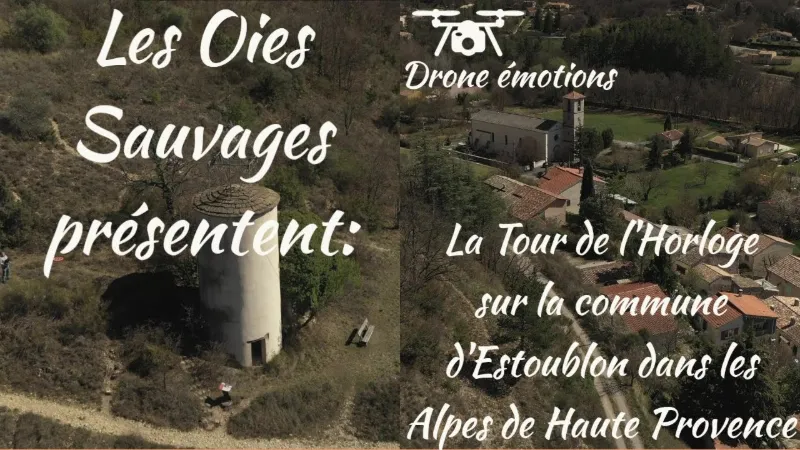
Estoublon, clock tower
No reviews yet
Have you flown here? Share your experience with other pilots.
+ Write the first reviewDescription
Probably a former stagecoach relay (its name is said to come from Establo, "small stable"), Estoublon has kept from its past a clock tower, listed as a historic monument, which overlooks the village with a pretty wrought-iron cage bell tower topped with an angel weathervane, and a 12th-century church whose apse is listed. Once parked in the lovely shaded car park, you may fall under the spell of this village nestled on a hillock, still rural and already adopted by city dwellers who have started renovating these magnificent old stones.
It's easy to understand, as Estoublon has incredible charm, with its superb "river pebble" stone houses, its two tile-roofed wash houses, and its clean, quiet little streets. As surprising as it is picturesque, and giving off a pleasant feeling of intimacy, Estoublon will surely win you over.
Don't leave without buying the AOC Haute-Provence olive oil from the Estoublon region, some dried flowers or lavender essence, local specialties! WORTH SEEING AND VISITING: Clock Tower (17th century, listed). Church (12th century). Trévans Gorges.
Map and restricted areas
Open in the main mapNearby aerodromes
Open aerodromes within 25 km of the spot, heliports included, with their distance and direction from the spot. Near an aerodrome, drone flying is prohibited or height-limited: check the UAS zones map.
| Aerodrome | Type | Distance | Elevation | Difference |
|---|---|---|---|---|
| Puimoisson Airfield | Aerodrome | 8.4 km S | 769 m | spot 204 m lower |
| Aérodrome de Château-Arnoux - Saint-Auban | Aerodrome | 20 km NW | 460 m | spot 105 m higher |
| Col de Lèques | Aerodrome | 25 km E | 1,126 m | spot 561 m lower |
Aviation weather (METAR and TAF)
No METAR station within 50 km.
Weather and Kp index
Sunrise and sunset
| Day | Dawn | Sunrise | Golden hour | Sunset | Dusk | Day length |
|---|---|---|---|---|---|---|
| Sat 21 Nov | 07:06 | 07:38 | 07:38–08:22 · 16:20–17:05 | 17:05 | 17:36 | 9 h 26 |
| Sun 22 Nov | 07:07 | 07:39 | 07:39–08:24 · 16:19–17:04 | 17:04 | 17:35 | 9 h 24 |
| Mon 23 Nov | 07:09 | 07:40 | 07:40–08:25 · 16:18–17:03 | 17:03 | 17:35 | 9 h 22 |
| Tue 24 Nov | 07:10 | 07:42 | 07:42–08:27 · 16:17–17:02 | 17:02 | 17:34 | 9 h 20 |
| Wed 25 Nov | 07:11 | 07:43 | 07:43–08:28 · 16:17–17:02 | 17:02 | 17:34 | 9 h 19 |
| Thu 26 Nov | 07:12 | 07:44 | 07:44–08:29 · 16:16–17:01 | 17:01 | 17:33 | 9 h 17 |
| Fri 27 Nov | 07:13 | 07:45 | 07:45–08:31 · 16:15–17:01 | 17:01 | 17:33 | 9 h 15 |




Reviews
Log in to review this spot. Log in · Create a free account
No reviews yet. Share yours!