Skip to content
Water

Jardin Volcanique
La Réunion

Jardin Volcanique – photo 1

No reviews yet

Have you flown here? Share your experience with other pilots.

+ Write the first review

Description

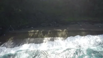
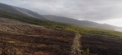
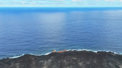
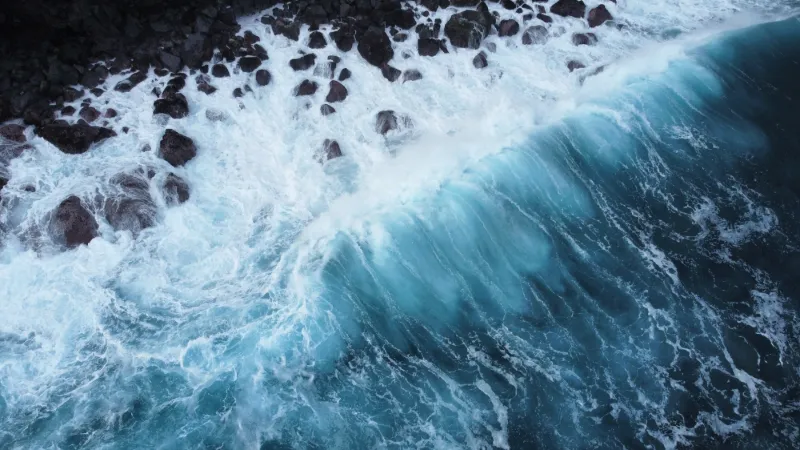
Lava trail. Huge waves crashing against a cliff of old lava flows.

Automatic translation.

Map and restricted areas

Open in the main map

Nearby aerodromes

Open aerodromes within 25 km of the spot, heliports included, with their distance and direction from the spot. Near an aerodrome, drone flying is prohibited or height-limited: check the UAS zones map.

No known open aerodrome within 25 km.

Indicative list: it does not replace official aeronautical information.

Aviation weather (METAR and TAF)

FMEP – Pierrefonds Airport · 39 km W VFR

METAR

Observed 21/11 14:30 · 18 min ago

METAR FMEP 211030Z AUTO 15015KT 9999 BKN049 30/22 Q1018 NOSIG

Wind
150°, 28 km/h
Visibility
10 km or more
Clouds
Broken (5-7/8) at 4,900 ft (1490 m)
Temperature
30 °C, dew point 22 °C
QNH
1018 hPa
Flight category
VFR: ceiling > 3,000 ft and visibility > 5 mi

TAF

Issued 21/11 12:00 · valid from 21/11 13:00 to 21/11 22:00

TAF FMEP 210800Z 2109/2118 27010KT 9999 FEW030 SCT070 BECMG 2111/2113 12017KT BECMG 2116/2118 03005KT

Period (local time) Change Wind Visibility Weather Clouds
21/11 13:00 → 21/11 15:00 Initial conditions 270°, 19 km/h 10 km or more Few (1-2/8) at 3,000 ft (910 m) ; Scattered (3-4/8) at 7,000 ft (2130 m)
21/11 15:00 → 21/11 20:00 Becoming 120°, 31 km/h 10 km or more Few (1-2/8) at 3,000 ft (910 m) ; Scattered (3-4/8) at 7,000 ft (2130 m)
21/11 20:00 → 21/11 22:00 Becoming 030°, 9 km/h 10 km or more Few (1-2/8) at 3,000 ft (910 m) ; Scattered (3-4/8) at 7,000 ft (2130 m)

Empty cell: no change forecast for that element.

METAR and TAF from NOAA (Aviation Weather Center), for guidance only: they do not replace flight planning with official sources (SIA, Météo-France). Nearest station that issues a METAR, not necessarily the nearest aerodrome.

Plan the light

Weather and Kp index

Loading forecast…

Sunrise and sunset

Local times at the spot (UTC+04:00). The golden hour, the warm, low light sought after for photos and videos, runs from sunrise until the sun reaches 6° above the horizon, and in the evening from 6° until sunset.

Day Dawn Sunrise Golden hour Sunset Dusk Day length
Sat 21 Nov05:02 05:26 05:26–05:57 · 18:08–18:39 18:39 19:0313 h 13
Sun 22 Nov05:02 05:26 05:26–05:57 · 18:08–18:40 18:40 19:0413 h 13
Mon 23 Nov05:02 05:26 05:26–05:57 · 18:09–18:40 18:40 19:0513 h 14
Tue 24 Nov05:02 05:26 05:26–05:57 · 18:10–18:41 18:41 19:0513 h 15
Wed 25 Nov05:01 05:26 05:26–05:57 · 18:10–18:42 18:42 19:0613 h 16
Thu 26 Nov05:01 05:26 05:26–05:57 · 18:11–18:42 18:42 19:0713 h 16
Fri 27 Nov05:01 05:26 05:26–05:57 · 18:11–18:43 18:43 19:0713 h 17

Nearby on Wikipedia

  • Puits Arabe · 0.3 km away

    Le Puits Arabe est manifestement un ancien puits de l'île de La Réunion, département d'outre-mer français dans le sud-ouest de l'océan Indien. Il est situé sur le littoral de la commune de Saint-Philippe à quelques centaines de mètres de la pointe de la Table, le principal cap au sud-est de l'île (...)

  • Pointe de la Table · 0.9 km away

    La pointe de la Table est le principal cap marquant le sud-est de l'île de La Réunion, département d'outre-mer français dans l'océan Indien. Situé sur le territoire communal de Saint-Philippe par 21°19'50" de latitude sud et 55°48'32" de longitude est, il a été formé par plusieurs éruptions du Piton (...)

  • Cheminée de La Trinité · 4.2 km away

    La cheminée de La Trinité est la cheminée d'une ancienne usine sucrière de l'île de La Réunion, département d'outre-mer français dans le sud-ouest de l'océan Indien. Située à La Trinité à Saint-Philippe, elle est inscrite en totalité à l'inventaire supplémentaire des Monuments historiques depuis le (...)

  • Saint-Philippe (La Réunion) · 4.5 km away

    Saint-Philippe est une commune française, située dans le sud-est du département et de la région de La Réunion. Ses habitants sont appelés les Saint-Philippois. Sa devise est : « Bien faire et laisser dire ». (...)

  • Écomusée Au bon roi Louis · 4.6 km away

    L'écomusée Au bon roi Louis est un musée d'histoire de l'île de La Réunion, département d'outre-mer français dans le sud-ouest de l'océan Indien. Situé sur le territoire communal de Saint-Philippe, dans le sud-est de l'île, cet écomusée privé présente des objets du quotidien significatifs de (...)

Articles found by GeoNames from the spot's position.

Nearby spots

Reviews

Log in to review this spot. Log in · Create a free account

No reviews yet. Share yours!

Connection to the site lost. Trying again…

The site is not responding. Trying again in seconds.

The site is no longer responding.

The site has been updated. Reloading the page…

This page has expired.

Resuming failed. Please reload the page.

The site is no longer responding.