

Pont Saint Pierre
No reviews yet
Have you flown here? Share your experience with other pilots.
+ Write the first reviewDescription
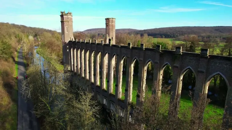
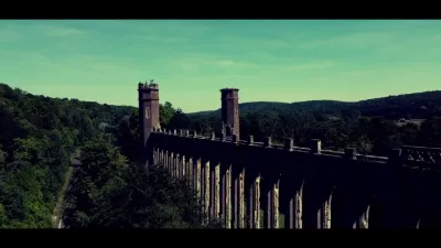
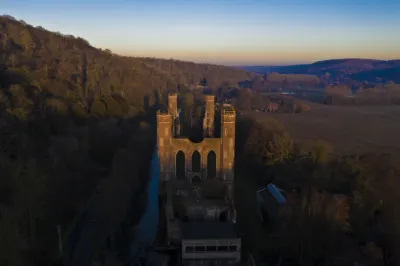
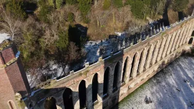
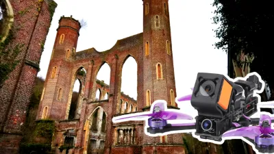
The spinning mill known as Levavasseur, at the place called Fontaine-Guérard in Pont-Saint-Pierre, is an industrial cathedral built in the mid-19th century. The mill was designed for 300 workers. It diverts the course of the Andelle and has a canal built that provides a 3.6 m waterfall. Work began in 1857. The factory, in English Gothic Revival style, is 114 m long and 26 m wide. The octagonal towers at the four corners rise to 38 m, with 5 floor levels served by staircases housed in three of them. The fourth tower is actually a chimney. A second mill, known as the "small mill" (96 m long and 20 m wide), was built nearby. In 1861, the factory began production.
On August 23, 1874, a fire ravaged the large mill. Charles Levavasseur then handed the business over to his son Arthur. As the insurance could not cover all the work, only the small mill was restored and put back into operation. In 1913, another fire broke out but did not stop operations from continuing.
Map and restricted areas
Open in the main mapNearby aerodromes
Open aerodromes within 25 km of the spot, heliports included, with their distance and direction from the spot. Near an aerodrome, drone flying is prohibited or height-limited: check the UAS zones map.
| Aerodrome | Type | Distance | Elevation | Difference |
|---|---|---|---|---|
| Base ULM de Val de Reuil | Aerodrome | 8.8 km SW | 10 m | spot 9 m higher |
| Rouen Airport | Airport | 10 km NW | 156 m | spot 137 m lower |
| Centre Hospitalier Heliport | Heliport | 17 km NW | 44 m | spot 25 m lower |
| Grand Couronne Heliport | Heliport | 23 km W | 5 m | spot 14 m higher |
| Étrépagny Airfield | Aerodrome | 25 km E | 94 m | spot 75 m lower |
Aviation weather (METAR and TAF)
LFOP – Rouen Airport MVFR
METAR
METAR LFOP 210700Z AUTO 13006KT 4900 BR SCT002 OVC060 06/06 Q1018 TEMPO 0900 FG VV///
- Wind
- 130°, 11 km/h
- Visibility
- 4.9 km
- Weather
- Mist
- Clouds
- Scattered (3-4/8) at 200 ft (60 m) ; Overcast (8/8) at 6,000 ft (1830 m)
- Temperature
- 6 °C, dew point 6 °C
- QNH
- 1018 hPa
- Flight category
- MVFR: ceiling 1,000–3,000 ft or visibility 3–5 mi
TAF
TAF LFOP 210500Z 2106/2115 12005KT 9999 BKN040 TEMPO 2106/2115 BKN009 PROB40 2106/2112 4000 BR OVC004 PROB30 2106/2109 0900 FG VV///
| Period (local time) | Change | Wind | Visibility | Weather | Clouds |
|---|---|---|---|---|---|
| 21/11 07:00 → 21/11 16:00 | Initial conditions | 120°, 9 km/h | 10 km or more | Broken (5-7/8) at 4,000 ft (1220 m) | |
| 21/11 07:00 → 21/11 16:00 | Temporarily | Broken (5-7/8) at 900 ft (270 m) | |||
| 21/11 07:00 → 21/11 13:00 | probability 40% | 4.0 km | Mist | Overcast (8/8) at 400 ft (120 m) | |
| 21/11 07:00 → 21/11 10:00 | probability 30% | 900 m | Fog |
Weather and Kp index
| Day | Weather | Temp. min. / max. | Wind | Rain | Max Kp |
|---|---|---|---|---|---|
| Sat 21 Nov | Cloudy | 5° / 10° | 14 km/h E | – | 2 |
| Sun 22 Nov | Light rain | 5° / 7° | 19 km/h E | 17 mm | 2 |
| Mon 23 Nov | Cloudy | 1° / 5° | 21 km/h NE | 2.5 mm | 4 |
| Tue 24 Nov | Clear sky | -3° / 3° | 18 km/h E | – | 2 |
| Wed 25 Nov | Cloudy | -1° / 3° | 17 km/h E | – | – |
| Thu 26 Nov | Clear sky | -3° / 1° | 13 km/h NE | – | – |
| Fri 27 Nov | Sleet | -4° / 3° | 17 km/h SE | 6.4 mm | – |
Hour by hour: Saturday 21 November
| Time | Weather | Temp. | Wind | Rain | Clouds | Kp |
|---|---|---|---|---|---|---|
| 08:00 | Fog | 5° | 9 km/h SE | – | 100 % | 2 |
| 09:00 | Fog | 6° | 9 km/h SE | – | 100 % | 2 |
| 10:00 | Fog | 6° | 9 km/h SE | – | 100 % | 2 |
| 11:00 | Fog | 8° | 8 km/h SE | – | 100 % | 2 |
| 12:00 | Cloudy | 9° | 8 km/h SE | – | 100 % | 2 |
| 13:00 | Cloudy | 9° | 10 km/h SE | – | 100 % | 1 |
| 14:00 | Cloudy | 10° | 11 km/h SE | – | 100 % | 1 |
| 15:00 | Cloudy | 10° | 10 km/h SE | – | 100 % | 1 |
| 16:00 | Cloudy | 10° | 11 km/h SE | – | 93 % | 2 |
| 17:00 | Partly cloudy | 9° | 10 km/h SE | – | 72 % | 2 |
| 18:00 | Cloudy | 8° | 11 km/h SE | – | 100 % | 2 |
| 19:00 | Cloudy | 8° | 12 km/h SE | – | 100 % | 2 |
| 20:00 | Cloudy | 8° | 12 km/h SE | – | 100 % | 2 |
| 21:00 | Cloudy | 8° | 11 km/h E | – | 100 % | 2 |
| 22:00 | Cloudy | 8° | 13 km/h E | – | 100 % | 2 |
Hour by hour: Sunday 22 November
| Time | Weather | Temp. | Wind | Rain | Clouds | Kp |
|---|---|---|---|---|---|---|
| 06:00 | Rain | 7° | 18 km/h E | 0.7 mm | 100 % | 2 |
| 07:00 | Rain | 7° | 19 km/h E | 0.5 mm | 100 % | 2 |
| 08:00 | Rain | 7° | 18 km/h E | 0.5 mm | 100 % | 2 |
| 09:00 | Rain | 7° | 18 km/h E | 0.7 mm | 100 % | 2 |
| 10:00 | Rain | 7° | 18 km/h E | 0.8 mm | 100 % | 2 |
| 11:00 | Rain | 7° | 16 km/h E | 0.6 mm | 100 % | 2 |
| 12:00 | Rain | 7° | 16 km/h E | 0.5 mm | 100 % | 2 |
| 13:00 | Light rain | 7° | 15 km/h E | 0.3 mm | 100 % | 2 |
| 14:00 | Light rain | 7° | 15 km/h E | 0.3 mm | 100 % | 2 |
| 15:00 | Rain | 7° | 13 km/h E | 0.6 mm | 100 % | 2 |
| 16:00 | Rain | 7° | 11 km/h E | 0.8 mm | 100 % | 2 |
| 17:00 | Rain | 6° | 12 km/h E | 0.7 mm | 100 % | 2 |
| 18:00 | Rain | 6° | 14 km/h E | 0.8 mm | 100 % | 2 |
| 19:00 | Heavy rain | 6° | 14 km/h E | 1.2 mm | 100 % | 2 |
| 20:00 | Heavy rain | 6° | 13 km/h E | 1.2 mm | 100 % | 2 |
| 21:00 | Heavy rain | 6° | 15 km/h E | 1.7 mm | 100 % | 2 |
| 22:00 | Heavy rain | 5° | 15 km/h E | 1.7 mm | 100 % | 2 |
Sunrise and sunset
| Day | Dawn | Sunrise | Golden hour | Sunset | Dusk | Day length |
|---|---|---|---|---|---|---|
| Sat 21 Nov | 07:39 | 08:15 | 08:15–09:06 · 16:15–17:07 | 17:07 | 17:42 | 8 h 51 |
| Sun 22 Nov | 07:41 | 08:16 | 08:16–09:08 · 16:14–17:06 | 17:06 | 17:41 | 8 h 49 |
| Mon 23 Nov | 07:42 | 08:18 | 08:18–09:10 · 16:12–17:05 | 17:05 | 17:40 | 8 h 47 |
| Tue 24 Nov | 07:43 | 08:19 | 08:19–09:12 · 16:11–17:04 | 17:04 | 17:40 | 8 h 44 |
| Wed 25 Nov | 07:45 | 08:21 | 08:21–09:13 · 16:10–17:03 | 17:03 | 17:39 | 8 h 42 |
| Thu 26 Nov | 07:46 | 08:22 | 08:22–09:15 · 16:09–17:02 | 17:02 | 17:38 | 8 h 40 |
| Fri 27 Nov | 07:47 | 08:23 | 08:23–09:17 · 16:08–17:01 | 17:01 | 17:38 | 8 h 38 |


Reviews
Log in to review this spot. Log in · Create a free account
No reviews yet. Share yours!