

Vic la Gardiole, the Étang d'Ingril
No reviews yet
Have you flown here? Share your experience with other pilots.
+ Write the first reviewDescription
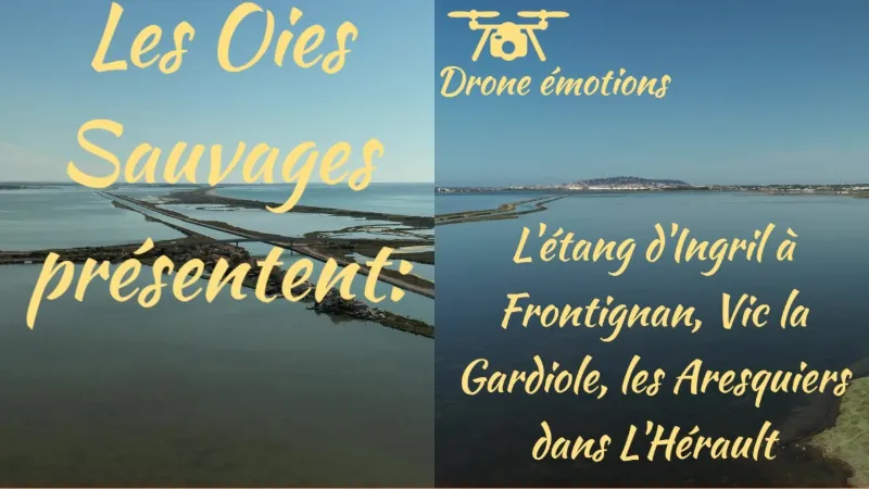
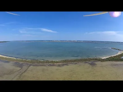
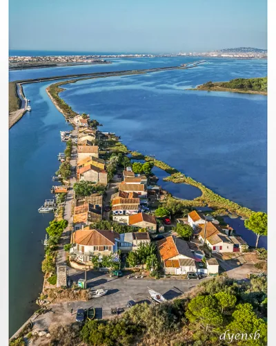
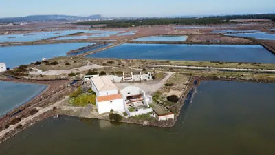
The Étang d'Ingril is a lagoon belonging to the lagoon complex of the Palavas ponds (étangs palavasiens). It lies on the Languedoc coast between the communes of Vic-la-Gardiole and Frontignan. About 7 km long, it is separated from the Mediterranean Sea by a strip of dunes on which the seaside resort of Frontignan-plage is located. It sits roughly halfway between Montpellier and Sète.
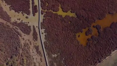
The Étang d'Ingril is split into two parts (north basin and south basin) by the Canal du Rhône à Sète. Wildlife and plants The former salt marshes have become a nature reserve for wetland fauna and flora. You can find pink flamingos (Phoenicopterus ruber), herons, cranes, glasswort and sansouire (salt-marsh steppe). It is a protected site (along with the bois des Aresquiers, the étang de Vic and the étang de la Pierre Blanche), listed in 1978 for its picturesque character.
Map and restricted areas
Open in the main mapNearby aerodromes
Open aerodromes within 25 km of the spot, heliports included, with their distance and direction from the spot. Near an aerodrome, drone flying is prohibited or height-limited: check the UAS zones map.
| Aerodrome | Type | Distance | Elevation | Difference |
|---|---|---|---|---|
| Le Corum Heliport | Heliport | 18 km NE | 54 m | spot 50 m lower |
| Montpellier-Méditerranée Airport | Airport | 19 km NE | 5 m | same altitude as the spot |
| Montpellier Chr Heliport | Heliport | 19 km N | 46 m | spot 42 m lower |
Aviation weather (METAR and TAF)
LFMT – Montpellier-Méditerranée Airport VFR
METAR
METAR LFMT 211100Z AUTO 08007KT CAVOK 15/11 Q1019 NOSIG
- Wind
- 080°, 13 km/h
- Visibility
- 10 km or more
- Clouds
- –
- Temperature
- 15 °C, dew point 11 °C
- QNH
- 1019 hPa
- Flight category
- VFR: ceiling > 3,000 ft and visibility > 5 mi
TAF
TAF LFMT 210800Z 2109/2209 07003KT CAVOK BECMG 2118/2120 01010KT TEMPO 2118/2203 BKN010 BECMG 2206/2208 28020G30KT
| Period (local time) | Change | Wind | Visibility | Weather | Clouds |
|---|---|---|---|---|---|
| 21/11 10:00 → 21/11 19:00 | Initial conditions | 070°, 6 km/h | 10 km or more | No significant weather | No significant cloud |
| 21/11 19:00 → 22/11 07:00 | Becoming | 010°, 19 km/h | 10 km or more | No significant weather | No significant cloud |
| 21/11 19:00 → 22/11 04:00 | Temporarily | Broken (5-7/8) at 1,000 ft (300 m) | |||
| 22/11 07:00 → 22/11 10:00 | Becoming | 280°, 37 km/h, gusts 56 km/h | 10 km or more | No significant weather | No significant cloud |
Weather and Kp index
Sunrise and sunset
| Day | Dawn | Sunrise | Golden hour | Sunset | Dusk | Day length |
|---|---|---|---|---|---|---|
| Sat 21 Nov | 07:15 | 07:46 | 07:46–08:30 · 16:31–17:15 | 17:15 | 17:47 | 9 h 29 |
| Sun 22 Nov | 07:16 | 07:47 | 07:47–08:31 · 16:30–17:15 | 17:15 | 17:46 | 9 h 27 |
| Mon 23 Nov | 07:17 | 07:48 | 07:48–08:33 · 16:30–17:14 | 17:14 | 17:45 | 9 h 25 |
| Tue 24 Nov | 07:18 | 07:50 | 07:50–08:34 · 16:29–17:13 | 17:13 | 17:45 | 9 h 23 |
| Wed 25 Nov | 07:19 | 07:51 | 07:51–08:36 · 16:28–17:13 | 17:13 | 17:44 | 9 h 21 |
| Thu 26 Nov | 07:20 | 07:52 | 07:52–08:37 · 16:27–17:12 | 17:12 | 17:44 | 9 h 20 |
| Fri 27 Nov | 07:22 | 07:53 | 07:53–08:38 · 16:27–17:12 | 17:12 | 17:43 | 9 h 18 |

Reviews
Log in to review this spot. Log in · Create a free account
No reviews yet. Share yours!