

Pincourt Quarry and Lime Kiln - Mauge-sur-Loire
No reviews yet
Have you flown here? Share your experience with other pilots.
+ Write the first reviewDescription
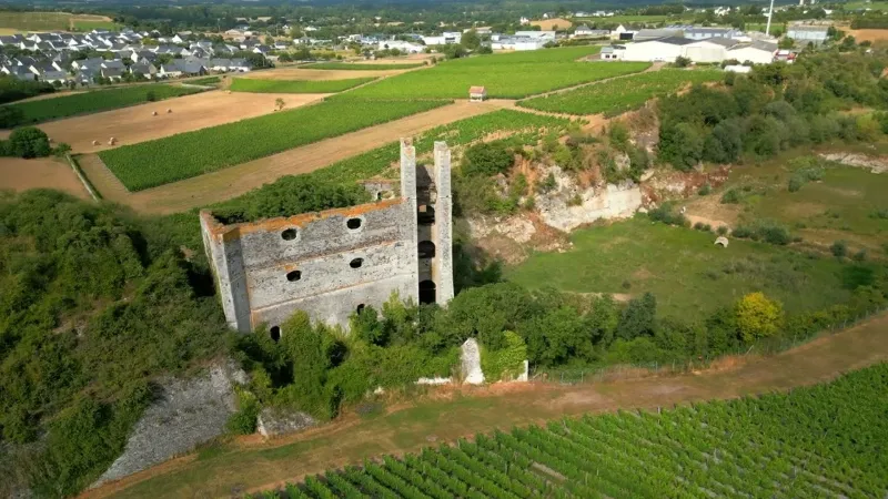
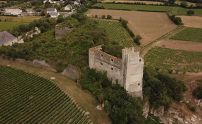
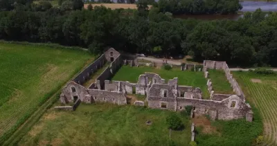
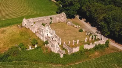
This strong and original architectural complex, created by Edmond Heusschen in 1863, includes:
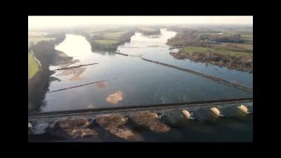
- the director's house with offices and a tool forge, the stables and the walls of the lime sheds, - the Sainte Barbe kiln, square in section, built against the mound of quarry spoil and lime-burning waste, - the lime and coal elevator, - the limestone quarry (primary Devonian limestone), whose lake covers the working benches to a greater or lesser extent depending on the season.
Operations stopped in 1892 but its shape has remained intact, with two working benches still showing blast holes, and two quarrymen's shelters emerging from a very muddy quarry floor. This is visible during dry periods, when the quarry's water level drops. Its backfilling, which began in the east, stopped because of its recognized role as a water retention basin.
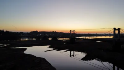
In the 19th century, Montjean sur Loire was the largest port on the Loire in terms of tonnage of goods transported.
- - - - - - - - - - - - - - - - - - - - - - - - - - - - - - - - - - - - - - - - - - - - - - - - - - - - - - - - - - - - - - - Spot: 47°22'38.5"N 0°51'21.1"W Equipment: Dji Mini 3 Pro Music: Time to go by Roman P. (https://artlist.io/song/32637/time-to-go)
Map and restricted areas
Open in the main mapNearby aerodromes
Open aerodromes within 25 km of the spot, heliports included, with their distance and direction from the spot. Near an aerodrome, drone flying is prohibited or height-limited: check the UAS zones map.
| Aerodrome | Type | Distance | Elevation | Difference |
|---|---|---|---|---|
| Saint Sigismond ULM | Aerodrome | 9.2 km NW | 76 m | spot 46 m lower |
| Ancenis Airfield | Aerodrome | 24 km W | 34 m | same altitude as the spot |
Aviation weather (METAR and TAF)
LFJR – Angers-Loire Airport LIFR
METAR
METAR LFJR 210630Z AUTO 11003KT 0450 0350 R26/0650N FG VV/// 08/08 Q1018
- Wind
- 110°, 6 km/h
- Visibility
- 450 m
- Weather
- Fog
- Clouds
- –
- Temperature
- 8 °C, dew point 8 °C
- QNH
- 1018 hPa
- Flight category
- LIFR: ceiling < 500 ft or visibility < 1 mi
TAF
Weather and Kp index
Sunrise and sunset
| Day | Dawn | Sunrise | Golden hour | Sunset | Dusk | Day length |
|---|---|---|---|---|---|---|
| Sat 21 Nov | 07:43 | 08:17 | 08:17–09:05 · 16:33–17:22 | 17:22 | 17:56 | 9 h 05 |
| Sun 22 Nov | 07:44 | 08:18 | 08:18–09:07 · 16:32–17:21 | 17:21 | 17:55 | 9 h 03 |
| Mon 23 Nov | 07:45 | 08:19 | 08:19–09:08 · 16:31–17:20 | 17:20 | 17:54 | 9 h 01 |
| Tue 24 Nov | 07:46 | 08:21 | 08:21–09:10 · 16:30–17:20 | 17:20 | 17:54 | 8 h 58 |
| Wed 25 Nov | 07:48 | 08:22 | 08:22–09:12 · 16:29–17:19 | 17:19 | 17:53 | 8 h 56 |
| Thu 26 Nov | 07:49 | 08:23 | 08:23–09:13 · 16:28–17:18 | 17:18 | 17:52 | 8 h 54 |
| Fri 27 Nov | 07:50 | 08:25 | 08:25–09:15 · 16:27–17:17 | 17:17 | 17:52 | 8 h 52 |
Reviews
Log in to review this spot. Log in · Create a free account
No reviews yet. Share yours!