

Cassis, the Port Miou calanque
No reviews yet
Have you flown here? Share your experience with other pilots.
+ Write the first reviewDescription
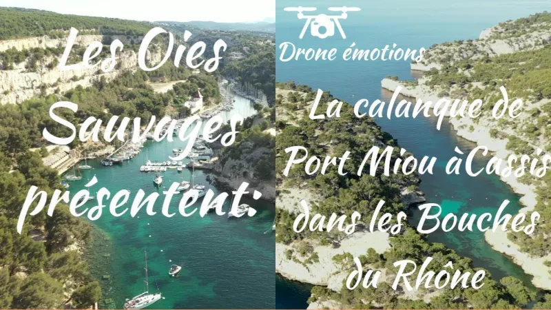
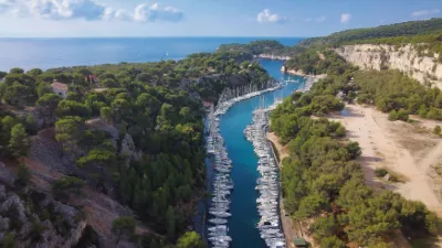
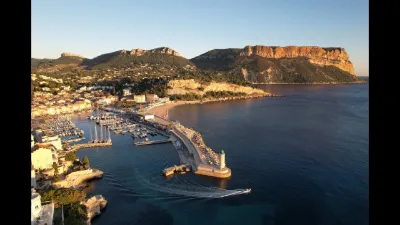
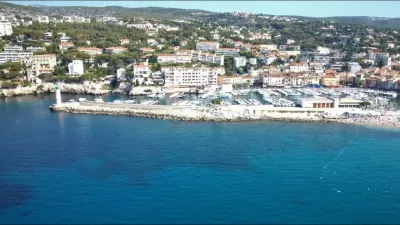
A pretty harbor in the middle of nature The Port-Miou calanque is the closest to Cassis. It is reachable on foot from the town center in 30 minutes along the GR58-51, and you can also come by car and park in the Presqu'île parking lot (paid in summer, 8 euros per day). The Port-Miou calanque is ideal for a family hike because it is easy to reach.
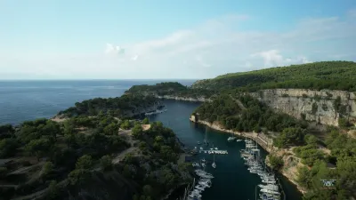
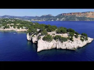
At the end of the peninsula you will have a magnificent view of Cap Canaille and its ocher cliffs, and on the right the wild mouth of the calanque. A palette of blue, white and green dominates: the sea, the limestone and the pine grove.
Port Pin, its neighbor, is only 2 km away, a 25-minute walk along the coast: it is easy to go from one calanque to the other. With a bit more effort, you can then reach the spectacular En Vau calanque in about 1 hour of walking, for 3.6 km.
Its particular geology Port-Miou winds its way inland for nearly a kilometer, hemmed in between cliffs. It has the strange feature of a small underwater spring, a resurgence whose origin is still not well understood. A little foam and a light surface current mark the phenomenon, which also brings a very cold freshwater current, mixed with the generally warmer seawater. A well-sheltered harbor The Port-Miou calanque served as a natural shelter for boats from antiquity on and, over the centuries, became a cargo port supplementing the one at Cassis. At the end of the 19th century, a quarry was worked there: unlike the noble stone of Cassis, the stone from Port-Miou was used only to make caustic soda, an ingredient of Marseille soap. The quarry closed in the early 1980s, and the calanque was turned into a small-craft nautical base. It now shelters some 550 boats under 20 meters, and has its own sailing club and harbor master's office. The main building of the calanque, pompously called "the castle", was occupied by the employees of the quarry's last operator, then renovated at the initiative of the Cassis municipality. Besides the harbor master's office, it now houses the Maison du Parc National des Calanques and environmental associations.
Map and restricted areas
Open in the main mapNearby aerodromes
Open aerodromes within 25 km of the spot, heliports included, with their distance and direction from the spot. Near an aerodrome, drone flying is prohibited or height-limited: check the UAS zones map.
| Aerodrome | Type | Distance | Elevation | Difference |
|---|---|---|---|---|
| Base Hydro-ULM de La Ciotat | Seaplane base | 11 km E | 0 m | spot 12 m higher |
| Zi Les Paluds Heliport | Heliport | 11 km NE | 116 m | spot 104 m lower |
| Hôpital La Timone Heliport | Heliport | 13 km NW | 42 m | spot 30 m lower |
| Marseille Hydro | Seaplane base | 17 km NW | 0 m | spot 12 m higher |
| Le Castellet Airport | Airport | 22 km E | 424 m | spot 412 m lower |
Aviation weather (METAR and TAF)
LFML – Marseille Provence Airport VFR
METAR
METAR LFML 211100Z AUTO VRB02KT CAVOK 14/07 Q1020 NOSIG
- Wind
- Variable, 4 km/h
- Visibility
- 10 km or more
- Clouds
- –
- Temperature
- 14 °C, dew point 7 °C
- QNH
- 1020 hPa
- Flight category
- VFR: ceiling > 3,000 ft and visibility > 5 mi
TAF
TAF LFML 210800Z 2109/2215 VRB03KT CAVOK TX17/2117Z TN13/2205Z BECMG 2116/2118 12010KT BECMG 2119/2121 -SHRA TEMPO 2120/2209 4000 SHRA BKN012 BKN025TCU BECMG 2208/2210 26020G35KT NSW
| Period (local time) | Change | Wind | Visibility | Weather | Clouds |
|---|---|---|---|---|---|
| 21/11 10:00 → 21/11 17:00 | Initial conditions | Variable, 6 km/h | 10 km or more | No significant cloud | |
| 21/11 17:00 → 21/11 20:00 | Becoming | 120°, 19 km/h | 10 km or more | No significant cloud | |
| 21/11 20:00 → 22/11 09:00 | Becoming | 120°, 19 km/h | 10 km or more | Showers of rain light | No significant cloud |
| 21/11 21:00 → 22/11 10:00 | Temporarily | 4.0 km | Showers of rain | Broken (5-7/8) at 1,200 ft (370 m) ; Broken (5-7/8) at 2,500 ft (760 m) (towering cumulus) | |
| 22/11 09:00 → 22/11 16:00 | Becoming | 260°, 37 km/h, gusts 65 km/h | 10 km or more | No significant weather | No significant cloud |
Weather and Kp index
| Day | Weather | Temp. min. / max. | Wind | Rain | Max Kp |
|---|---|---|---|---|---|
| Sat 21 Nov | Fair | 14° / 16° | 26 km/h E | 0.8 mm | 2 |
| Sun 22 Nov | Clear sky | 14° / 17° | 62 km/h W | 8.3 mm | 2 |
| Mon 23 Nov | Fair | 10° / 14° | 58 km/h NW | – | 4 |
| Tue 24 Nov | Cloudy | 8° / 14° | 42 km/h NW | 0.9 mm | 2 |
| Wed 25 Nov | Heavy rain | 11° / 12° | 41 km/h E | 31 mm | – |
| Thu 26 Nov | Partly cloudy | 8° / 13° | 10 km/h N | – | – |
| Fri 27 Nov | Fair | 8° / 12° | 15 km/h NW | – | – |
Hour by hour: Saturday 21 November
| Time | Weather | Temp. | Wind | Rain | Clouds | Kp |
|---|---|---|---|---|---|---|
| 12:00 | Partly cloudy | 15° | 22 km/h NW | – | 84 % | 2 |
| 13:00 | Fair | 15° | 21 km/h W | – | 23 % | 1 |
| 14:00 | Partly cloudy | 16° | 18 km/h NW | – | 40 % | 1 |
| 15:00 | Partly cloudy | 16° | 15 km/h W | – | 48 % | 1 |
| 16:00 | Partly cloudy | 15° | 12 km/h W | – | 52 % | 2 |
| 17:00 | Partly cloudy | 15° | 9 km/h W | – | 52 % | 2 |
| 18:00 | Partly cloudy | 15° | 5 km/h SE | – | 93 % | 2 |
| 19:00 | Partly cloudy | 15° | 12 km/h E | – | 100 % | 2 |
| 20:00 | Partly cloudy | 14° | 18 km/h E | – | 77 % | 2 |
| 21:00 | Cloudy | 14° | 21 km/h E | – | 98 % | 2 |
| 22:00 | Light rain | 14° | 22 km/h E | 0.1 mm | 100 % | 2 |
Hour by hour: Sunday 22 November
| Time | Weather | Temp. | Wind | Rain | Clouds | Kp |
|---|---|---|---|---|---|---|
| 06:00 | Rain | 17° | 33 km/h S | 0.9 mm | 99 % | 2 |
| 07:00 | Heavy rain | 16° | 31 km/h SW | 1.5 mm | 100 % | 2 |
| 08:00 | Heavy rain | 16° | 35 km/h W | 2.2 mm | 100 % | 2 |
| 09:00 | Light rain | 17° | 44 km/h W | 0.2 mm | 100 % | 2 |
| 10:00 | Cloudy | 16° | 59 km/h NW | – | 97 % | 2 |
| 11:00 | Cloudy | 16° | 54 km/h NW | – | 100 % | 2 |
| 12:00 | Cloudy | 15° | 54 km/h NW | – | 98 % | 2 |
| 13:00 | Clear sky | 16° | 51 km/h NW | – | 5 % | 2 |
| 14:00 | Clear sky | 16° | 55 km/h NW | – | 12 % | 2 |
| 15:00 | Fair | 16° | 54 km/h NW | – | 16 % | 2 |
| 16:00 | Clear sky | 15° | 54 km/h NW | – | 12 % | 2 |
| 17:00 | Fair | 15° | 54 km/h NW | – | 16 % | 2 |
| 18:00 | Clear sky | 15° | 56 km/h W | – | 12 % | 2 |
| 19:00 | Clear sky | 14° | 59 km/h W | – | 9 % | 2 |
| 20:00 | Clear sky | 14° | 60 km/h W | – | 10 % | 2 |
| 21:00 | Fair | 14° | 62 km/h W | – | 19 % | 2 |
| 22:00 | Clear sky | 14° | 61 km/h NW | – | 9 % | 2 |
Sunrise and sunset
| Day | Dawn | Sunrise | Golden hour | Sunset | Dusk | Day length |
|---|---|---|---|---|---|---|
| Sat 21 Nov | 07:07 | 07:38 | 07:38–08:22 · 16:25–17:09 | 17:09 | 17:40 | 9 h 30 |
| Sun 22 Nov | 07:08 | 07:40 | 07:40–08:24 · 16:25–17:09 | 17:09 | 17:40 | 9 h 28 |
| Mon 23 Nov | 07:10 | 07:41 | 07:41–08:25 · 16:24–17:08 | 17:08 | 17:39 | 9 h 27 |
| Tue 24 Nov | 07:11 | 07:42 | 07:42–08:26 · 16:23–17:07 | 17:07 | 17:38 | 9 h 25 |
| Wed 25 Nov | 07:12 | 07:43 | 07:43–08:28 · 16:22–17:07 | 17:07 | 17:38 | 9 h 23 |
| Thu 26 Nov | 07:13 | 07:44 | 07:44–08:29 · 16:22–17:06 | 17:06 | 17:37 | 9 h 21 |
| Fri 27 Nov | 07:14 | 07:46 | 07:46–08:30 · 16:21–17:06 | 17:06 | 17:37 | 9 h 20 |

Reviews
Log in to review this spot. Log in · Create a free account
No reviews yet. Share yours!