

The SAINT ULRICH castle
No reviews yet
Have you flown here? Share your experience with other pilots.
+ Write the first reviewDescription
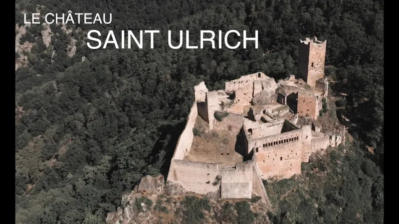
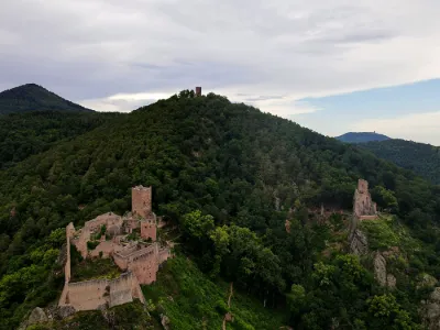
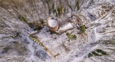
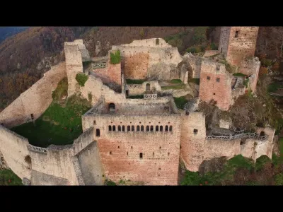
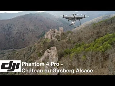
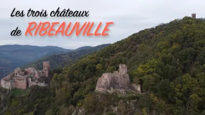
The SAINT ULRICH castle Among the four ruins overlooking Ribeauvillé, Saint Ulrich is undoubtedly one of the most fascinating castle complexes in Haute-Alsace. It once controlled the strategic road linking the Alsace plain to the upper Lièpvre valley. A witness to the power of the lords of Ribeaupierre, it was their main residence until it was finally abandoned in the 16th century. It therefore features several architectural styles: Gothic and even Renaissance elements were added to the Romanesque parts. Not far from there, the Girsberg castle was built in the 13th century to house a new branch of the Ribeaupierre family: the living quarters are still clearly visible. The Haut-Ribeaupierre was certainly built during the troubled period of the Great Interregnum, around the middle of the 13th century, on the site of an earlier castle probably dating from the 10th century. It served as an outpost during the King of France's plans to invade Alsace, then as a watchtower intended to give warning of forest fires. The whole building is dominated by an imposing circular keep that offers a magnificent view over the Alsace plain and the neighboring ridges. A fourth castle was recently discovered below Saint Ulrich.
Allow 1h30 for the round trip to reach the castle from the D416, parking on the road to Sainte-Marie-aux-Mines. Easy hike, uphill only on the way there.
Map and restricted areas
Open in the main mapNearby aerodromes
Open aerodromes within 25 km of the spot, heliports included, with their distance and direction from the spot. Near an aerodrome, drone flying is prohibited or height-limited: check the UAS zones map.
| Aerodrome | Type | Distance | Elevation | Difference |
|---|---|---|---|---|
| Colmar-Houssen Airport | Airport | 11 km SE | 191 m | spot 289 m higher |
| Hôpital Pasteur Heliport | Heliport | 15 km S | 201 m | spot 280 m higher |
| Aérodrome d'Albé - Val de Villé | Aerodrome | 16 km N | 380 m | spot 101 m higher |
| Envol ULM Alsace | Aerodrome | 19 km E | 176 m | spot 305 m higher |
| Club ULM de Kogenheim | Aerodrome | 22 km NE | 161 m | spot 320 m higher |
Aviation weather (METAR and TAF)
LFGA – Colmar-Houssen Airport VFR
METAR
METAR LFGA 211100Z AUTO VRB02KT 9999 FEW013 BKN037 OVC043 08/06 Q1020
- Wind
- Variable, 4 km/h
- Visibility
- 10 km or more
- Clouds
- Few (1-2/8) at 1,300 ft (400 m) ; Broken (5-7/8) at 3,700 ft (1130 m) ; Overcast (8/8) at 4,300 ft (1310 m)
- Temperature
- 8 °C, dew point 6 °C
- QNH
- 1020 hPa
- Flight category
- VFR: ceiling > 3,000 ft and visibility > 5 mi
TAF
Weather and Kp index
Sunrise and sunset
| Day | Dawn | Sunrise | Golden hour | Sunset | Dusk | Day length |
|---|---|---|---|---|---|---|
| Sat 21 Nov | 07:12 | 07:47 | 07:47–08:37 · 15:57–16:47 | 16:47 | 17:21 | 9 h 00 |
| Sun 22 Nov | 07:13 | 07:48 | 07:48–08:38 · 15:56–16:46 | 16:46 | 17:20 | 8 h 57 |
| Mon 23 Nov | 07:15 | 07:50 | 07:50–08:40 · 15:54–16:45 | 16:45 | 17:20 | 8 h 55 |
| Tue 24 Nov | 07:16 | 07:51 | 07:51–08:42 · 15:53–16:44 | 16:44 | 17:19 | 8 h 53 |
| Wed 25 Nov | 07:17 | 07:52 | 07:52–08:43 · 15:52–16:43 | 16:43 | 17:18 | 8 h 50 |
| Thu 26 Nov | 07:19 | 07:54 | 07:54–08:45 · 15:51–16:42 | 16:42 | 17:18 | 8 h 48 |
| Fri 27 Nov | 07:20 | 07:55 | 07:55–08:46 · 15:51–16:42 | 16:42 | 17:17 | 8 h 46 |

Reviews
Log in to review this spot. Log in · Create a free account
No reviews yet. Share yours!