Skip to content
Water

Observatory

Canada

The video is only loaded from YouTube (youtube-nocookie.com) when you start it.

No reviews yet

Have you flown here? Share your experience with other pilots.

+ Write the first review

Description

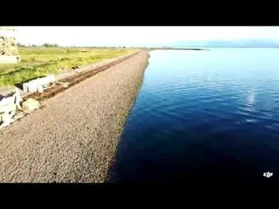
Quiet beach with a view of the village

Automatic translation.

Aviation weather (METAR and TAF)

CZCR · 16 km SW ?

METAR

Observed 21/11 07:00 · 59 min ago

METAR CZCR 211200Z AUTO 22005KT M00/M02 RMK AO1 SLP267 T10021015 51012

Wind
220°, 9 km/h
Visibility
–
Clouds
–
Temperature
-0 °C, dew point -2 °C
Flight category
Unknown category

TAF

This station does not issue a TAF (or none is currently valid).

METAR and TAF from NOAA (Aviation Weather Center), for guidance only: they do not replace flight planning with official sources (SIA, Météo-France). Nearest station that issues a METAR, not necessarily the nearest aerodrome.

Plan the light

Weather and Kp index

Loading forecast…

Sunrise and sunset

Local times at the spot (UTC−05:00). The golden hour, the warm, low light sought after for photos and videos, runs from sunrise until the sun reaches 6° above the horizon, and in the evening from 6° until sunset.

Day Dawn Sunrise Golden hour Sunset Dusk Day length
Sat 21 Nov06:06 06:41 06:41–07:31 · 14:51–15:41 15:41 16:159 h 00
Sun 22 Nov06:08 06:42 06:42–07:32 · 14:50–15:40 15:40 16:158 h 57
Mon 23 Nov06:09 06:44 06:44–07:34 · 14:49–15:39 15:39 16:148 h 55
Tue 24 Nov06:10 06:45 06:45–07:35 · 14:48–15:38 15:38 16:138 h 53
Wed 25 Nov06:11 06:46 06:46–07:37 · 14:47–15:38 15:38 16:128 h 51
Thu 26 Nov06:13 06:48 06:48–07:39 · 14:46–15:37 15:37 16:128 h 49
Fri 27 Nov06:14 06:49 06:49–07:40 · 14:45–15:36 15:36 16:118 h 47

Nearby on Wikipedia

  • Rivière Stewart (Baie-des-Chaleurs) · 0.5 km away

    La rivière Stewart est un affluent de la rive Nord de la Baie-des-Chaleurs, coulant dans la région administrative de la Gaspésie-Îles-de-la-Madeleine, au Québec, au Canada. La rivière Stewart coule vers le sud dans les municipalités régionales de comté (MRC) de : * Bonaventure : dans le territoire (...)

  • Rivière Stewart Est · 3.7 km away

    La rivière Stewart coule dans la municipalité de Carleton-sur-Mer, dans la municipalité régionale de comté (MRC) d'Avignon, dans la région administrative de la Gaspésie-Îles-de-la-Madeleine, au Québec, au Canada (...)

  • Rivière Nouvelle · 5.0 km away

    La rivière Nouvelle est un cours d'eau canadien situé dans l'est du Québec plus précisément dans la région de la Gaspésie-Îles-de-la-Madeleine sur la péninsule gaspésienne. Ce cours d'eau traverse les municipalités régionales de comté (MRC) de: * La Matapédia, située dans la région administrative du (...)

  • Drapeau (Québec) · 5.2 km away

    Drapeau est un village de l'Est du Québec situé sur la péninsule gaspésienne dans la région de la Gaspésie–Îles-de-la-Madeleine faisant partie de la municipalité de Nouvelle dans la municipalité régionale de comté d'Avignon au Canada. (...)

  • Gare de Carleton · 6.5 km away

    La gare de Carleton à Carleton-sur-Mer est desservie par Via Rail Canada. La gare est avec service. Il y a 3 trains par semaine, dans chaque direction. (...)

Articles found by GeoNames from the spot's position.

Reviews

Log in to review this spot. Log in · Create a free account

No reviews yet. Share yours!

Connection to the site lost. Trying again…

The site is not responding. Trying again in seconds.

The site is no longer responding.

The site has been updated. Reloading the page…

This page has expired.

Resuming failed. Please reload the page.

The site is no longer responding.