Skip to content
Mountain

Val Jalbert village
Canada

The video is only loaded from YouTube (youtube-nocookie.com) when you start it.

No reviews yet

Have you flown here? Share your experience with other pilots.

+ Write the first review

Description

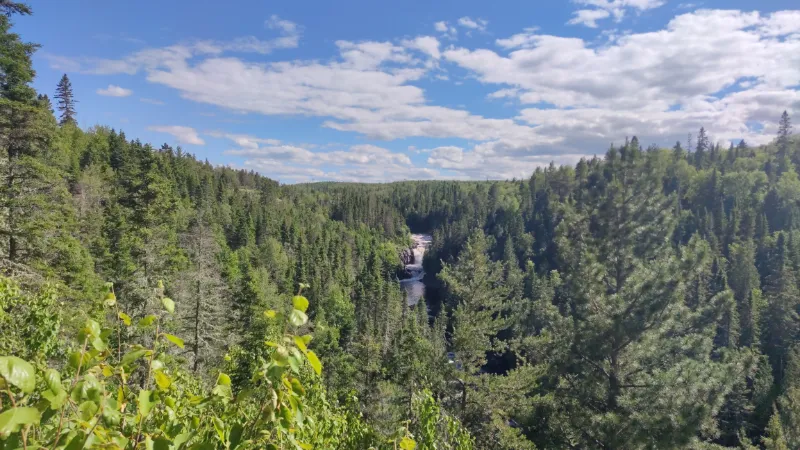
Clever waterfall

Automatic translation.

Aviation weather (METAR and TAF)

CYRJ – Roberval Airport · 13 km NW VFR

METAR

Observed 21/11 07:00 · 35 min ago

METAR CYRJ 211200Z 20005KT 40SM BKN039 BKN230 05/02 A3020 RMK SC7CI1 CI TR SLP237

Wind
200°, 9 km/h
Visibility
64 km
Clouds
Broken (5-7/8) at 3,900 ft (1190 m) ; Broken (5-7/8) at 23,000 ft (7010 m)
Temperature
5 °C, dew point 2 °C
QNH
1023 hPa
Flight category
VFR: ceiling > 3,000 ft and visibility > 5 mi

TAF

This station does not issue a TAF (or none is currently valid).

METAR and TAF from NOAA (Aviation Weather Center), for guidance only: they do not replace flight planning with official sources (SIA, Météo-France). Nearest station that issues a METAR, not necessarily the nearest aerodrome.

Plan the light

Weather and Kp index

Loading forecast…

Sunrise and sunset

Local times at the spot (UTC−05:00). The golden hour, the warm, low light sought after for photos and videos, runs from sunrise until the sun reaches 6° above the horizon, and in the evening from 6° until sunset.

Day Dawn Sunrise Golden hour Sunset Dusk Day length
Sat 21 Nov06:31 07:06 07:06–07:56 · 15:13–16:04 16:04 16:388 h 57
Sun 22 Nov06:32 07:07 07:07–07:58 · 15:12–16:03 16:03 16:388 h 55
Mon 23 Nov06:34 07:08 07:08–07:59 · 15:11–16:02 16:02 16:378 h 53
Tue 24 Nov06:35 07:10 07:10–08:01 · 15:10–16:01 16:01 16:368 h 51
Wed 25 Nov06:36 07:11 07:11–08:03 · 15:09–16:00 16:00 16:358 h 48
Thu 26 Nov06:37 07:13 07:13–08:04 · 15:08–15:59 15:59 16:358 h 46
Fri 27 Nov06:39 07:14 07:14–08:06 · 15:07–15:59 15:59 16:348 h 44

Nearby on Wikipedia

  • Rivière Ouiatchouan · 0.8 km away

    La rivière Ouiatchouan (anciennement OuiatchouaneCommission de toponymie du Québec, (Page consultée le 9 janvier 2013)) est une rivière canadienne de la province de Québec qui alimente le lac Saint-Jean. Coulant vers le Nord, cette rivière de 110 kilomètres prend sa source dans le lac Ouiatchouane, (...)

  • Val-Jalbert · 0.9 km away

    Val-Jalbert est un ancien village du Québec, au Canada. Son territoire, qui aujourd'hui fait partie de la municipalité de Chambord, au Lac-Saint-Jean, a été transformé en attraction touristique dans les années 1960. Le village a été classé site historique en 1996. (...)

  • CHRL-FM · 6.5 km away

    CHRL-FM (mieux connu sous le nom de Planète 99,5) est une station de radio située dans la ville de Roberval au Québec appartenant à RNC Media et fait partie du groupe Planète Radio. Elle diffuse un format de musique adulte contemporaine (...)

  • Chambord (Québec) · 7.6 km away

    Chambord est une municipalité du Québec faisant partie de la MRC le Domaine-du-Roy, située dans la région administrative du Saguenay–Lac-Saint-Jean. Elle est nommée en l'honneur d'Henri d'Artois, comte de Chambord et prétendant au trône de France au moment de la fondation du village, en 1845 (...)

  • Roberval (Québec) · 11 km away

    Roberval est une ville de la province de Québec située au bord du lac Saint-Jean dans la municipalité régionale de comté du Domaine-du-Roy et dans la région administrative de Saguenay–Lac-Saint-Jean. Roberval a été fondée en 1855 par Thomas Jamme. (...)

Articles found by GeoNames from the spot's position.

Reviews

Log in to review this spot. Log in · Create a free account

No reviews yet. Share yours!

Connection to the site lost. Trying again…

The site is not responding. Trying again in seconds.

The site is no longer responding.

The site has been updated. Reloading the page…

This page has expired.

Resuming failed. Please reload the page.

The site is no longer responding.