Skip to content
Water

Saint Paul

La Réunion

The video is only loaded from YouTube (youtube-nocookie.com) when you start it.

No reviews yet

Have you flown here? Share your experience with other pilots.

+ Write the first review

Description

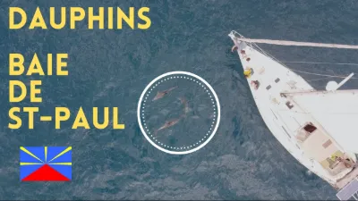
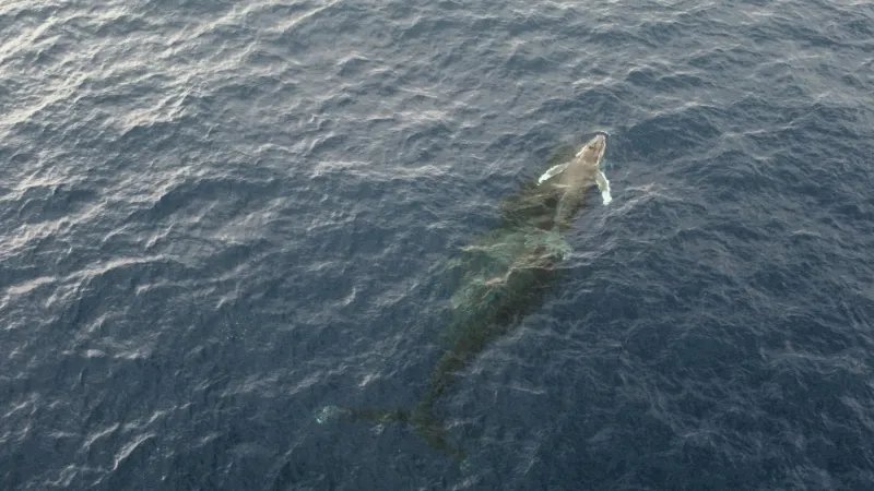
Whale show in August 2022 in the bay of Saint Paul

Automatic translation.

Map and restricted areas

Open in the main map

Nearby aerodromes

Open aerodromes within 25 km of the spot, heliports included, with their distance and direction from the spot. Near an aerodrome, drone flying is prohibited or height-limited: check the UAS zones map.

No known open aerodrome within 25 km.

Indicative list: it does not replace official aeronautical information.

Aviation weather (METAR and TAF)

FMEE – Roland Garros Airport · 31 km NE VFR

METAR

Observed 17/11 17:30 · 25 min ago

METAR FMEE 171330Z AUTO 09013KT 9999 FEW098/// ///TCU 27/22 Q1016 TEMPO 4000 SHRA BECMG SCT080

Wind
090°, 24 km/h
Visibility
10 km or more
Clouds
Few (1-2/8) at 9,800 ft (2990 m)
Temperature
27 °C, dew point 22 °C
QNH
1016 hPa
Flight category
VFR: ceiling > 3,000 ft and visibility > 5 mi

TAF

Issued 17/11 15:00 · valid from 17/11 16:00 to 18/11 22:00

TAF FMEE 171100Z 1712/1818 08012KT 9999 SCT080 PROB30 TEMPO 1712/1715 4000 SHRA BKN020TCU BECMG 1717/1719 14010KT BECMG 1804/1806 08015KT

Period (local time) Change Wind Visibility Weather Clouds
17/11 16:00 → 17/11 21:00 Initial conditions 080°, 22 km/h 10 km or more Scattered (3-4/8) at 8,000 ft (2440 m)
17/11 16:00 → 17/11 19:00 Temporarily, probability 30% 4.0 km Showers of rain Broken (5-7/8) at 2,000 ft (610 m) (towering cumulus)
17/11 21:00 → 18/11 08:00 Becoming 140°, 19 km/h 10 km or more Scattered (3-4/8) at 8,000 ft (2440 m)
18/11 08:00 → 18/11 22:00 Becoming 080°, 28 km/h 10 km or more Scattered (3-4/8) at 8,000 ft (2440 m)

Empty cell: no change forecast for that element.

METAR and TAF from NOAA (Aviation Weather Center), for guidance only: they do not replace flight planning with official sources (SIA, Météo-France). Nearest station that issues a METAR, not necessarily the nearest aerodrome.

Plan the light

Weather and Kp index

Loading forecast…

Sunrise and sunset

Local times at the spot (UTC+04:00). The golden hour, the warm, low light sought after for photos and videos, runs from sunrise until the sun reaches 6° above the horizon, and in the evening from 6° until sunset.

Day Dawn Sunrise Golden hour Sunset Dusk Day length
Tue 17 Nov05:06 05:30 05:30–06:01 · 18:07–18:38 18:38 19:0213 h 08
Wed 18 Nov05:06 05:29 05:29–06:01 · 18:08–18:39 18:39 19:0313 h 09
Thu 19 Nov05:05 05:29 05:29–06:00 · 18:08–18:40 18:40 19:0313 h 10
Fri 20 Nov05:05 05:29 05:29–06:00 · 18:09–18:40 18:40 19:0413 h 11
Sat 21 Nov05:05 05:29 05:29–06:00 · 18:09–18:41 18:41 19:0513 h 11
Sun 22 Nov05:05 05:29 05:29–06:00 · 18:10–18:41 18:41 19:0513 h 12
Mon 23 Nov05:05 05:29 05:29–06:00 · 18:11–18:42 18:42 19:0613 h 13

Nearby on Wikipedia

  • Cap la Houssaye · 0.8 km away

    Le cap la Houssaye est un cap de l'île de La Réunion, département d'outre-mer français dans l'océan Indien. Situé sur le territoire communal de Saint-Paul, le long de la côte ouest, il marque la limite sud de la baie de Saint-Paul, au-delà du cap la Marianne (...)

  • Cap la Marianne · 1.2 km away

    Le cap la Marianne est un cap de l'île de La Réunion, département d'outre-mer français dans le sud-ouest de l'océan Indien. Situé sur le territoire communal de Saint-Paul, le long de la côte ouest, il est proche de la limite sud de la baie de Saint-Paul, qui s'achève au cap la Houssaye voisin (...)

  • Savane de Saint-Paul · 1.2 km away

    La savane de Saint-Paul est une savane de l'île de La Réunion, département d'outre-mer français dans le sud-ouest de l'océan Indien. Elle est située sur le territoire de la commune de Saint-Paul entre le centre-ville de Saint-Paul au nord-est, Plateau Caillou à l'est, L'Éperon au sud et Boucan Canot (...)

  • Grotte des Premiers Français · 1.5 km away

    La grotte des Premiers Français est une caverne de l'île de La Réunion, un département d'outre-mer français dans l'océan Indien. Elle est située sur le territoire de la commune de Saint-Paul à proximité immédiate du centre-ville, qui se trouve plus au nord (...)

  • Cimetière marin de Saint-Paul · 1.7 km away

    Le cimetière marin de Saint-Paul est un cimetière marin français construit au bord de l'océan Indien dans la baie de Saint-Paul, la baie qui abrite le centre-ville de la commune de Saint-Paul, à La Réunion. Il est inscrit en totalité à l'inventaire supplémentaire des Monuments historiques depuis le (...)

Articles found by GeoNames from the spot's position.

Nearby spots

Reviews

Log in to review this spot. Log in · Create a free account

No reviews yet. Share yours!

Connection to the site lost. Trying again…

The site is not responding. Trying again in seconds.

The site is no longer responding.

The site has been updated. Reloading the page…

This page has expired.

Resuming failed. Please reload the page.

The site is no longer responding.