

Route du Ballon
No reviews yet
Have you flown here? Share your experience with other pilots.
+ Write the first reviewDescription
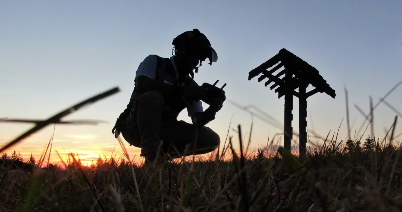
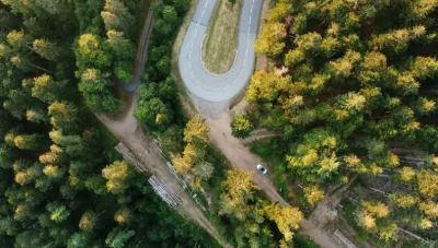
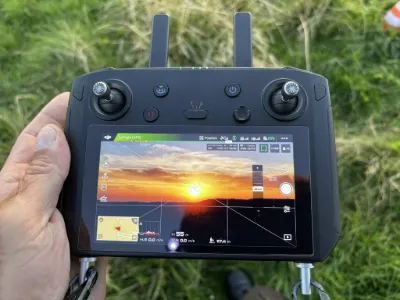
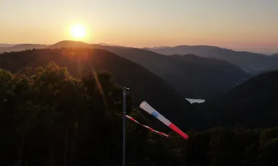
ZP00036 "Route du Ballon d'Alsace , Saint Maurice sur Moselle 88560 " New spot to catch a sunset 4K quality video S1 / Max height 120m // Max distance Radius 200m KP3: Some transmission disturbances due to an announced solar flare. Paragliders present in the airspace. Difficulty encountered: The drop in temperature at nightfall caused slight condensation on the lens during the flight and unfortunately I didn't notice it! (27°/ 16°) 50% of my raw footage is unusable. So I'll have to do it again.
Location:
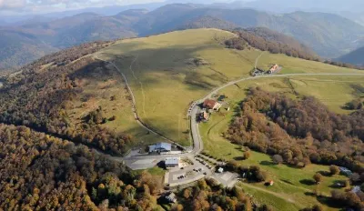
"La Jumenterie" is located at the Ballon d'Alsace in the Vosges department. EJ'N organizes holiday stays there during the short school holidays and summer holidays, as well as snow and mountain discovery school trips. Perched at an altitude of 1,070 m, in the south of the Vosges massif, the Jumenterie center is located near the summit of the Ballon d'Alsace, at the foot of the slopes.
"Saint Maurice sur Moselle " 88560 This municipality is the southernmost of the former Lorraine region. Located at 550 m and with more than a dozen peaks exceeding 1,000 m, the village and its vast territory are an integral part of the southern Hautes-Vosges. It is a popular place for mountain activities, notably hiking, mountaineering and skiing.
The Ballon de Servance and the Ballon d'Alsace are the two best-known peaks of Saint-Maurice and the southern Hautes Vosges, making the village a relatively touristy municipality.
Map and restricted areas
Open in the main mapNearby aerodromes
Open aerodromes within 25 km of the spot, heliports included, with their distance and direction from the spot. Near an aerodrome, drone flying is prohibited or height-limited: check the UAS zones map.
| Aerodrome | Type | Distance | Elevation | Difference |
|---|---|---|---|---|
| La Tête Des Champs Altiport | Aerodrome | 9.3 km N | 970 m | spot 90 m higher |
| Ramonchamp ULM | Aerodrome | 9.3 km NW | 577 m | spot 483 m higher |
| Belfort Chaux Airfield | Aerodrome | 15 km S | 417 m | spot 643 m higher |
Aviation weather (METAR and TAF)
LFSX – Luxeuil-Saint-Sauveur (BA 116) Air Base VFR
METAR
METAR LFSX 210630Z AUTO 23003KT 9999 FEW016/// SCT027/// BKN032/// ///TCU 07/06 Q1019
- Wind
- 230°, 6 km/h
- Visibility
- 10 km or more
- Clouds
- Few (1-2/8) at 1,600 ft (490 m) ; Scattered (3-4/8) at 2,700 ft (820 m) ; Broken (5-7/8) at 3,200 ft (980 m)
- Temperature
- 7 °C, dew point 6 °C
- QNH
- 1019 hPa
- Flight category
- VFR: ceiling > 3,000 ft and visibility > 5 mi
TAF
Weather and Kp index
Sunrise and sunset
| Day | Dawn | Sunrise | Golden hour | Sunset | Dusk | Day length |
|---|---|---|---|---|---|---|
| Sat 21 Nov | 07:13 | 07:47 | 07:47–08:37 · 16:00–16:50 | 16:50 | 17:24 | 9 h 02 |
| Sun 22 Nov | 07:14 | 07:49 | 07:49–08:38 · 15:59–16:49 | 16:49 | 17:23 | 9 h 00 |
| Mon 23 Nov | 07:16 | 07:50 | 07:50–08:40 · 15:58–16:48 | 16:48 | 17:22 | 8 h 57 |
| Tue 24 Nov | 07:17 | 07:51 | 07:51–08:41 · 15:57–16:47 | 16:47 | 17:22 | 8 h 55 |
| Wed 25 Nov | 07:18 | 07:53 | 07:53–08:43 · 15:56–16:46 | 16:46 | 17:21 | 8 h 53 |
| Thu 26 Nov | 07:19 | 07:54 | 07:54–08:45 · 15:55–16:46 | 16:46 | 17:20 | 8 h 51 |
| Fri 27 Nov | 07:21 | 07:56 | 07:56–08:46 · 15:54–16:45 | 16:45 | 17:20 | 8 h 49 |


Reviews
Log in to review this spot. Log in · Create a free account
No reviews yet. Share yours!